Whernside Ingleborough Circular Walk
![]()
![]() This challenging circular walk visits two of the famous Yorkshire Three Peaks. You'll climb to Ingleborough before heading up to Whernside from the famous Ribblehead Viaduct.
This challenging circular walk visits two of the famous Yorkshire Three Peaks. You'll climb to Ingleborough before heading up to Whernside from the famous Ribblehead Viaduct.
The route runs for a distance of just over 13 miles, rising to a height of well over 2000ft at the high points.
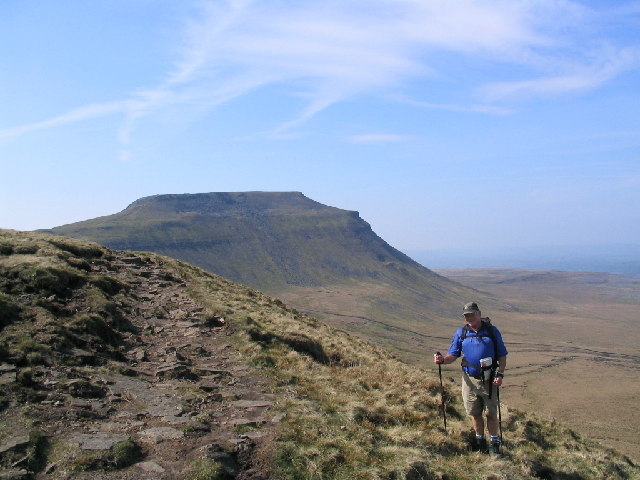
Start the walk from the car park and visitor centre at the Ribblehead Viaduct. From here you pick up footpaths taking you up to Park Fell and Simon Fell, before ascending to Ingleborough. The mountain stands at a height of 723 metres (2,372 ft) providing fabulous views over the surrounding Yorkshire Dales countryside. The area surrounding the mountain is also designated as a National Nature Reserve. The limestone habitats promote a range of interesting wildflowers including Yorkshire primrose, limestone pavement with bloody crane's-bill, calcareous grassland with common rock-rose and limestone rock outcrops, cliffs and scree with juniper. Wildlife also thrives with the northern brown argus butterfly, curlew and roe deer to look out for in the area.
The route then descends to Humphrey Bottom before continuing north to Highwood Pasture and Philpin Lane. You then ascend to Bruntscar and High Pike before reaching the summit of Whernside. The mountain stands at a height of 736 m (2,415 ft) making it the highest of the Yorkshire Three Peaks. From here there are fantastic views over the Yorkshire Dales, the Lake District and Morecambe Bay.
After taking in the views the route then descends to Knoutberry Hill and Grain Head. You then turn south toward Slack Hill, passing a series of waterfalls on the way. The final section takes you along the Blue Clay Ridge before returning to the viaduct and the car park.
To continue your walking in the area try the longer Yorkshire Three Peaks Walk which also visits Pen y ghent.
Whernside Ingleborough Circular Walk Ordnance Survey Map  - view and print off detailed OS map
Whernside Ingleborough Circular Walk Open Street Map  - view and print off detailed map
Whernside Ingleborough Circular Walk OS Map  - Mobile GPS OS Map with Location tracking
Whernside Ingleborough Circular Walk Open Street Map  - Mobile GPS Map with Location tracking
Pubs/Cafes
After your exercise treat yourself to well earned refreshments at the Station Inn (Postcode: LA6 3AS). The pub is located next to the Ribblehead Viaduct and is very walker friendly. There's a good menu and you can also book rooms for the night. Just up the road to the west you'll find the Old Hill Inn (LA6 3AR). This pub dates all the way back to 1615 and is another popular spot for walkers climbing the peaks.


