GPS Cycle and Walking Routescycle iconwalk icon

Wray Castle to Ferry House Walk

4 miles (6.5 km)

Ordnance Survey Map Open Streetmap A walk along Lake Windermere from Wray Castle to Ferry House. The route allows you to reach Bowness on foot from the National Trust property.
It's a fairly easy walk of about 4 miles, following trails through peaceful woodland with nice views over the lake to enjoy on the way.
The walk starts from Wray Castle, a National Trust owned property with attractive grounds to explore. From the car park you descend a short distance to the lake at Epley Point. You then follow the lake past Red Nab and Belle Grange Bay, with views of Belle Isle, the largest of Windermere's 18 islands.
The walk finishes at Ferry House where you can catch the passenger ferry over to Bowness. On the other side you'll find a cafe with outdoor seating where you can relax and enjoy a view of the boats on the lake.
You can extend your exercise by picking up our Bowness Walk and following a nice lakeside path around Cockshott Point to the village.
On the eastern side of the water you pass beneath Claife Heights where there's some nice woodland trails and a number of pretty tarns.

Wray Castle to Ferry House Walk OS Map Ordnance survey map - Mobile GPS OS Map with Location tracking

Wray Castle to Ferry House Walk Open Street Map Open Streetmap - Mobile GPS Map with Location tracking

Cycle Routes and Walking Routes Nearby

Photos

Wray Castle - geograph.org.uk - 404020

Wray Castle

View over Windermere from Red Nab - geograph.org.uk - 39809

View over Windermere from Red Nab. This photograph was taken from the car-park at the end of the unclassified road that leads down to the west shore of Windermere from High Wray.

Access road and gate to Belle Grange - geograph.org.uk - 894360

Access road and gate to Belle Grange

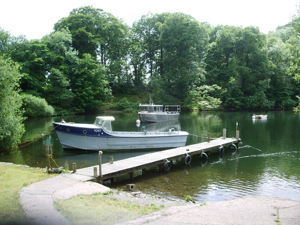
Jetty, The Ferry House - geograph.org.uk - 872785

Jetty, The Ferry House

Boats moored by Strawberry Gardens - geograph.org.uk - 2784589

Boats moored by Strawberry Gardens

Belle Grange Bay, Floating Jetty at Bark Barn - geograph.org.uk - 4004854

Belle Grange Bay, Floating Jetty at Bark Barn

High Wray Bay - geograph.org.uk - 1938236

High Wray Bay

Beach with wild garlic (Allium ursinum) - geograph.org.uk - 3488071

Beach with wild garlic (Allium ursinum). View in spring, just south of the castle.

Video

GPS Files

GPX File

Wray Castle to Ferry House Walk.gpx (On Desktop:Right Click>Save As. On Ipad/Iphone:Click and hold>Download Linked File)

Memory Map Route

Wray Castle to Ferry House Walk.mmo (On Desktop:Right Click>Save As. On Ipad/Iphone:Click and hold >Download Linked File)