Wraysbury Walk
![]()
![]() This pretty Berkshire village is located close to the River Thames near Windsor.
This pretty Berkshire village is located close to the River Thames near Windsor.
This walk from the village visits the National Trust's Ankerwycke where there's an ancient yew and a ruined priory to see.
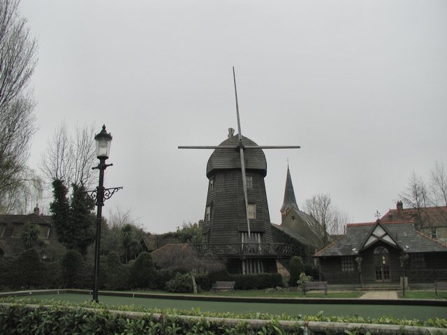
The walk starts on the village green next to the mock windmill. From here you can follow footpaths south to Ankerwycke Farm and Priory ruins. You'll also pass the 2,500 year old Ankerwycke Yew which is the National Trust's oldest tree. It is rumoured that beneath the tree King Henry VIII courted Anne Boleyn, and some reports suggest that he even proposed in its shadow. While the Magna Carta is said to have been sealed at Runnymede on the other side of the Thames, some think it was sealed on tihs side of the river, perhaps under the ancient yew. You can enjoy a stroll down to the river before circling round and returning to the village.
To extend your walking in the area head north east to visit Wraysbury Reservoir and Staines Moor.
Wraysbury Ordnance Survey Map  - view and print off detailed OS map
Wraysbury Open Street Map  - view and print off detailed map
Wraysbury OS Map  - Mobile GPS OS Map with Location tracking
Wraysbury Open Street Map  - Mobile GPS Map with Location tracking
Pubs/Cafes
Head to the George at Wraysbury for some refreshments after your walk. This fine 16th century inn includes a delightful Olive Garden where you can sit outside on warmer days. You can find the pub in the village at 29 Windsor Road with a postcode of TW19 5DE for your sat navs.
Dog Walking
It's a nice place to take your dog for a stroll and the George pub mentioned above is also dog friendly.
Further Information and Other Local Ideas
On the opposite side of the river you can visit the historic site of Runnymede, the birthplace of the Magna Carta. The interesting town of Egham is also located in this area.
You could also pick up the Thames Path and follow it towards Windsor where you can visit the expansive Windsor Great Park.
For more walking ideas in the area see the Berkshire Walks page.
Cycle Routes and Walking Routes Nearby
Photos
Ankerwyke Farm. The hill in the distance is on the west bank of the Thames where the Runnymede Kennedy Memorial is located. The track in the foreground leads to the site of Ankerwyke Priory, originally a Benedictine foundation.


