Holme Pierrepont Country Park
![]()
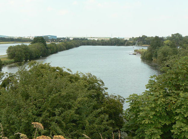
![]() Enjoy a waterside walk or cycle in this splendid 270 acre country park in Nottingham. The park includes several large lakes and the delightful Skylark Nature Reserve. You can hire a bike or just go for a stroll along the lovely, lakeside paths. The River Trent also runs through the park so there is scope for continuing your walk along the Trent Valley Way walking route. Adjacent to Holme Pierrpont is Colwick Country Park which is another option for extending your outing. You could also head to Broxtowe Country Park where there's some nice woodland trails and a BMX track to try.
Enjoy a waterside walk or cycle in this splendid 270 acre country park in Nottingham. The park includes several large lakes and the delightful Skylark Nature Reserve. You can hire a bike or just go for a stroll along the lovely, lakeside paths. The River Trent also runs through the park so there is scope for continuing your walk along the Trent Valley Way walking route. Adjacent to Holme Pierrpont is Colwick Country Park which is another option for extending your outing. You could also head to Broxtowe Country Park where there's some nice woodland trails and a BMX track to try.
The park is the home of the National Watersports Centre so you could have a go at kayaking or windsurfing. Holme Pierrepont is located just to the south of Nottingham city centre.
Postcode
NG12 2LU - Please note: Postcode may be approximate for some rural locationsPlease click here for more information
Holme Pierrepont Country Park Ordnance Survey Map  - view and print off detailed OS map
Holme Pierrepont Country Park Open Street Map  - view and print off detailed map
Holme Pierrepont Country Park OS Map  - Mobile GPS OS Map with Location tracking
Holme Pierrepont Country Park Open Street Map  - Mobile GPS Map with Location tracking
Further Information and Other Local Ideas
Just to the east there's the Radcliffe on Trent Cliff Walk which takes you along an elevated tree lined path above the river. The area also includes the Rockley Memorial Park where you'll find lovely gardens in a peaceful setting.
To the south there's Cotgrave Country Park. This park was developed on a former colliery site and includes woodland and wetland trails. The Grantham Canal can also be picked up here and followed to Hickling where there's a fine 18th century canalside pub.
The West Bridgford Walk visits the park by following the Trent Valley Way along the river from the market town. There's a nice riverside pub you could visit here with views over the Trent to Nottingham.
For more walking ideas in the area see the Nottinghamshire Walks page.
Cycle Routes and Walking Routes Nearby
Photos
Lane at Holme Pierrepont. This is a private road at this point, although it forms part of a marked long distance footpath. Pre-war OS maps show a toll gate at this point which implies that there has always been an expectation of its use for general passage. There certainly doesn't seem to be much restriction on its use, although realistically it doesn't provide a better route than using the main A52.
Finger ponds This is the name given to the area of former gravel workings at the eastern end of Holme Pierrepont Country Park. It derives from the way that this area was worked leaving long narrow strips of water divided by narrow banks. The formation shows up better on the 1:25000 maps than on the 1:50000.
Home Farm, Holme Pierrepont. The stone just visible in the dormer gable carries the letter M and the date 1903. The M refers to the fact that the estate belongs to the Earl of Manvers.


