Kerry Ridgeway
![]()
![]() This is an exceptionally beautiful walk or cycle through Powys and then into Shropshire.
This is an exceptionally beautiful walk or cycle through Powys and then into Shropshire.
The route runs along a ridge top overlooking Wales on the one side and England on the other with spectacular views for the duration of the ride. It runs for about 15 miles with a gradual descent when going from west to east.
You start at Cider House Farm near Kerry and head east to Bishop's Castle passing through Ceri Forest on the way. You will pass through heather moors, woodlands and bilberry rich heaths with fabulous views of the Welsh and Shropshire Hills.
Kerry Ridgeway Ordnance Survey Map  - view and print off detailed OS map
Kerry Ridgeway Open Street Map  - view and print off detailed map
Kerry Ridgeway OS Map  - Mobile GPS OS Map with Location tracking
Kerry Ridgeway Open Street Map  - Mobile GPS Map with Location tracking
Pubs/Cafes
The Three Tuns Inn is a good place for some refreshments at the end of the walk. It's a historic pub of some note, dating all the way back to 1642. The associated brewery is possibly the oldest in the country, with records showing that King Charles 1st issued the first brewing licences in that year to raise funds to pay for his army fighting the civil war. It's a cosy place with an excellent selection of real ales. You can find the pub at Salop Street with a postcode of SY9 5BW.
Dog Walking
The ridgeway is a fine place for a dog walk with fine woodland trails in Ceri Forest on the way. The Three Tuns mentioned above is also dog friendly.
Further Information and Other Local Ideas
At the eastern end of the route you can pick up the circular Bishop's Castle Ring Walk and the Shropshire Way. You could use a section of either of these long distance trails to create a circular walk from the ridgeway.
For more walking ideas in the area see the Shropshire Walks page.
Cycle Routes and Walking Routes Nearby
Photos
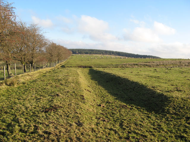
Beyond Block Wood, the Ridgeway path is open on both sides before it reaches the Ceri Forest in the distance. Low sun accentuates the ditch at the side of the track.
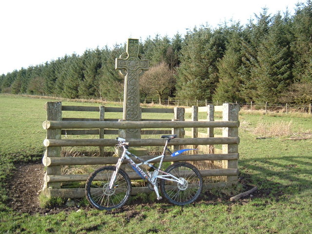
Mountain bike ride on the Kerry Ridgeway and a visit to the Cantlin Stone. Here you'll find a rough stone about two feet across with an inscription recording the death of Willam Cantlin. It is located only twenty or so yards away from the Wales–England border. In 1858, the Ludlow M.P. Beriah Botfield erected a limestone cross next to the original stone to commemorate the pedlar. This has since been replaced with a modern replica.
Looking back down the track which climbs from the small town of Kerry to the Kerry Ridgeway. Just visible through the trees is the roof of Lower Rhos.
Wall by the Ridgeway. The Kerry Ridgeway is known as the oldest road in Wales and is a former drovers’ route, where cattle were taken from Wales to markets in England. It takes a 15 mile west to east route with fine views from near Dolfor to Bishop's Castle. Here a public road follows part of the route past Ceri Forest.
Haybob near the Ridgeway. Just below the Ridgeway on the track this Haybob, (a machine for turning hay during haymaking) has been left on the trackside. The Vale of Kerry can be seen in the background.
Elevation Profile


