Raincliffe Woods
![]()
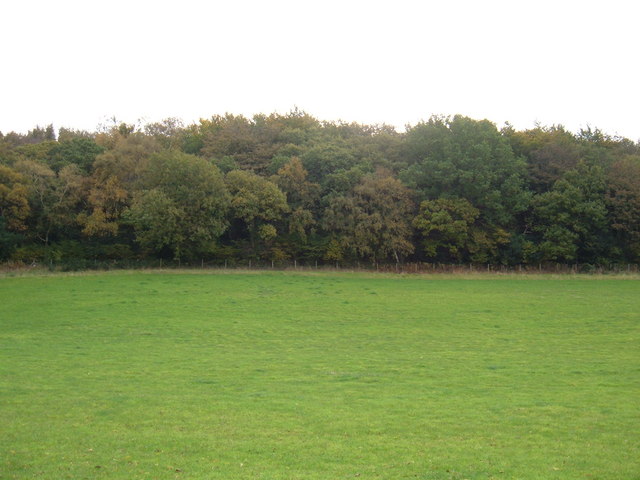
![]() This woodland area in the North York Moors has some good bridleways for mountain biking and nice walking trails. You can park at the car park off Mowthorp Road to pick up the tracks. Follow Middle Road through the centre of the forest before picking up Lady Mildred's Ride to return. If you head all the way through the woods you will come to Scarborough where you can pick up National Cycle Network Route 1.
This woodland area in the North York Moors has some good bridleways for mountain biking and nice walking trails. You can park at the car park off Mowthorp Road to pick up the tracks. Follow Middle Road through the centre of the forest before picking up Lady Mildred's Ride to return. If you head all the way through the woods you will come to Scarborough where you can pick up National Cycle Network Route 1.
The woods are good for wildlife spotting with deer, badgers, squirrels, frogs, toads, foxes and various woodland birds to look out for. In the spring months there are also lots of bluebells.
To extend your exercise you can head into the adjacent Forge Valley Woods. This nature reserve has a nice boardwalk trail along the River Derwent. The woods can be reached on the circular West Ayton Walk which starts from the delightful village. Just to the west is the expansive Wykeham Forest with miles more trails to try.
Postcode
YO12 5TG - Please note: Postcode may be approximate for some rural locationsRaincliffe Woods Ordnance Survey Map  - view and print off detailed OS map
Raincliffe Woods Open Street Map  - view and print off detailed map
Raincliffe Woods OS Map  - Mobile GPS OS Map with Location tracking
Raincliffe Woods Open Street Map  - Mobile GPS Map with Location tracking
Pubs/Cafes
Head south through the Forge Valley and you will soon come to the pleasant village of West Ayton with its 14th century castle ruins. You can also enjoy a drink at the noteworthy Old Forge Valley Inn. The historic Tudor-style coaching inn dates back to the the 18th century and is located in a fine spot alongside John Carr's bridge over the River Derwent. They serve excellent homecooked food which you can enjoy in the lovely garden area on warmer days. There's good facilites too with a large car park and pool table. You can find them on 5 Pickering Road in West Ayton with a postcode of YO13 9JE for your sat navs.
Dog Walking
The woods are an ideal place for a dog walk and the Old Forge Valley Inn mentioned above is also very dog friendly with water bowls and biscuits provided.
Further Information and Other Local Ideas
The circular Scarborough Sea Cut and Scalby Beck Walk passes through the woods. The waterside walk starts in nearby Scalby village and takes you along the picturesque river before returning through the woods.
For more walking ideas in the area see the North York Moors Walks page.


