Brockhampton Estate
![]()
![]() The Brockhampton Estate in Herefordshire has a number of excellent waymarked walking trails to follow. The trails take you through large areas of ancient oak woodland with oak carved sculptures to look out for on the way. There are also waterside paths around the small lake and along the pretty stream. Look out for a variety of wildlife including buzzard, heron, woodpecker, and nuthatch.
The Brockhampton Estate in Herefordshire has a number of excellent waymarked walking trails to follow. The trails take you through large areas of ancient oak woodland with oak carved sculptures to look out for on the way. There are also waterside paths around the small lake and along the pretty stream. Look out for a variety of wildlife including buzzard, heron, woodpecker, and nuthatch.
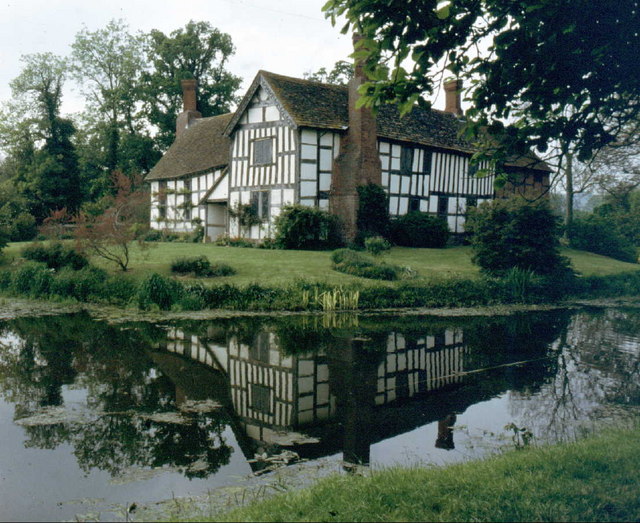
The estate covers 1,700 acres so you can extend your walk and visit the relaxing orchards and the 14th century moated manor house. There's also acres of farmland with Hereford cattle and Ryeland sheep.
It's easy to further extend your walk by heading to the nearby Bringsty Common. It's right next to the estate and consists of miles of lovely footpaths with great views towards the Malvern Hills. You could also pick up the Worcestershire Way in Knightwick and explore the Suckley Hills and the River Teme valley.
Postcode
WR6 5TB - Please note: Postcode may be approximate for some rural locationsPlease click here for more information
Brockhampton Estate Ordnance Survey Map  - view and print off detailed OS map
Brockhampton Estate Open Street Map  - view and print off detailed map
Brockhampton Estate OS Map  - Mobile GPS OS Map with Location tracking
Brockhampton Estate Open Street Map  - Mobile GPS Map with Location tracking
Explore the Area with Google Street View 
Pubs/Cafes
The site includes a nice National Trust tea room where you can enjoy refreshments after your walk. Situated on the top of the estate, it serves a range of lunches.
If you fancy a pub lunch then head to the The Live and Let Live at the nearby Bringsty Common. The attractive thatched pub has a lovely large beer garden where you can sit out and enjoy a meal with fine views across Bringsty Common to the Malvern Hills. You can find it right next to the common at postcode WR6 5UW for your sat navs.
Dog Walking
The woodland and country trails on the estate are great for dog walking. The tea room mentioned above is dog friendly in the outdoor area where water bowls are provided too. The Live and Let Live pub mentioned above is also dog friendly.
Further Information and Other Local Ideas
Just to the west of the estate you'll find Bromyard Downs. The Downs are another popular place for walkers with gorse, grassland, woodland, coppice and fine views to the Clee Hills from the high points.
For more walking ideas in the county see the Herefordshire Walks page.
Cycle Routes and Walking Routes Nearby
Photos
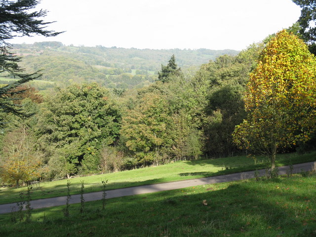
Track on the Brockhampton Estate. Looking south-east with Holy Bank Wood on the right. This is also the entrance for woodland walks on the estate, which is quite hard to spot from the main road
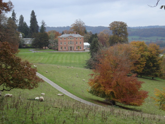
Brockhampton House. View northwards from Brockhampton Park. Privately owned red brick house, originally built in the mid-18th century but extensively altered in the mid-19th Century.


