Alfriston to Cuckmere Haven Walk
![]()
![]() This lovely waterside walk takes you along the Cuckmere River from Alfriston to the beautiful Cuckmere Haven on the south coast. The walk starts in Alfriston and follows the riverside path to Exceat, passing the famous chalk White Horse on the way. You continue to the coast and Cuckmere Haven where you will find a shingle beach and wonderful views of the Seven Sisters Cliffs. The route then passes along the beach and picks up the South Downs Way to take you into the popular Seven Sisters Country Park. In the park there are 700 acres of parkland with wonderful views over the South Downs.
This lovely waterside walk takes you along the Cuckmere River from Alfriston to the beautiful Cuckmere Haven on the south coast. The walk starts in Alfriston and follows the riverside path to Exceat, passing the famous chalk White Horse on the way. You continue to the coast and Cuckmere Haven where you will find a shingle beach and wonderful views of the Seven Sisters Cliffs. The route then passes along the beach and picks up the South Downs Way to take you into the popular Seven Sisters Country Park. In the park there are 700 acres of parkland with wonderful views over the South Downs.
The walk continues to Exceat where you cross the bridge and follow the footpath along the western side of the river to Alfriston. It's a super walk and very flat and easy apart from a short climb on the coastal section. The area is also a nature reserve with species-rich chalk grassland and wildflowers. Look out for wildlife which includes a variety of butterflies and wildfowl.
If you enjoy this walk then you could try the Long Man of Wilmington walk which also starts in Alfriston and takes you up to the iconic chalk figure.
Our South Downs Circular Walk also passes through the area. It will take you on a tour of the surrounding area, visiting Friston Forest and Birling Gap.
Cuckmere River and Cuckmere Haven Ordnance Survey Map  - view and print off detailed OS map
Cuckmere River and Cuckmere Haven Open Street Map  - view and print off detailed map
*New* - Walks and Cycle Routes Near Me Map - Waymarked Routes and Mountain Bike Trails>>
Cuckmere River and Cuckmere Haven OS Map  - Mobile GPS OS Map with Location tracking
Cuckmere River and Cuckmere Haven Open Street Map  - Mobile GPS Map with Location tracking
Pubs/Cafes
The Saltmarsh Cafe & Rooms is located at Exceat and a fine choice for some refreshments on the route. The delightful cafe is set in a 16th Century farmhouse and includes a pretty courtyard where you can relax on warmer days. The rustic café, kitchen and bar serves a delicious menu with a focus on fresh Sussex produce. Dishes make good use of foraged and seasonal ingredients for a rich and distinctive flavour. Saltmarsh also does high quality accommodation if you'd like to stay in the area. You can find the cafe near the start of the walk in Exceat, on the East Dean Road at postcode BN25 4AD.
Back in Alfriston you could try the The George Inn. The historic pub dates all the way back to the 14th century and has a charming interior with low beams and a roaring fire. Outside there's a lovely beer garden to relax in on warmer days. You can find the pub on the High Street at a postcode of BN26 5SY for your sat navs. The pub is also dog friendly if you have your canine friend with you.
Further Information and Other Local Ideas
The circular Seaford Walk visits the area from the car park at the Seaford Head Nature Reserve. The reserve is located on the eastern side of the river and includes a variety of flora and fauna with some spectacular views of the valley.
Cycle Routes and Walking Routes Nearby
Photos
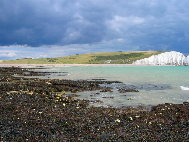
The river near Cuckmere Haven. The area features chalk grasslands, salt marshes, and intertidal zones, each hosting distinct plant communities. In the chalk grasslands, wildflowers such as hawthorn, honeysuckle, and sweet briar flourish, providing vibrant displays, especially in autumn. The salt marshes support specialised vegetation adapted to saline conditions, while the intertidal zones are home to seaweeds growing on the chalk substrate.
Cuckmere River, seen at Seven Sisters Country Park, East Sussex in September. The diverse habitats of Cuckmere Haven support a wide range of wildlife. The chalk reef provides a home for burrowing animals like piddocks and worms, as well as sea squirts, limpets, mussels, oysters, crabs, lobsters, sponges, and various fish species. The intertidal zones are a haven for wading birds such as oystercatchers, and the estuarine waters are frequented by migratory fish like European eel and sea trout.
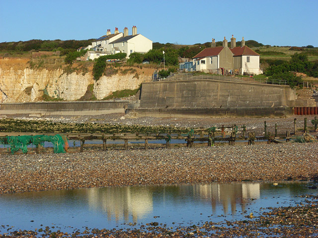
The haven in the summer of 2008. The coastguard cottages stand on the cliff top immediately to the west of the Haven. The cliffs are gradually receding so have been protected with walls below the cottages. This is the view from the western side of the channel of the Cuckmere River. Areas of standing water had been left by the tide.
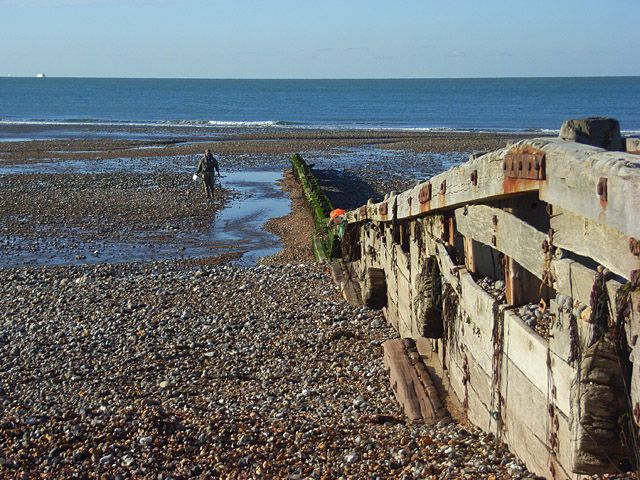
A groyne just to the west of the Cuckmere River. Some of the river's water, but not the main channel, is spilling across the beach. A Newhaven - Dieppe ferry is on the horizon.


