Derwent Water Walk
![]()
![]() Enjoy a walk along one of the Lake District's most beautiful lakes. Derwent Water (or Derwenwater) is particularly lovely - it's surrounded by fells and has several pretty islands including Derwent Island House, an 18th-century residence owned by the National Trust and open to the public on five days each year.
Enjoy a walk along one of the Lake District's most beautiful lakes. Derwent Water (or Derwenwater) is particularly lovely - it's surrounded by fells and has several pretty islands including Derwent Island House, an 18th-century residence owned by the National Trust and open to the public on five days each year.
The route makes use of the Cumbria Way and the Allerdale Ramble walking trails so is well defined and way-marked throughout.
The walk starts in the popular town of Keswick and follows the path along the western side of the lake. On the way down you stay close to the waters edge for most of the way. There are also some lovely woodland sections to enjoy.
At the end of the lake you return north on the Allerdale Ramble with a short climb taking you along the lower part of Cat Bells fell and away from the lakeside. There are fabulous views of the lake from the high points before descending through Overside Wood and returning to Keswick.
Derwent Water Ordnance Survey Map  - view and print off detailed OS map
Derwent Water Open Street Map  - view and print off detailed map
Derwent Water OS Map  - Mobile GPS OS Map with Location tracking
Derwent Water Open Street Map  - Mobile GPS Map with Location tracking
Pubs/Cafes
The route passes close to the delightful Lingholm Kitchen. This splendid cafe also includes the Kitchen gardens which Beatrix Potter credited as her inspiration for Mr McGregor’s garden in The Tale of Peter Rabbit. The Victorian style garden has herbaceous borders while it’s central areas are for vegetable production that is then served fresh daily in the Kitchen.
Back in Keswick the Lake Road Inn is a good choice for some post walk refreshments. The pub does good food and also has a nice garden area to sit out in if the weather is fine. You can find the pub on 10 Lake Road with a postcode of CA12 5BT for your sat navs. It's also dog friendly inside and outside if you have your canine friend with you.
Further Information and Other Local Ideas
To continue your walking in the area climb to Catbells on the western side of the lake. The walk is one of the most popular in the Lake District and provides wonderful views back down to the lake.
Cycle Routes and Walking Routes Nearby
Photos
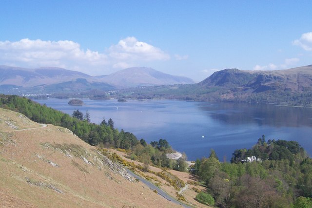
Brandelhow Bay, Derwentwater. The descent from Hawes End gives a superb view of Derwentwater. Manesty Wood is bottom right leading to Brandelhow Point. On the left is Brandelhow Wood and in the far distance Blencathra. Walla Crag rises above the eastern shore


