How Stean Gorge Circular Walk Map
![]()
![]() Visit this spectacular limestone gorge and enjoy a walk through the beautiful Nidderdale countryside.
Visit this spectacular limestone gorge and enjoy a walk through the beautiful Nidderdale countryside.
You can park in the village of Middlesmoor and then follow footpaths to the gorge about half a mile south. It's great for walkers with lots of public footpaths along the rushing river and through the surrounding woodland. The area also has an activity centre where you can try caving, rock climbing, abseiling and canoeing.
After exploring the gorge you could extend your walk by picking up the Nidderdale Way and following it to the nearby Gouthwaite Reservoir or Scar House Reservoir.
Postcode
HG3 5SF - Please note: Postcode may be approximate for some rural locationsHow Stean Gorge Ordnance Survey Map  - view and print off detailed OS map
How Stean Gorge Open Street Map  - view and print off detailed map
*New* - Walks and Cycle Routes Near Me Map - Waymarked Routes and Mountain Bike Trails>>
How Stean Gorge OS Map  - Mobile GPS OS Map with Location tracking
How Stean Gorge Open Street Map  - Mobile GPS Map with Location tracking
Pubs/Cafes
The on site How Stean Cafe does lovely homely food, sourced from local farms in Yorkshire. They also make their own ice cream available in a variety of flavours and made only ½ mile away in Lofthouse, you can even see the cows that make it from the car park. When the weather is good you can sit outside on the lovely sun terrace and enjoy fine views of the area.
You could also head north into the little village of Middlesmoor and visit the Crown Hotel. The traditional yorkshire pub has nice cosy log fires and good home cooked food. They also do decent accommodation if you need to stay over. You can find the pub at the top of the hill at postcode HG3 5ST.
Dog Walking
Under control dogs are welcome at the gorge.
Further Information and Other Local Ideas
The site organises a number of activies including rock climbing and mountain biking.
Cycle Routes and Walking Routes Nearby
Photos
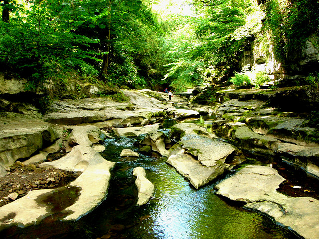
Lush vegetation on the fenced section of the walkway. The limestone ravine was carved over millennia by How Stean Beck. The gorge extends for about a kilometre and reaches depths of up to 20 metres. The limestone walls are home to a variety of mosses and liverworts, some of which are rare in the region. The surrounding area features diverse flora, including ferns, wildflowers, and wild garlic, particularly in spring. The fast-flowing beck supports brown trout, and the caves provide roosting sites for bats. Otters and deer are occasionally spotted in the vicinity, and bird species such as dippers and grey wagtails are common near the water.
Great view of the rock formations and the sun coming through a small gap in the trees. The gorge is also notable for its geological features, including fossils embedded in the rock formations. Tom Taylor's Cave, named after a local highwayman, is one of several caves accessible to visitors. The area is designated as a Site of Special Scientific Interest due to its unique geological and ecological characteristics.
Middlesmoor from Stean. The place name was first mentioned in the 12th century. It probably means "moorland in the middle of two streams" referring to the River Nidd and its tributary How Stean Beck. At the top of the hill you can see the church. This was built in 1864 by William Henry Crossland and is a Grade II listed building. The church occupies a commanding position overlooking upper Nidderdale


