Airdrie to Bathgate Cycle Path
![]()
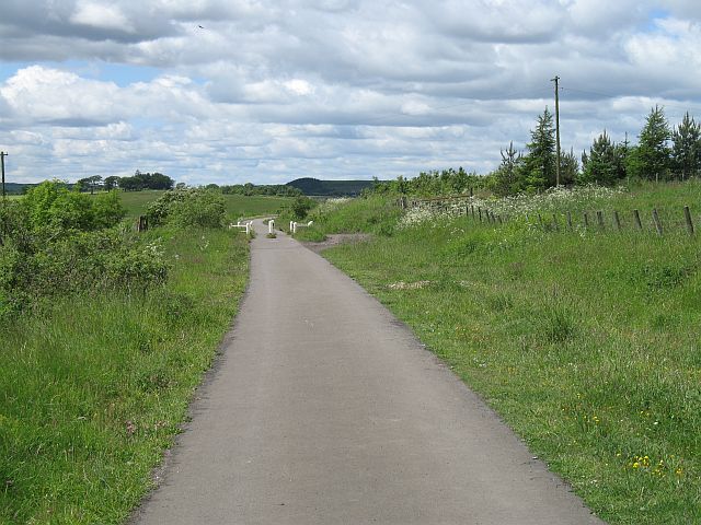
![]() This shared cycling and walking trail runs along a disused railway from Airdrie to Bathgate in North Lanarkshire. The route runs for about 14 miles along a good surfaced path on Sustrans National Cycle Route 75.
This shared cycling and walking trail runs along a disused railway from Airdrie to Bathgate in North Lanarkshire. The route runs for about 14 miles along a good surfaced path on Sustrans National Cycle Route 75.
You start of in Airdrie at Drumgelloch Station and head east to the attractive Hillend Reservoir. The trail runs along the southern side of the water before passing Garrieston, Blackridge, Westcraigs Hill, Armadale and Polkemmet Country Park. The trail finishes in Bathgate on the western side of the town near the train station.
Airdrie to Bathgate Cycle Path Ordnance Survey Map  - view and print off detailed OS map
Airdrie to Bathgate Cycle Path Open Street Map  - view and print off detailed map
Airdrie to Bathgate Cycle Path OS Map  - Mobile GPS OS Map with Location tracking
Airdrie to Bathgate Cycle Path Open Street Map  - Mobile GPS Map with Location tracking
Further Information and Other Local Ideas
To the south of the trail near Hillend Reservoir you could visit Forrestburn Reservoir and Roughrigg Reservoir where there's a circular walk along the grassy paths of the old railway track.
For cyclists the route links with Sustrans National Cycle Route 75. This signed route takes you from Edinburgh to Glasgow and then to Portavadie on the shores of Loch Fyne on the west coast of the Cowal peninsula in Argyll and Bute.
Cycle Routes and Walking Routes Nearby
Photos
Bathgate to Airdrie railway The trackbed beside the Hillend Reservoir. At the time it was used as part of the national cycle network. In October 2008 the cycle path was closed to allow reconstruction of the railway. Eventually the cyclepath will be reopened beside the restored railway.


