Brunel Cycle Trail
![]()
![]() This shared cycling and walking trail follows a disused railway line from Neyland to Johnston and Haverfordwest.
This shared cycling and walking trail follows a disused railway line from Neyland to Johnston and Haverfordwest.
You'll run along the route of Brunel’s Great Western Railway with fine views of the Pembroke countryside to enjoy on the way. It's just under 8 miles on a fairly flat surfaced path.
The route starts near Neyland Marina and follows part of National Cycle Route 4 north to Rosemarket, passing the Westfield Pill Nature Reserve on the way.
You continue north west to Johnston where there is a woodland section around Boltonhill Wood. The final section takes you north east, finishing near Merlin's Bridge on the western side of Haverfordwest.
Brunel Trail Ordnance Survey Map  - view and print off detailed OS map
Brunel Trail Open Street Map  - view and print off detailed map
Brunel Trail OS Map  - Mobile GPS OS Map with Location tracking
Brunel Trail Open Street Map  - Mobile GPS Map with Location tracking
Cycle Routes and Walking Routes Nearby
Photos
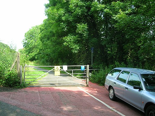
Cycle route near Johnston. This is an extension of the Brunel cycleway from Neyland to Johnston. It follows close to the course of the railway, which is just to the right in this picture, and ends at Haverfordwest.


