National Cycle Route 4
![]()
![]() This is the complete route for Sustrans National Cycle Route 4. The epic Sustrans route runs from London to Fishguard on the Welsh coast.
This is the complete route for Sustrans National Cycle Route 4. The epic Sustrans route runs from London to Fishguard on the Welsh coast.
On the route you'll pass Windsor, Reading, Newbury, Bath and Bristol before crossing the Severn Bridge into Wales. The route then heads through Newport, Swansea, Llanelli, Carmarthen, Tenby and Haverfordwest before coming to the wonderful Pembrokershire coast. The final section then runs from St Davids to Fishguard. There's lots of fine traffic free sections including the popular Bristol and Bath Railway Path, the Kennet and Avon Canal, Windsor Great Park, the Chippenham to Calne Railway Path, the Taff Trail and the splendid Millennium Coastal Park in Llanelli.
Scroll down to the bottom of the page for the complete route gpx file and some videos of the route.
Cycle Routes on National Cycle Route 4
- London to Windsor - This long cycle ride runs along the trail from West London to Windsor in Berkshire
- Reading to Windsor - Travel along NCN route 4 from Reading to Windsor
- Marlborough to Reading - This lovely ride takes you along the trail from Marlborough in Wiltshire to Reading in Berkshire via Newbury & Hungerford.
- Trowbridge to Marlborough - Follow the trail from Trowbridge to Marlborough on this waterside ride
- Bath to Chippenham - Follow the trail from Somerset into Wiltshire on this attractive water based ride
- Bristol to Trowbridge - This lovely largely traffic free route takes you along the trail from Bristol to Bath and Bradford-on Avon before finishing in Trowbridge
- Bristol to Thornbury - This route starts by the River Avon in Bristol and follows the tow path for a few miles before heading north along the trail to Thornbury
- Swansea to Bridgend - Follow the trail on this lovely ride which has splendid views of the South Wales coast and a fantastic stretch through Margam Country Park
- Swansea to Carmarthen - Follow the trail from Swansea to Carmathen with wonderful coastal views of the beautiful Gower Peninsula and several long traffic free sections to enjoy.
You start by the marina in Swansea and head west along the front with super views of Swansea Bay and Mumbles Bay - Llanelli to Carmarthen - This ride follows the trail and the splendid Millennium Coastal path from Llanelli to Carmarthen.
You start by heading west towards Burry Port along the Llanelli sea front on the off road Millennium Coastal path - Carmarthen to Tenby - Follow the trail on this attractive ride through Carmarthenshire and along the beautiful Pembrokeshire coast.
The ride starts with an attractive on road stretch to Laugharne via St Clears - Ogmore Valley - Follow the Ogmore Valley Cycle Track from Aberkenfig to Nant-y-Moel on this traffic free cycle ride in Bridgend County.
- Swansea Bike Path - A lovely traffic free ride along Swansea Bay from Mumbles Head to Swansea.
National Cycle Route 4 Ordnance Survey Map  - view and print off detailed OS map
National Cycle Route 4 Open Street Map  - view and print off detailed map
National Cycle Route 4 OS Map  - Mobile GPS OS Map with Location tracking
National Cycle Route 4 Open Street Map  - Mobile GPS Map with Location tracking
Further Information and Other Local Ideas
In Somerset the trail links with the Avon Cycleway. The long distance circular ride explores the area around Bristol, visiting the edge of the Cotswolds and the coast around Clevedon.
The Great Western Way uses NCN Route 4. The trail runs from Bristol to London following the route of Isambard Kingdom Brunel's 19th century railway. It finishes at Southwark's Brunel Museum, where you can learn all about the life and works of the famous engineer.
Also of interest is the Brunel Trail which runs along part of the route between Haverfordwest and Neyland Marina.
At Kintbury the route links with National Cycle Route 246 which runs from Hampshire based Romsey to Kintbury in West Berkshire.
Cycle Routes and Walking Routes Nearby
Photos
The Millennium Coastal Path at Pembrey. This is part of National Cycle Network route 4 where it runs along the edge of the dunes at Pembrey at the western end of the Llanelli Millennium Coastal Park. The 22km long park was mostly reclaimed from industrial wasteland and otherwise useless waste products - 800,000 tons of pulverised fuel ash from the site of the Carmarthen Bay power station and sewage sludge and silt from Burry Port harbour - were used in the reclamation process.
Black Dog Halt, near Calne, Wilts. Black Dog Halt was on the railway branch line between Chippenham and Calne in Wiltshire. The halt was built in 1873 to serve nearby Bowood House; it only became a public station in 1952 and closed with the rest of the line in 1965. The line is now a cycle path, part of the National Cycle Network route 4 from London to the West. The railings are by artist Laura Lian.
Normal tidal limit, Afon Afan, Port Talbot. Looking west, downstream, from Cramic Way. The sluice on the left hand side marks the normal tidal limit. National Cycle Network Route 4 follows the bank of the river here.
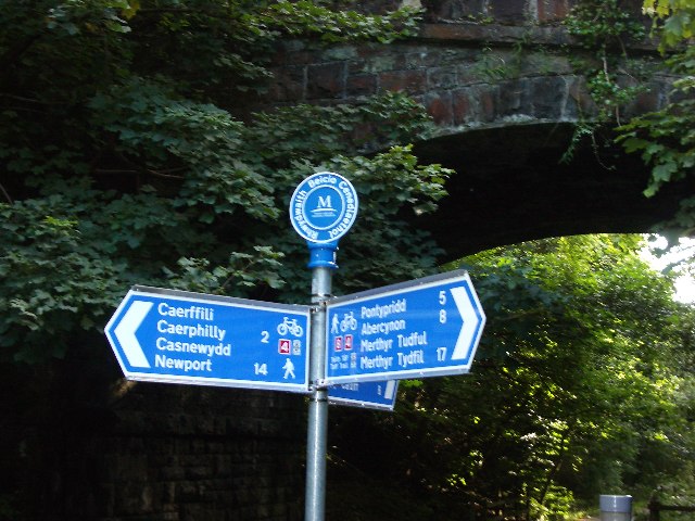
The Taff Trail Junction of National Cycleway Routes 4 and 8. The route of the Taff Trail from Taffs Well follows the former Rhymney Railway. At this point Cycleway Route 4 (east) continues in the deep Penrhos Cutting towards Caerphilly. Routes 4(west) and 8(North) continue over the same course towards Pontypridd.


