GPS Cycle and Walking Routescycle iconwalk icon

Leeds to Bradford Cycle Superhighway

8.8 miles (14.2 km)

Ordnance Survey Map Open Streetmap This ride takes you along the Cycle Superhighway from Leeds to Bradford.
The route runs for just under 9 miles connecting the two Yorkshire cities. You start off in Leeds at the train station, just south of the cathedral and east of the canal wharf. The route then heads west through Pudsey before finishing at the cathedral in Bradford.
If you would like to turn it into a circular route you could follow National Cycle Route 66 back to Leeds. This can be followed north from Bradford to Shipley before heading east along the Leeds and Liverpool Canal to Rodley and Kirkstall.

Leeds to Bradford Cycle Superhighway OS Map Ordnance survey map - Mobile GPS OS Map with Location tracking

Leeds to Bradford Cycle Superhighway Open Street Map Open Streetmap - Mobile GPS Map with Location tracking

Cycle Routes and Walking Routes Nearby

Photos

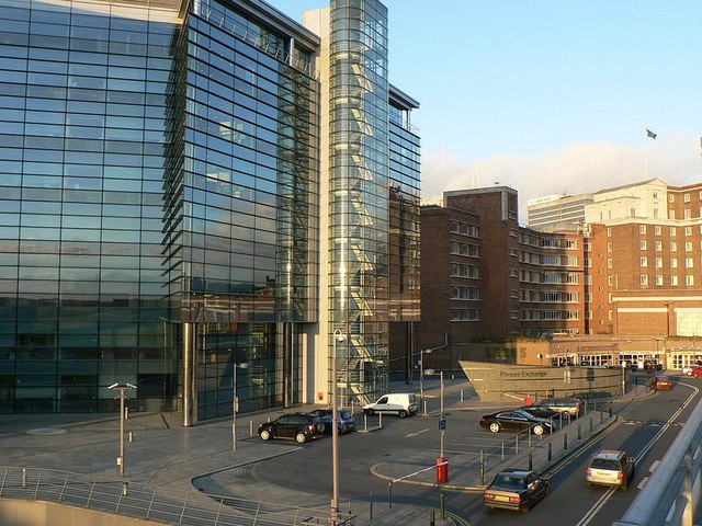
Princes Exchange, Princes Square - geograph.org.uk - 278788

Princes Exchange, Princes Square Leeds. Near the train station.

River Aire from Wellington Road Bridge - geograph.org.uk - 552112

River Aire from Wellington Road Bridge Leeds

Stanningley Road, Upper Armley - geograph.org.uk - 922649

Stanningley Road, Upper Armley

Bradford Cathedral 01

Bradford Cathedral

Video

GPS Files

GPX File

Leeds to Bradford Cycle Superhighway.gpx (On Desktop:Right Click>Save As. On Ipad/Iphone:Click and hold>Download Linked File)