Lugnaquilla Walk
![]() Climb to the highest mountain in Ireland on this challenging walk in the Wicklow Mountains.
Climb to the highest mountain in Ireland on this challenging walk in the Wicklow Mountains.
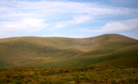
The route starts from the Baravore Car Park in a remote part of the Glenmalure Valley. From here you can pick up the footpaths heading north west along the Avonberg River. The route then turns west, heading up to Fraughan Rock Glen and Cannow Mountain. You then turn south to climb to the 925-metre (3,035 ft) summit of Lugnaquilla. From here you can enjoy fine views to the east across the Irish Sea to the hills of the Llyn Peninsula and mountains of Snowdonia in Wales, and west to the mountains of Munster.
You descend to Cloghernagh before turning north to Art's Lough. The final section descends through woodland to return to the river and the car park.
To continue your walking in the area head north east to Glendalough Lakes. Here you will find waymarked trails, taking you around both lakes with riverside sections, woodland and a waterfall to enjoy as well.
Lugnaquilla Open Street Map  - view and print off detailed map
Lugnaquilla Open Street Map  - Mobile GPS Map with Location tracking
Further Information and Other Local Ideas
Just to the west you can pick up the Barrow Way, a 100km walk following the River Barrow from Robertstown, County Kildare to Graiguenamanagh and St Mullins Walk in County Carlow.
The epic Wicklow Way passes through the area. You could pick up this waymarked trail to further explore the Wicklow Mountains.
To the south east there's Avondale Forest Park where you can try the circular woodland trail along the River Avonmore. The park also includes a popular treetop walk where you can enjoy wonderful views over the area from an elevated path through the trees. It is the first of its kind in Ireland.


