Abbots Bromley Walks
![]()
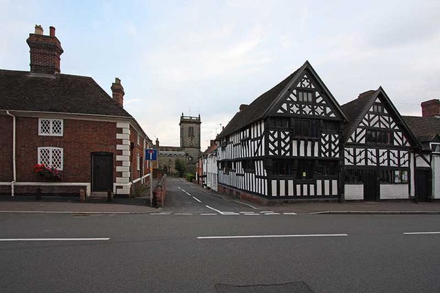
![]() This fine Staffordshire village is a worthy place to explore. The village has won best kept village awards and was rated the best place to live in the Midlands by the Sunday Times in 2013 and again in 2016. There's a number of historic listed buildings to see including the half timbered Church House and The Goats Head Inn.
This fine Staffordshire village is a worthy place to explore. The village has won best kept village awards and was rated the best place to live in the Midlands by the Sunday Times in 2013 and again in 2016. There's a number of historic listed buildings to see including the half timbered Church House and The Goats Head Inn.
This walk from the village uses the Staffordshire Way to visit some of the highlights of the area including Blithfield Reservoir, the Trent and Mersey Canal and Shugborough Park.
The walk starts in the village where you can pick up the Staffordshire Way and follow the waymarked footpath south to Yenbrook and the impressive dam at Blithfield Reservoir.
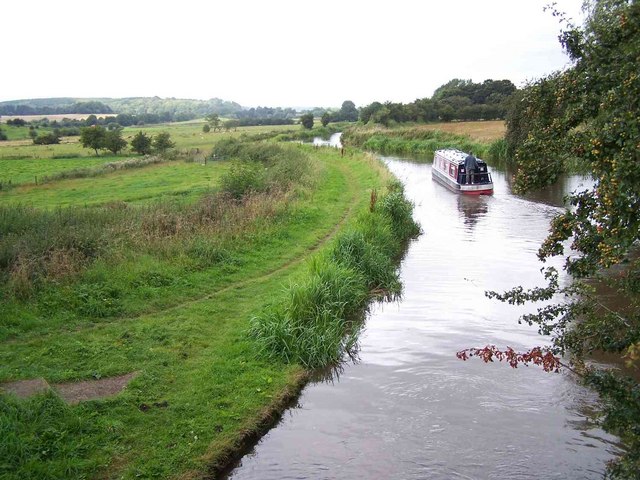
The route continues through the village of Colton before joining up with the canal near Rugeley. You then follow it north west through Colwich and Little Haywood where there are views of the River Trent. You continue to Great Haywood where you can cross the river to visit Shugborough Hall Park.
Postcode
WS15 3BN - Please note: Postcode may be approximate for some rural locationsAbbots Bromley Ordnance Survey Map  - view and print off detailed OS map
Abbots Bromley Open Street Map  - view and print off detailed map
Abbots Bromley OS Map  - Mobile GPS OS Map with Location tracking
Abbots Bromley Open Street Map  - Mobile GPS Map with Location tracking
Walks near Abbots Bromley
- Staffordshire Way - Travel through Staffordshire, Cheshire, Derbyshire, Worcestershire and enjoy canals, lakes, country parks and a series of pretty towns and villages
- Blithfield Reservoir - This large reservoir in the Blithe Valley has three nice colour coded walking trails to try
- Trent and Mersey Canal - Follow the Trent and Mersey Canal through Derbyshire, Staffordshire and Cheshire on this long distance waterside walk
- Shugborough Park - This circular walk uses public footpaths and the Staffordshire Way to take you around Shugborough Park in Great Haywood
- Uttoxeter - This Staffordshire based market town has some nice river and country trails to try.
- Doveridge - This quiet Derbyshire based village sits close to the border with Staffordshire and the River Dove
Pubs/Cafes
The Coach & Horses is located on the High Street at postcode WS15 3BN for your sat navs. They serve good quality food at reasonable prices. There's also the historic Goats Head which is housed in a fine looking half timbered building on the Market Place. They have a good sized outdoor area and can be found at postcode WS15 3BP.
Dog Walking
The country and canalside trails make for a fine dog walk and The Coach & Horses mentioned above is also dog friendly.
Further Information and Other Local Ideas
Head north along the Staffordshire Way and it will take you to nearby Uttoxeter where you can visit the famous Uttoxeter Racecourse.
For more walking ideas in the area see the Staffordshire Walks page.


