Agglestone Rock
![]()
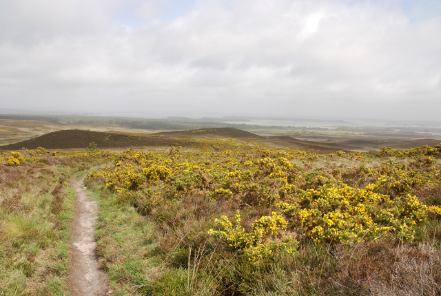
![]() This walk takes you across the Godlingston Heath Nature Reserve to the prominent sandstone block of Agglestone Rock. The walk crosses Black Down which rises some 300ft above sea level. As such it is a moderately challenging walk with the reward of fantastic views towards the coast for much of the way. Look out for wildlife including wild horses and possibly deer.
This walk takes you across the Godlingston Heath Nature Reserve to the prominent sandstone block of Agglestone Rock. The walk crosses Black Down which rises some 300ft above sea level. As such it is a moderately challenging walk with the reward of fantastic views towards the coast for much of the way. Look out for wildlife including wild horses and possibly deer.
The walk starts at Middle Beach in Studland where there is ample parking. From here you follow Beach Road round to the Studland Store and then cross the main road. Walk up Heath Green Road and then turn right onto Agglestone Road and you will soon come to the heath where you can pick up the footpaths.
Head south west along the paths to Fishing Barrow which climbs to a height of nearly 400ft. Here you turn right and continue towards Agglestone Rock. There's splendid views across the heath to Studland Bay and Poole Harbour as you go. You can see the view from the rock using the Google Street View link below.
After admiring the impressive rock the walk descends to Knowl Hill before crossing the eastern edge of the heath and returning to the car park.
Godlingston Heath sits right next to Studland Heath where there are more nice walking trails to try. You could head north from the rock and visit the Little Sea to extend your exercise.
The start point for this walk is also very close to the popular Old Harry Rocks. You can follow the South West Coast Path to the rocks and enjoy a climb to Ballard Down.
Just to the west you will find miles of heathland cycling and walking trails on Rempstone Heath.
Agglestone Rock Ordnance Survey Map  - view and print off detailed OS map
Agglestone Rock Open Street Map  - view and print off detailed map
Agglestone Rock OS Map  - Mobile GPS OS Map with Location tracking
Agglestone Rock Open Street Map  - Mobile GPS Map with Location tracking
Explore the Area with Google Street View 
Pubs/Cafes
There's some good options for refreshments in Studland on the walk. The Studland Stores on the corner sell lots of sandwiches and snacks which you could eat outside somewhere on the route. There's also the Bankes Arms which has a splendid garden area with views over the sea. The 16th century inn also has a fine interior with wood fires in the winter. You can find it on Manor Road with a postcode of BH19 3AU for your sat navs.
Dog Walking
The heath is a fine place for a dog walk so you'll probably see plenty of other owners on a fine day. Please keep them on leads between March and September because of the wildlife though. The Bankes Arms pub mentioned above is also dog friendly.
Cycle Routes and Walking Routes Nearby
Photos
Gate on Godlingston Heath. On the other side is genuine heathland with ponies and other animals. On this side a golf course.


