Ampney Crucis Walk
![]()
![]() This small Cotswolds based village lies just to the east of Cirencester.
This small Cotswolds based village lies just to the east of Cirencester.
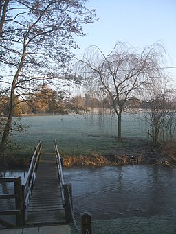
This circular walk from the village takes you to small of the local ancient churches and the neighbouring village of Ampney St Peter. On the way there's some pleasant countryside paths and views of the Ampney Brook which flows through the area.
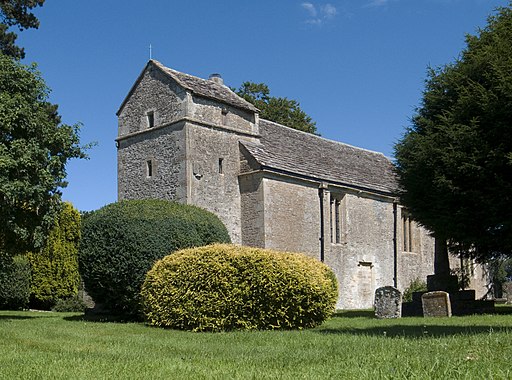
The walk starts on the Main Street in the village and heads west towards Ampney Park. Here you turn south to visit the noteworthy Church of the Holy Rood. The Grade I listed church has Saxon foundations with some of the stonework being Norman.
You continue south to Waterton Farm where you turn east on public country footpaths to St Mary church, crossing the Ampney Brook on the way. Another Grade I listed building this church dates back to the 1100s.
You continue to Ampney St Peter where the Anglican Church has Saxon origins. The fabric of the current building dates from the late 12th or early 13th century and underwent Victorian restoration.
The route then heads to Ashbrook Farm where you turn west to follow country path back to Ampney Crucis.
Ampney Crucis Ordnance Survey Map  - view and print off detailed OS map
Ampney Crucis Open Street Map  - view and print off detailed map
Ampney Crucis OS Map  - Mobile GPS OS Map with Location tracking
Ampney Crucis Open Street Map  - Mobile GPS Map with Location tracking
Further Information and Other Local Ideas
To the east there's Eastleach where you can enjoy two noteworthy Norman churches and an ancient stone slab clapper footbridge over the River Leach. It's another picture postcard place known for its numerous historic buildings and a colourful display of daffodils in the spring. Lovely Southrop can also be visited in this area.
Cycle Routes and Walking Routes Nearby
Photos
15th Century Cross, Holy Rood Church, Ampney Crucis This is probably the cross from which the village takes its name (Crux (& hence Crucis) is the Latin for cross). Apparently it was hidden in the church to save it from destruction by Puritan iconoclasts in the mid 17th century, and only rediscovered in 1840. It was restored and put in its present position in 1860.


