Sapperton Circular Walk
![]()
![]() The Cotswolds village of Sapperton has some good trails to follow through the extensive local woodland and attractive Cotswolds countryside. This walk visits the Sapperton Canal Tunnel where there are footpaths along the well known local structure. There's also nice waterside walking along the canal and rivers which run through the area.
The Cotswolds village of Sapperton has some good trails to follow through the extensive local woodland and attractive Cotswolds countryside. This walk visits the Sapperton Canal Tunnel where there are footpaths along the well known local structure. There's also nice waterside walking along the canal and rivers which run through the area.
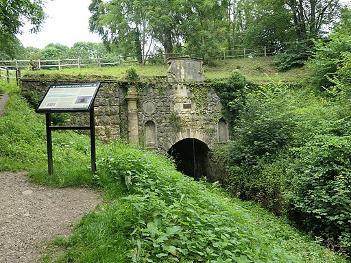
The walk starts in the village and heads west to Sapperton Wood and Frampton Wood, before picking up waterside paths along the River Frome to the village of Frampton Mansell. It then turns south east, following the old Sapperton Tunnel and other tracks towards Tarlton. You then pick up the Macmillan Way to take you along the Sapperton Canal Tunnel. With a length of 3,817 yards it was the longest canal tunnel, and the longest tunnel of any kind, in England from 1789 to 181. This section runs through Hailey Wood, before following country lanes back into the village.
At the southern point of this walk you are very close to the Source of the Thames near Kemble. If you have time it's worth a detour from the route to visit the site where you can pick up the Thames Path National Trail.
To extend your walking in the Sapperton area you can pick up the Cotswold Canals long distance trail. You could follow it west along the Thames and Severn Canal to Chalford.
You could also follow the Macmillan Way north east, and explore the Cotswolds Hills.
Sapperton Circular Walk Ordnance Survey Map  - view and print off detailed OS map
Sapperton Circular Walk Open Street Map  - view and print off detailed map
Sapperton Circular Walk OS Map  - Mobile GPS OS Map with Location tracking
Sapperton Circular Walk Open Street Map  - Mobile GPS Map with Location tracking
Walks near Sapperton
- Chalford and the Toadsmoor Valley - Enjoy a walk along the Thames and Severn Canal before exploring the woodland of the Toadsmoor Valley on this walk from Chalford
- Source of the Thames - This walk takes you from the village of Kemble to the source of the River Thames at Thames Head, in Gloucestershire
- Cotswold Canals - Follow a series of delightful waterways from Framilode to Lechlade on this waterside walk through Gloucestershire.
The walk starts at Framilode, next to the River Severn and follows the Stroudwater Canal and the River Frome to the market town of Stroud - Thames Path - Starting at the Source of the Thames at Thames Head in Gloucestershire, follow the iconic river through beautiful countryside and historic towns to the city of London.
- Frampton Mansell - This little village has some nice trails to try through the Frome Valley and up into the Cotswold Hills.
This walk takes you along the river and the Thames and Severn Canal to the nearby village of Sapperton - Cirencester Park - Explore 3000 acres of parkland and woodland on this fine circular walk in Cirencester
- Ampney Crucis - This small Cotswolds based village lies just to the east of Cirencester.
Pubs/Cafes
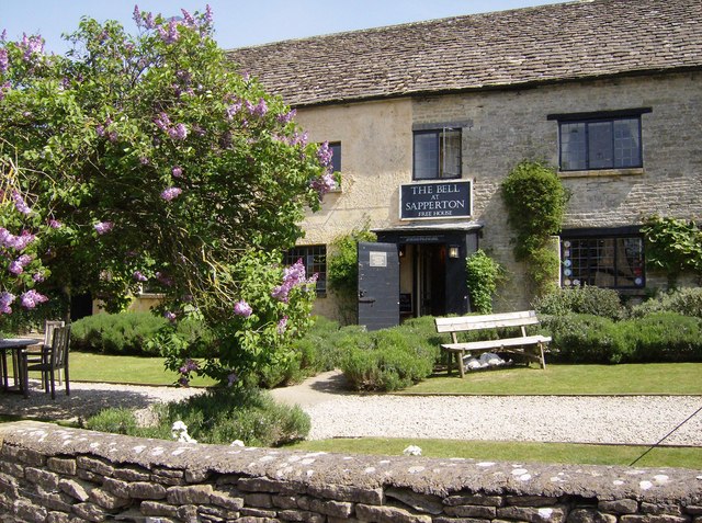
The Bell is a nice local village pub where you can enjoy some refreshments after your walk. The 18th century pub has a charming interior with cosy log fires. Outside there's a pleasant courtyard garden for the summer months. You can find them at a postcode of GL7 6LE for your sat navs.
Dog Walking
The woodland and canal side paths make for a fine dog walk. The Bell mentioned above is also dog friendly.
Further Information and Other Local Ideas
Head a short distance east from the village and you could explore the expansive Cirencester Park. This park has miles of woodland trails, a large lake, old follies and a deer park. Just to the east of the park there's the villages of Ampney Crucis and Ampney St Peter where you can visit a series of noteworthy ancient churches.
Photos
Footpath through woods, near Frampton Mansell. This is a view to the south south east along the footpath near the edge of the woodland. At left out of shot is a large field from where the daylight is coming to highlight the path in the middle distance. In the far distance the path crosses over the top of the Sapperton Long railway tunnel. Autumn has arrived as confirmed by the start of the leaf fall.
St Luke's church and a cottage, Frampton Mansell. Frampton Mansell is a small, pretty village in a deep valley. The church just to the right of centre dates from the first half of the 19th century. This is all I could find out about it: 'The church was built in 1843 by the then Lord Bathurst, in the Italian style. It has an unusual chancel with fine stone vaulting. All windows are of stained glass with five richly coloured windows depicting Christ flanked by Matthew, Mark, Luke & John.' Courtesy of the Gloucestershire County Council website.
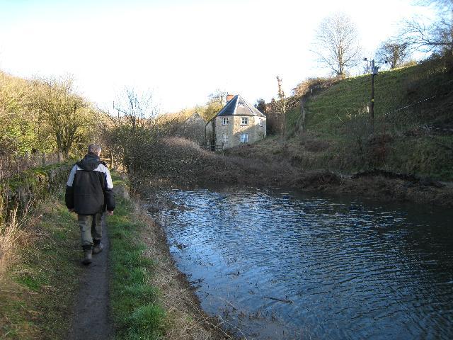
Puck's Mill Upper Lock. This lock on the Thames & Severn Canal is to the left of the unusual lock keeper's cottage and has an aqueduct underneath over the River Frome. The pound visible in the picture between the two Puck Mill Locks was completely relined with clay in the early 1900s but today it leaks like a sieve and only holds water after exceptionally wet periods. No prizes for guessing what the weather had been like in the days just before this picture was taken!
South or Coates portal of the Sapperton Canal Tunnel, Gloucestershire, with interpretation sign on the left.


