Arrochar Circular Walk
![]()
![]() This circular walk explores the area around the village of Succoth, just to the west of Arrochar. There's nice views over Loch Long and the surrounding mountains. You can catch the train to Arrochar from Glasgow on the West Highland Line. The journey is less than 1.5 hours and is also a direct service.
This circular walk explores the area around the village of Succoth, just to the west of Arrochar. There's nice views over Loch Long and the surrounding mountains. You can catch the train to Arrochar from Glasgow on the West Highland Line. The journey is less than 1.5 hours and is also a direct service.
The walk starts from Arrochar and Tarbet train station where you can pick up the Three Lochs Way waymarked trail and follow it towards Stronafyne and then on to Succoth. You can then follow a waymarked, circular trail through woodland around the village. You'll enjoy fine views of Glen Loin, Loin Water, Loch Long and Ben Lomond as you make your way along the path.
To continue your walking in the area climb to The Cobbler Mountain in the Arrochar Alps. Also known as Ben Arthur, the climb to the summit starts near Succoth and heads in a north westerly direction.
The Cowal Way also passes the village. The waymarked trail visits Loch Fyne, the Kyle of Bute and Loch Ruel.
You could follow the trail west to visit Lochgoilhead and Loch Goil where you can enjoy some splendid waterfalls on Donich Water.
Arrochar Ordnance Survey Map  - view and print off detailed OS map
Arrochar Open Street Map  - view and print off detailed map
Arrochar OS Map  - Mobile GPS OS Map with Location tracking
Arrochar Open Street Map  - Mobile GPS Map with Location tracking
Further Information and Other Local Ideas
Head a few miles north and you could visit the impressive Loch Sloy Dam and enjoy fine views down to the loch below. Ben Vorlich is also near the loch and a good climb to try in the area.
Head west to Loch Fyne and you could visit Inveraray Castle. The photogenic Gothic Revival castle dates back to the 18th century and is surrounded by lovely parkland, woodland and gardens. There's also a wonderful viewpoint with fine views down to the loch.
For more walking ideas in the area see the Loch Lomond and the Trossachs Walks page.
Cycle Routes and Walking Routes Nearby
Photos
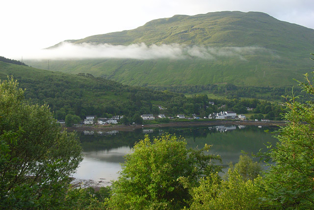
Loch Long and Arrochar, near to Arrochar, Argyll And Bute, Great Britain. A view across the head of the tidal loch from the start of the path to Beinn Narnain above Succoth. Ben Reoch is in the background beyond the ridge extending southwest from Cruach Taibeirt.


