Backwater Reservoir
![]()
![]() Enjoy a circular walk around this reservoir in Glen Isla, north west Angus. For the past 30 years, the Backwater Reservoir has supplied the residents of Angus with their water. This walk takes you around the reservoir and includes two climbs to hills overlooking the water. It's a wonderfully peaceful area with the large reservoir surrounded by attractive countryside and forest.
Enjoy a circular walk around this reservoir in Glen Isla, north west Angus. For the past 30 years, the Backwater Reservoir has supplied the residents of Angus with their water. This walk takes you around the reservoir and includes two climbs to hills overlooking the water. It's a wonderfully peaceful area with the large reservoir surrounded by attractive countryside and forest.
Start the walk from the car park at the southern end of the reservoir. Then follow the footpaths along the western side of the water before climbing to Hare Cairn. At over 500m (1640ft) there is a great view from the top of the hill. The route then heads along the eastern side of the reservoir, climbing Creigh Hill before returning to the car park. From Creigh Hill there are more nice views back down to the reservoir.
The Cateran Trail runs just to the west of the reservoir, through the village of Kirkton of Glenisla. You can pick up the trail and follow it south towards Alyth.
You could also head south and visit the pretty Lintrathen Loch which is a great place for wildlife watching.
Postcode
PH11 8PR - Please note: Postcode may be approximate for some rural locationsBackwater Reservoir Ordnance Survey Map  - view and print off detailed OS map
Backwater Reservoir Open Street Map  - view and print off detailed map
Backwater Reservoir OS Map  - Mobile GPS OS Map with Location tracking
Backwater Reservoir Open Street Map  - Mobile GPS Map with Location tracking
Pubs/Cafes
Head west to Kirkton of Glenisla and you could enjoy some refreshments at the 17th century Glenisla Hotel. They have a Bar & Restaurant with a good menu of light lunches and main meals. You can find them at postcode PH11 8PH for your sat navs.
Further Information and Other Local Ideas
A few miles to the south east you could visit Kirriemuir and the Loch of Kinnordy. The RSPB nature reserve includes a wide variety of wildlife and more nice waterside trails.
The remote Loch Shandra is just to the north west.
Cycle Routes and Walking Routes Nearby
Photos
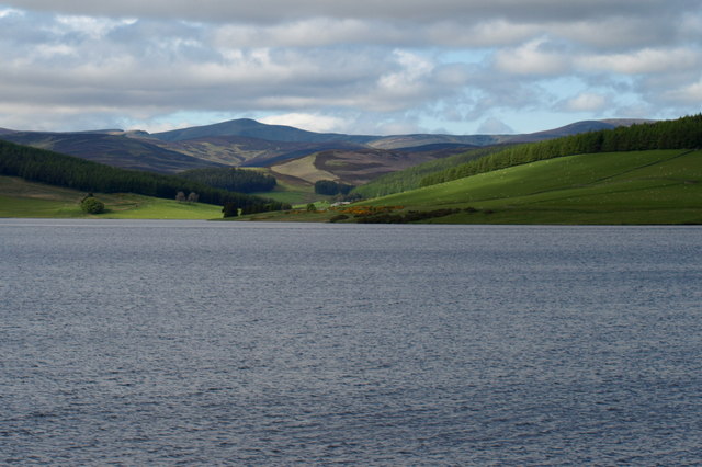
View of Backwater Reservoir and Beyond. Picture taken from the southeast end of the road that traverses the reservoir.
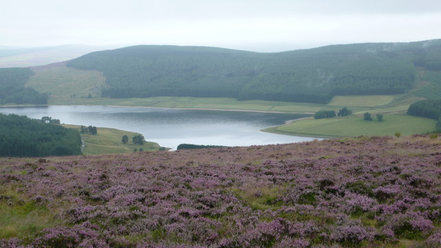
Backwater Reservoir viewed from the slopes of the 503m top of Milldewan Hill where there is lots of pretty heather to see. Shortly after this a landrover drove by, no doubt having a check on the moor prior to the start of the grouse season, for which this area is well known.


