Barston Lakes And River Blythe Walk
![]()
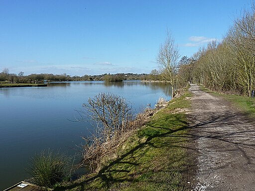
![]() This walk takes you around Barston Lakes near the village of Barston in the West Midlands.
This walk takes you around Barston Lakes near the village of Barston in the West Midlands.
The site includes some pleasant waterside footpaths around the lake and along the River Blythe which runs beside the eastern part of the lake. At the northern end you will pass the old Packhorse Bridge which dates back to the 15th century. The area also includes a nature reserve where you can look out for a variety of wildlife.
The walk can be started at the car park at the southern end of the lake.
You can also walk down from Hampton in Arden which is only about half a mile to the north.
Postcode
B92 0LB - Please note: Postcode may be approximate for some rural locationsPlease click here for more information
Barston Lakes Ordnance Survey Map  - view and print off detailed OS map
Barston Lakes Open Street Map  - view and print off detailed map
Barston Lakes OS Map  - Mobile GPS OS Map with Location tracking
Barston Lakes Open Street Map  - Mobile GPS Map with Location tracking
Walks near Barston
- Berkswell Circular Walk - This village near Coventry has a number of good waymarked footpaths to try
- Hampton in Arden - This West Midlands based village includes a train station, a good 17th century village pub and a pleasant local nature reserve for easy walks.
- Coventry - This long circular walk uses a mixture of waymarked footpaths and minor roads to take you to some of the highlights of the city
- Balsall Common - This village near Coventry is surrounded by some lovely countryside with a major long distance trail running right through it.
- Coventry Canal - Enjoy waterside cycling and walking along the 38 mile long Coventry Canal towpath
- Brandon Woods - These woods near Coventry have a network of good footpaths to follow around the 178 acre site
- Kenilworth - A short circular walk around the Warwickshire town of Kenilworth, visiting St Mary's Abbey, Abbey Fields and Kenilworth Castle
- Coventry Way - This walk circles the countryside around Coventry taking you through some fine Warwickshire countryside and a series of interesting villages.
The walk starts at Meriden and heads towards Kenilworth with its impressive castle - described by architectural historian Anthony Emery as the 'finest surviving example of a semi-royal palace of the later middle ages, significant for its scale, form and quality of workmanship' - Brandon Marsh - This lovely nature reserve near Coventry has some nice footpaths taking you around a series of lakes and lagoons
- Ryton Pools Country Park - Enjoy a cycle or walk around this lovely park in Ryton, Warwickshire
- Hearsall Common - This area of common land is located just to the west of Coventry city centre and is a nice place for a peaceful afternoon stroll
- Heart of England Way - Follow the Heart of England Way through the Midlands of England
- Warwickshire Millennium Way - Follow the Millennium Way through the Warwickshire, Worcestershire and Northamptonshire countryside from Pershore to Middleton Cheney
- Solihull - This large town is located in the West Midlands, near Birmingham
- Meriden - This West Midlands village is located in the Solihull area of the county.
Pubs/Cafes
The Lake at Barston is located at the adjacent West Midlands Golf Club. It's open to the public and all tables have a view of the 21 acre Barston Lake. They serve quality dishes including a fine Sunday carvery.
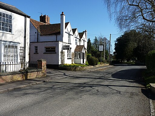
You could also head into Barston village and visit The Bulls Head. The former coaching inn dates to the 1600s and includes a particularly lovely, large garden area for warmer days. They have a good menu and also serve real ale. You can find them on Barston Lane at postcode B92 0JU. A stroll around the village is also very pleasant with many historic buildings, some of which are timber-framed.
Photos
15th-century packhorse bridge across the River Blythe at Hampton-in-Arden, West Midlands (formerly Warwickshire). This is part of Marsh Lane but is not accessible to vehicles. In the foreground is a ford through the river.


