Benacre Walk - Covehithe, Beach and Broad
![]()
![]() This circular walk explores the Benacre National Nature Reserve in the Suffolk Coast and Heaths AONB.
This circular walk explores the Benacre National Nature Reserve in the Suffolk Coast and Heaths AONB.
On the way you'll visit the tranquil Benacre Broad, Benacre Beach and the ruined church at the little hamlet of Covehithe. The extensive reserve also includes open water lagoons, reed beds and a large variety of wildlife. Look out for marsh harrier, bearded reedling, water rail and bittern as you make your way through this lovely area.
The walk starts in the little village of Benacre and follows the Suffolk Coast Path east to the beach. You then follow the beach south to the broad where you can look out for a number of water loving birds from the waterside hide.
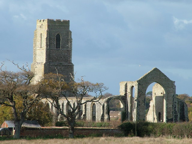
You continue along the beach before following a country lane to Covehithe where you will pass the noteworthy St Andrews Church. The 14th century ruined church is recorded in the National Heritage List for England as a designated Grade I listed building.
The route then follows the trail north west towards Wrentham before turning north to return to Benacre.
Benacre Ordnance Survey Map  - view and print off detailed OS map
Benacre Open Street Map  - view and print off detailed map
Benacre OS Map  - Mobile GPS OS Map with Location tracking
Benacre Open Street Map  - Mobile GPS Map with Location tracking
Pubs/Cafes
Slightly off the route is The Five Bells Inn near Wrentham. It's a decent pub with open fires and wooden beams inside and a large garden area outside. The pub is also dog friendly if you have your canine friend with you. You can find it on the Southwold Road with a postcode of NR34 7JF for your sat navs.
Further Information and Other Local Ideas
The Kessingland to Southwold Walk passes through the reserve and is a nice way to extend your walking in the vicinity. Near here you can pick up the circular Blythburgh Walk and enjoy a walk through the Walsberwick Nature Reserve. If you followed the Blyth river west from the settlement you will soon come to the neighbouring town of Halesworth. This town has some interesting history with a walk down the central Thoroughfare highly recommended. The pedestrianised area includes many buildings dating back to the sixteenth century.
If you head north along the coast path it will take you to the major town of Lowestoft.
For more walking ideas in the area see the Suffolk Coast and Heaths Walks page.
Cycle Routes and Walking Routes Nearby
Photos
Benacre beach. The nature reserve at Benacre, the tree in the sea is a strange feature. The shingle beach also forms an important habitat and the coastal area of the parish is part of the Pakefield to Easton Barents Site of Special Scientific Interest.


