Halesworth Walks
![]()
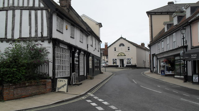
![]() This Suffolk based market town has some nice trails along the Blyth River. It's also close to the Suffolk Coast and Heaths AONB where there are miles of excellent walking trails and a series of wildlife rich nature reserves to explore. The town itself has some interesting history with a walk down the Thoroughfare highly recommended. This pedestrianised area includes many buildings dating back to the sixteenth century.
This Suffolk based market town has some nice trails along the Blyth River. It's also close to the Suffolk Coast and Heaths AONB where there are miles of excellent walking trails and a series of wildlife rich nature reserves to explore. The town itself has some interesting history with a walk down the Thoroughfare highly recommended. This pedestrianised area includes many buildings dating back to the sixteenth century.
This walk from the town takes you east along the New Reach river and the River Blyth to Blyford.
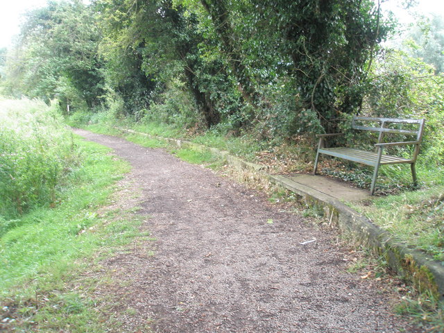
The walk starts just to the south of the train station where you can pick up a shared cycling and walking route along the New Reach. Follow the path east and it will take you to Mells and Blyford where you could stop for refreshments before the return leg.
You could extend the walk by continuing east to visit nearby Blythburgh. Here you can visit the Suffolk Coast National Nature Reserve and the Walberswick Nature Reserve. The historic village is also well known for the Grade I listed Holy Trinity Church, known as the Cathedral of the Marshes.
Postcode
IP19 8HR - Please note: Postcode may be approximate for some rural locationsHalesworth Ordnance Survey Map  - view and print off detailed OS map
Halesworth Open Street Map  - view and print off detailed map
Halesworth OS Map  - Mobile GPS OS Map with Location tracking
Halesworth Open Street Map  - Mobile GPS Map with Location tracking
Walks near Halesworth
- Blythburgh - This small East Suffolk based village lies on the River Blyth near to Dunwich Forest, the Suffolk Coast National Nature Reserve and the Walberswick Nature Reserve
- Dunwich Forest - This large forest is located in the Suffolk Coasts and Heaths Area of Outstanding Natural Beauty in the village of Dunwich
- Dunwich Heath - This beautiful coastal heathland is a wonderful place for a peaceful circular walk
- Dunwich to Walberswick Walk - This circular walk takes you from Dunwich to Walkberswick on the Suffolk coast
- Southwold to Walberswick - This is a popular walk from Southwold to Walberswick, passing along the coast and the River Blyth
- Suffolk Coast Path - A walk along the beautiful Suffolk coast from Felixstowe to Lowestoft
- Suffolk Coast National Nature Reserve - This delightful coastal nature reserve is situated around the village of Walberswick in the Suffolk Coast and Heaths Area of Outstanding Natural Beauty
- Benacre - This circular walk explores the Benacre National Nature Reserve in the Suffolk Coast and Heaths AONB.
- East Suffolk Line Walks - Follow the 'East Suffolk Line' railway from Ipswich to Lowestoft on this splendid walk through the Suffolk countryside
- Southwold - This lovely circular walk takes you from the coastal town of Southwold to the nearby village of Walberswick in the Suffolk Coast and Heaths Area of Outstanding Natural Beauty
- Saxmundham - This Suffolk based market town has some nice trails to try through the valley of the River Fromus
- Laxfield - This walk visits the splendidly preserved medieval village of Laxfield in Suffolk.
Pubs/Cafes
The White Hart is a good choice for some post walk refreshment. They serve high quality dishes and have a pleasant courtyard garden to sit out in. You can find them in a nice spot on the historic Thoroughfare at postcode IP19 8AH for your sat navs.
Dog Walking
The river trails make for a fine dog walk. The woodland trails in Dunwich Forest just to the south east are also great for dog walking. The White Hart mentioned above is very dog friendly with water bowls provided.
Further Information and Other Local Ideas
The East Suffolk Line Walks passes through the town. This takes you along the old railway line running from Ipswich to Lowestoft via neighbouring Saxmundham.
To the south west there's the noteworthy village of Laxfield. The historic settlement has a number of traditional thatched cottages and timber-framed houses. There's also a 14th century church and 16th century pub in this attractive village.
For more walking ideas in the area see the Suffolk Coast and Heaths Walks and the Suffolk Walks pages.


