Blackwood Forest Walks and MTB
![]()
![]() This forested area is located a few miles south west of Basingstoke and not far from Winchester.
This forested area is located a few miles south west of Basingstoke and not far from Winchester.
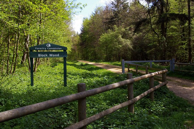
There's a number of good walking and cycling trails to try in the 270-hectare beech woods. It's also the home of Forest Holidays where you can hire a log cabin and stay over in the woods. The site includes a centre where you can hire mountain bikes or enjoy a meal in the cafe. You can start your exercise from the centre where there's parking available at postcode SO21 3BG for your sat navs. If you are coming by public transport then Micheldever train station is located just to the west of the forest.
Other highlights in the forest include various woodland birds and pretty bluebells in the spring.
Postcode
SO21 3BG - Please note: Postcode may be approximate for some rural locationsBlackwood Forest Ordnance Survey Map  - view and print off detailed OS map
Blackwood Forest Open Street Map  - view and print off detailed map
Blackwood Forest OS Map  - Mobile GPS OS Map with Location tracking
Blackwood Forest Open Street Map  - Mobile GPS Map with Location tracking
Pubs/Cafes
There's a good on site cafe or a number of picnic tables if you'd like to bring your own food.
If you fancy a pub lunch you could head into nearby Micheldever where there's a village green, picturesque thatched cottages and the noteworthy Half Moon & Spread Eagle inn. It's a typical village pub with a patio and a nice garden to sit out in on warmer days. There's a cosy interior with a wood-burning stove and ensuite B&B rooms if you need to stay over. The old drovers’ inn dates back to 1703 and is in a nice position over looking the former cricket pitch. You can find them on Winchester Road with a postcode of SO21 3DG for your sat navs.
Dog Walking
The woodland trails are ideal for dog walking so you'll probably bump into other owners on your visit. The on site cafe is also dog friendly with water bowls and dog treats.
Further Information and Other Local Ideas
Micheldever train station is located just a mile west of the forest so you could potentially come by public transport if you prefer.
To continue your walking around the area you could head east and pick up the Wayfarer's Walk. This waymarked trail explores the countryside around Basingtoke.
You could also try the Basingstoke Canal Walk or head into nearby Winchester and try the
Winchester Circular Walk and the Winchester River Walk. For cyclists the Winchester to Basingstoke Cycle Route is a good option.
Just to the south there's more pleasant wooded trails in Micheldever Woods. The woods are particularly popular in the spring when there are carpets of bluebells to see.
On the southern side of Basingstoke there's the historic area of Old Basing. Here you'll find the 16th century Basing House, a Tudor Tithe Barn, Basingstoke Common and the Basing Lime Pits. There's also some more nice trails along the River Loddon in this area.
Just south of Old Basing there's also Hackwood Park to explore. The Grade I listed park has a series of public footpaths taking you past the old estate which includes an ornamental bridge, fountains, a statue of George I, deer and the impressive Hackwood House. Just to the east of the park you can pick up the circular Mapledurwell Walk and visit the pretty villages of Mapledurwell and Upton Grey.
For more walking ideas in the area see the Hampshire Walks page.
Cycle Routes and Walking Routes Nearby
Photos
Roe Deer in Black Wood. This was one of a pair of Roe deer (Capreolus capreolus), as they are usually found; the other is off to the right behind a tree. But unusually, they did not bolt immediately. We stared at each other for quite a while, sufficiently long for me to get out my camera. The wood is an ancient woodland, part of Micheldever Forest, managed by the Forestry Commission to a 30 year plan.


