GPS Cycle and Walking Routescycle iconwalk icon

Blatherwycke Lake

2.4 miles (3.8 km)

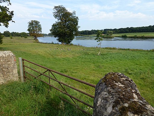
Ordnance Survey Map Open Streetmap This walk visits the little Northamptonshire village of Blatherwycke where you can enjoy a stroll along the pretty lake. The peaceful lake is a great place for bird watching with Herons, Red Kites, Swans and Mandarin Ducks to look out for.
The walk then takes you east to King's Cliffe, passing along the picturesque Willow Brook, a tributary of the River Nene. Here you could extend the walk by picking up the Kings Cliffe Railway Walk which runs along a disused railway line to the east of the village.
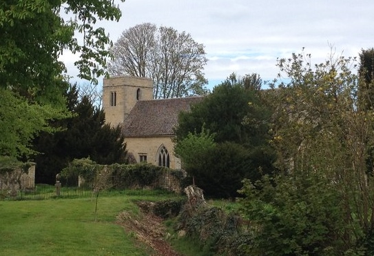
Near the start of the walk you'll also pass the old church where there's a lovely walled garden and arboretum to see.

Postcode

PE8 6YW - Please note: Postcode may be approximate for some rural locations

Blatherwycke Lake OS Map Ordnance survey map - Mobile GPS OS Map with Location tracking

Blatherwycke Lake Open Street Map Open Streetmap - Mobile GPS Map with Location tracking

Photos

Walled garden perimeter and Blatherwycke church - geograph.org.uk - 1858582

Walled garden perimeter and Blatherwycke church

Ha Ha, Blatherwycke - geograph.org.uk - 3150098

Ha Ha, Blatherwycke

Holy Trinity church, Blatherwycke-geograph.org.uk-4447367

Holy Trinity church, Blatherwycke

Birds by the brook, Blatherwycke - geograph.org.uk - 2122896

Birds by the brook

Blatherwycke lake - geograph.org.uk - 1858523

Blatherwycke lake

Gateway and pasture near Blatherwycke Lake - geograph.org.uk - 3124426

Gateway and pasture near Blatherwycke Lake

Grassland along Willow Brook - geograph.org.uk - 3124786

Grassland along Willow Brook

Footbridge over Willow Brook - geograph.org.uk - 2060795

Footbridge over Willow Brook

Video

GPS Files

GPX File

Blatherwycke Lake.gpx (On Desktop:Right Click>Save As. On Ipad/Iphone:Click and hold>Download Linked File)