Walk Around Corby
![]()
![]() This is a delightful 31 mile circular walk which visits a number of pretty villages and parks around the town of Corby in Northamptonshire.
This is a delightful 31 mile circular walk which visits a number of pretty villages and parks around the town of Corby in Northamptonshire.
You start off at East Carlton Park on the edge of the Welland Valley and follow the path through a series of pretty villages including Wilbarston, Geddington, Great Oakley, Gretton, Rockingham, Stanion and Brigstock.
Walk highlights include a visit to the 17th century Elizabethan House at Kirby Hall. The Great Hall and state rooms are impressive as are the surrounding grounds of the estate.
Rockingham Castle is another major attraction on route. Built on the instruction of William the Conqueror, the castle's Great Hall and Long Gallery are particularly noteworthy, while the 18 acre gardens are also well worth exploring. Scroll down for a list of walks near Corby.
Around Corby Ordnance Survey Map  - view and print off detailed OS map
Around Corby Open Street Map  - view and print off detailed map
Around Corby OS Map  - Mobile GPS OS Map with Location tracking
Around Corby Open Street Map  - Mobile GPS Map with Location tracking
Walks near Corby
- East Carlton Park - This popular country park near Corby has a number of nature trails taking you through the mature woodland and grasslands surrounding the 19th century East Carlton Hall
- Rockingham Castle - The grounds and pretty gardens surrounding this castle near Corby are ideal for an easy afternoon stroll
- Eyebrook Reservoir - Enjoy a stroll alongside this lovely reservoir near Corby
- Barnwell Country Park - Enjoy lovely waterside walking trails in this country park in Oundle, Northamptonshire
- Jurassic Way - This walk follows the Jurassic limestone ridge from Banbury to Stamford passing through Northamptonshire, Oxfordshire and Lincolnshire.
The walk includes a stretch along the Oxford Canal from Banbury and another waterside stretch along the Grand Union Canal near Braunston - Rockingham Forest - A lovely walk from King's Cliffe to Barrowden through the ancient woodland of Rockingham Forest.
The walk starts in the village of King's Cliffe and picks up a section of the Jurassic Way long distance trail to take you through Westhay Woods in Fineshade Woods - Uppingham - The town of Uppingham is located in a pleasant position in Rutland
- Hallaton - This pretty Leicestershire village is well worth a visit with its picturesque village pond, 13th century church and thatched cottages
- Kibworth - This Leicestershire village is nicely positioned for some fine canal and country walking
- Wakerley Woods - Enjoy several cycling and walking trails in this forest near Corby and Peterborough
- Harringworth Welland Viaduct - This circular walk visits the impressive Harringworth Viaduct or Welland Viaduct in North Northamptonshire.
- Fineshade Woods - Top Lodge in Fineshade Woods has several waymarked cycling and walking trails
Further Information and Other Local Ideas
A few miles to the north east there's some excellent mountain bike trails and walking routes to be found at Wakerley Woods and Fineshade Woods. Near here you'll also find the noteworthy Harringworth Welland Viaduct. The Grade II listed viaduct is about a kilometre long, and was completed in 1878. It contains 82 arches and is notable as the longest masonry viaduct across a valley in Britain.
Just to the east of Fineshade you'll find the pretty village of King's Cliffe where you can pick up the Kings Cliffe Railway Walk. The easy trail runs along a now disused railway line to the east of the village. King's Cliffe is also a pleasant place for a stroll with a Norman church, picturesque 17th century almshouses and nice views of the Willow Brook, a tributary of the River Nene. There's also a fine old 18th century pub for refreshments afterwards. Near here there's also Blatherwycke Lake to explore. There's some lovely waterside trails with lots of birdlife to see on the water at this scenic spot.
For more walking ideas in the area see the Northamptonshire Walks page.
Photos
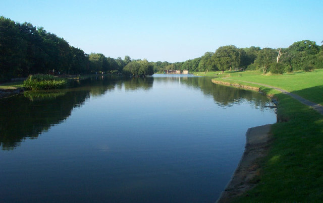
Corby Boating Lake. Viewed looking north-eastwards from the southern end, in 2002 this was certainly a popular lake for anglers and model boat enthusiasts, but despite its name I don't think that the general public were allowed to take to the water...! This pleasant park is a nice place for a stroll in the town.
Elevation Profile

GPS Files
GPX File
Around Corby.gpx (On Desktop:Right Click>Save As. On Ipad/Iphone:Click and hold>Download Linked File)NB GPS file for this route only details route start - route is waymarked from there in


