Bohernabreena Reservoir Walk
![]() This circular walk takes you around the Bohernabreena Reservoir in County Dublin. The trail runs for just under 4km around the perimeter lake on a fairly flat path.
This circular walk takes you around the Bohernabreena Reservoir in County Dublin. The trail runs for just under 4km around the perimeter lake on a fairly flat path.
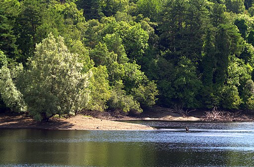
It's a popular place for a scenic walk, being only about 40 minutes drive from Dublin. On the way there's fabulous views of the deep glacial valley with Kippure mountain making a splendid backdrop near the head of the lake. It's also great for flora and fauna with pretty wildflowers and deer to look out for on the way.
You can start off from the Bohernabreena Upper lake car park at the southern end of the water, on the Allagour Road. From here head north west to pick up the Dublin Mountains Way near the lake. You can follow this waymarked, long distance trail north along the eastern side of the water.
You can extend the walk by continuing north to visit the lower reservoir.
To continue your walking in the area head north to pick up the Montpelier Hill and Hellfire Forest Loop Walk.
Bohernabreena Reservoir Open Street Map  - view and print off detailed map
Ireland Walking Map - View All the Routes in the Country>>
*New* - Walks and Cycle Routes Near Me Map - Waymarked Routes and Mountain Bike Trails>>
Bohernabreena Reservoir Open Street Map  - Mobile GPS Map with Location tracking
Further Information and Other Local Ideas
A few miles north of Tallaght there's another major highlight of the area at Tymon Park. Here you will find miles of waymarked trails taking you to pretty lakes, tree lined avenues and the River Poddle.
To the south west there's more waterside walking along Poulaphouca Reservoir at the expansive Blessington Lakes. The village of Ballymore Eustace is also located in this area. Here you can pick up the popular Ballymore Eustace Loop and enjoy pleasant footpaths along the River Liffey and some fine views over the Golden Falls Reservoir.
To the east there's Ticknock Forest where you can climb to the Two Rock and Three Rock Mountains and enjoy amazing views over Dublin.
The nearby Saggart Woods in the Slade Valley includes some pleasant woodland paths and mountain bike trails.
Cycle Routes and Walking Routes Nearby
Photos
Upper Bohernabreena Reservoir. Built in the 1880's and also known as Glenasmole Reservoir. On the left is a by-pass channel, along which the River Dodder flows under normal circumstances. Although it was built in the Dodder valley, the reservoir is not fed by that river – it is too peaty for the public water supply. Instead it collects water from a number of local streams which don't originate in the mountain peat bogs. However, during heavy rain some of the Dodder flow spills over the weir at Castlekelly and is contained in the reservoir, hopefully preventing flooding further downstream in Dublin.
Upper Bohernabreena Reservoir Dam. In 2003 new spillways were constructed to protect this earthwork dam from the threat of destruction during extreme flooding – which came close to happening during “Hurricane” Charlie in 1986.


