Dublin Mountains Way Walk Map
![]() This challenging hike follows the Dublin Mountains Way from†Shankill in Dublin†in the east to†Tallaght†in the west.†
This challenging hike follows the Dublin Mountains Way from†Shankill in Dublin†in the east to†Tallaght†in the west.†
The waymarked trail runs for 42km, taking you through the spectacular scenery of the Wicklow Mountains.
You start off in Shankill,†an outlying suburb of†Dublin, located†in the southeast of the historic†County Dublin, close to the border with†County Wicklow. You then head west to Rathmichael,†Barnaslingan and Carrickgollogan,†Glencullen, Ballyedmonduff,†Ticknock Forest, Three Rock Mountain,†Two Rock Mountain,†Tibradden Mountain, Cruagh Woods, Featherbed Forest, Bohernabreena Reservoir, Glenasmole and Kiltipper before finishing at†the SeŠn Walsh Memorial Park†in Tallaght.
At Tibradden Wood near Two Rock Mountain the route links up with the Wicklow Way which runs from north to south between Dublin and Clonegal.
Dublin Mountains Way Open Street Map  - view and print off detailed map
Ireland Walking Map - View All the Routes in the Country>>
*New* - Walks and Cycle Routes Near Me Map - Waymarked Routes and Mountain Bike Trails>>
Dublin Mountains Way Open Street Map  - Mobile GPS Map with Location tracking
Further Information and Other Local Ideas
Just to the south of the start point in Shankill you can pick up the Bray to Greystones Walk. The cliff top walk is hugely popular, providing some stunning views over Irish Sea, The Wicklow Mountains and Bray.
For an easy circular walk on the trail see the Bohernabreena Reservoir Walk. There's a popular trail running around these two picturesque lakes just south of Tallaght, near the end of the route.
Cycle Routes and Walking Routes Nearby
Photos
The trailhead of the Dublin Mountains Way outside Brady's pub, Shankill. The information board includes a map and some details of the route.
View from the southernmost tor on the summit of Three Rock Mountain, Dublin, Ireland looking towards Bray Head, the Little Sugar Loaf and the Great Sugar Loaf
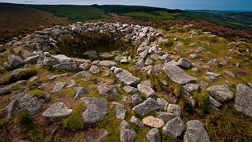
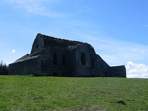
The Bronze Age passage grave, known as Fairy Castle, on the summit of Two Rock Mountain in the Dublin Mountains. At an altitude of 536m, it's one of the highest situated megalithic monuments in the region and is visible from a wide area around the county. The entrance to the passage was once described by locals as a "cave" but can no longer be seen (it has probably disappeared below the peat bog), although a small depression on one side of the mound may mark its location. It also marks the highest point on the Dublin Mountains Way


