Borehamwood Walks
![]()
![]() This Hertfordshire based town has a number of local parks, reservoirs, nature reserves and areas of common land to explore.
This Hertfordshire based town has a number of local parks, reservoirs, nature reserves and areas of common land to explore.
This walk from the town uses a section of the London Loop to visit some of the walking highlights of the area. You'll visit Aldenham Reservoir Country Park, Stanmore Common, Bentley Priory Nature Reserve and Harrow Weald Common on the route.
The walk starts from Borehamwood train station where you can directly pick up the London Loop and follow the waymarked trail west to Aldenham Country Park.
You continue west to visit Stanmore Common and Bentley Priory where there are beautiful gardens and a nature reserve with lots of wildlife to look out for.
From here it is a short walk west to visit Harrow Weald Common where there's woodland, heath and pasture. You can also climb to the Harrow Viewpoint and enjoy far reaching views over the city of London.
Postcode
WD6 4SE - Please note: Postcode may be approximate for some rural locationsBorehamwood Ordnance Survey Map  - view and print off detailed OS map
Borehamwood Open Street Map  - view and print off detailed map
Borehamwood OS Map  - Mobile GPS OS Map with Location tracking
Borehamwood Open Street Map  - Mobile GPS Map with Location tracking
Walks near Borehamwood
- Aldenham Country Park - Enjoy 100 acres of woodland and parkland adjacent to a 60 acre lake at this splendid park near Elstree/Borehamwood
- Stanmore Common - This is a walk across Stanmore Common to Aldenham Country Park using part of the London Loop long distance trail
- Scratchwood and Moat Mount Open Space - These two parks are situated right next to each other in the London Borough of Barnet
- Totteridge - Totteridge is a lovely little village to visit on the outskirts of London in the borough of Barnet
- Harrow Weald Common - This area of common land in Harrow has some nice footpaths to try
- Bentley Priory - This circular walk explores the popular Bentley Priory nature reserve in Harrow
- Harrow Viewpoint - This walk visits the splendid Harrow Viewpoint in North London
- Watling Chase Timberland Trail - Follow the Watling Chase Timberland Trail through the Watling Chase Community Forest on this historical path used by travellers for at least two thousand years
- Shenley - The idyllic Hertfordshire village of Shenley sits in a pleasant rural position on the outskirts of North London.
- Ridge - This circular walk from Hertfordshire based Ride explores the countryside to the west, visiting the Catherine Bourne River, Littleridge Wood and the neighbouring village of South Mimms
- London Colney - This pleasant Hertfordshire based village is located just to the south of St Albans
- Mill Hill - Mill Hill village is located in the London Borough of Barnet in Greater London.
- Harrow On The Hill - Harrow on the Hill village is an interesting place for a walk in Greater London.
Pubs/Cafes
Back in the town The Wellington is a good place for some post walk refreshment. The mid 19th century pub has a good menu and a beautiful secluded garden for warmer weather. You can find them at 4 Theobald St, WD6 4SE.
Dog Walking
The country and woodland trails on the route make for a fine dog walk. The Wellington mentioned above is also dog friendly.
Further Information and Other Local Ideas
If you follow the London Loop south east from the town you will soon come to the Scratchwood and Moat Mount Open Space. The park has some fine footpaths and a good viewpoint with views towards London.
The long distance Watling Chase Timberland Trail starts from the train station in the town and visits Shenley Park before heading towards Smallford, St Albans and Hatfield. The villages of London Colney and Ridge are also near here. Ridge has a fine local pub with a particularly huge countryside garden area.
For more walking ideas in the area see the Hertfordshire Walks page.
Photos
Tykes Water and Brook Meadow. The Environment Agency have established a water level monitoring sensor on Tykes Water, and the gaugeboard on the left is part of these arrangements. The top of the graduations is at 80.6 metres above sea level. The watercourse is also known as Borehamwood Brook. The photograph was taken looking across Brook Meadow on a damp misty April morning
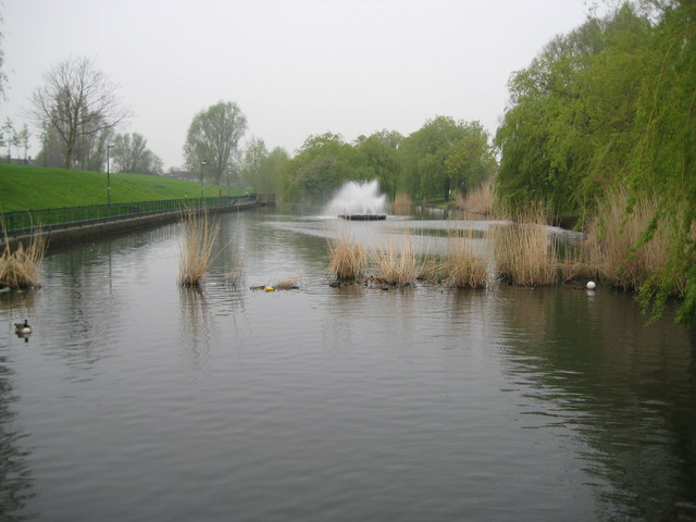
Parkfields and Allum Lane Spinney. Managed by the local authority, Hertsmere Borough Council, and the Countryside Management Service, this park is the largest in the borough and occupies a considerable area of land to the west of the railway line. This is the view from the Red Road entrance to the park.
Bentley Priory. Bentley Priory was occupied by the RAF from 1926 until the spring of 2008, perhaps the most important time in its history was during World War Two when it was the headquarters of Fighter Command. The site has been sold to a developer and plans to convert some of the building to luxury apartments and build new houses have been approved. The Bentley Priory Battle of Britain Trust has secured part of the building to be used as a museum and memorial dedicated to those who served in the RAF. In September 2008 the site was open to the public for the first time part of the Civic Trust Heritage Open Days, this photograph shows the south face of the main buildings on one of those days.


