Hertfordshire Walks
Use the filter to show walks of a certain type such as woods, reservoirs, hills, long distance, country parks, canals and rivers.
In the spring walkers flock to the beautiful bluebell woods in the Hertfordshire area. Click the 'Woodland' button below to see these.
Use the links to view full route information including elevation profiles, interactive maps and GPS downloads.
You can also view an overview map of all the routes in the using the Hertfordshire Walk Map>>
*New* - Walks and Cycle Routes Near Me Map - Waymarked Routes and Mountain Bike Trails>>
| Filter: |
| Route Name | Photo | Distance | Description |
| Alban Way | 5.7 miles (9.2 km) | Follow the disused Hatfield to St Albans railway line on this popular route from St Albans to Hatfield. View Full Details>> | |
| Aldenham Country Park | 3.4 miles (5.5 km) | Enjoy 100 acres of woodland and parkland adjacent to a 60 acre lake at this splendid park near Elstree and Borehamwood. The park also has a rare breeds farm, pony rides and nature walks. The lakeside trail also makes for a lovely, peaceful cycle ride. View Full Details>> | |
| Amwell Nature Reserve | 3.1 miles (5 km) | This nature reserve is located in village of Great Amwell just to the south of Ware in Hertfordshire. View Full Details>> | |
| Ashridge Boundary Trail | 16.2 miles (26 km) | This walk takes you on a tour of the National Trust owned Ashridge Estate in the Chiltern Hills. The estate consists of 5,000 acres of woodlands, commons and chalk downland which supports a rich variety of wildlife. The walk starts at the Ashridge Estate Visitor Centre next to the Bridgewater Monument, erected in 1832 to the Duke of Bridgewater. You can climb the monument for fabulous panoramic views of the estate before starting the circular tour of the beautiful grounds. Highlights on the walk include the Golden Valley to the north-east of Little Gaddesden and Ashridge House which was created by famous landscape gardener Capability Brown in the 18th century. You will also visit Ivinghoe Beacon, with its splendid views of the Vale of Aylesbury, Berkhamsted Common and Dunstable Downs. Another highlight of the walk is the popular Dockey Wood. View Full Details>> | |
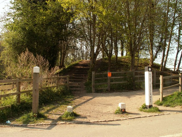
| Ayot Greenway | 4.7 miles (7.5 km) | Follow this disused railway line from Wheathampstead to Welwyn Garden City on this easy cycle or walk in Hertfordshire. It's a nice flat, traffic free path making it ideal for families or beginners looking for an easy cycle ride. Along the way there's good views of the River Lea and a woodland section through Sherrardspark Wood at the end of the route. The woods are also a nature reserve with lots of birdlife and butterflies to look out for. If you're on foot you can extend your walk by picking up the Lea Valley Walk which runs alongside the greenway. If you're on a bike then you could head east to Hertford from Welwyn Garden City along the Cole Green Way. View Full Details>> | |
| Baldock | 3.1 miles (5 km) | This walk from Baldock visits two pretty nature reserves along the River Ivel which flows through the area. The settlement is a historic market town with interesting architecture, including Georgian, Victorian and Edwardian buildings. There's also good transport links to London from the train station. For walkers there's a few decent waymarked trails and some nice riverside nature reserves to visit.
The walk starts from Baldock train station where you can pick up the Kingfisher Way. Follow the waymarked footpath north and it will take you to the river at Norton Mill and Radwell Meadows Country Park. There's some interesting willow sculptures of the characters from the Wind in the Willows to be found here. It's a lovely spot with some nice footpaths, a picnic area and lots of birds and butterflies to look out for. After exploring the park the route continues north to Stotfold where you will pass a the lovely Stotfold Mill Nature Reserve. View Full Details>> | |
| Berkhamsted Canal Walk | 6.2 miles (10 km) | This walk takes you along the Grand Union Canal from Berkhamsted to Tring and then on to Mawsworth. It's a very pretty section of the canal with a series of locks and nice views over the Hertfordshire and Buckinghamshire countryside. The walk starts in the town centre near the train station and the pretty Canal Fields park. You can then follow the towpath north west past Northchurch Common on the Ashridge Estate. The common has some nice woodland walking trails and feeds into the pretty Berkhamsted Common. You continue towards Tring where you will pass the lovely Tring Reservoirs. The reservoirs are a great place to extend your walk with a series of waterside footpaths and lots of birdlife to look out for on the water. After passing round Marsworth Reservoir the walk finishes in the village of Marsworth. Here the canal splits of in two directions. If you head west you can follow the Aylesbury Canal to Aylesbury. View Full Details>> | |
| Berkhamsted Common | 4 miles (6.5 km) | This large area of common land has some nice waymarked footpaths to try. The area is made up of attractive Silver birch woodland and gorsey heath with miles of ancient tracks to follow. You can start the walk from the car park off the New Road which leads north to the common from Berkhamsted. From here you can pick up the waymarked trails around the site. The circular trail takes you past Coldharbour Farm and Frithsden Beaches before returning to the car park. Look out for wildlife including wild deer and a variety of woodland birds. The common is part of the wider Ashridge Estate which includes 5,000 acres of woodlands, commons and chalk downland. You can further explore the area on the long distance Ashridge Boundary Trail or the Icknield Way Path. Heading north will take you through Thunderdell Wood and Aldbury Common to Moneybury Hill. View Full Details>> | |
| Bishop's Stortford Canal and River Walk | 13.7 miles (22 km) | Follow the River Stort Navigation canal from Bishop's Stortford to Hoddesdon, on this delightful waterside walk through Hertfordshire. The walk follows the flat towpath through Sawbridgeworth and Harlow with lots of barges, weirs and pretty locks to look out for on the way. Starting in the town centre follow the Hertfordshire Way east and then south to the river. View Full Details>> | |
| Broxbourne Woods | 9 miles (14.5 km) | Follow the Broxbourne Woods Nature Trail on this splendid walk in Hertfordshire. The site is Hertfordshire's only National Nature Reserve and includes Wormley Woods, Cowheath Wood and Hoddesdonpark Wood. You'll pass attractive Hornbeam coppice, tranquil ponds, pretty meadows and field edges as you make your way along the figure of eight trail. The woods have car parks on White Stubbs Lane where you can pick up the waymarked trails. This 9 mile walk takes you around most of the site but there are shorter walks and mountain bike trails for cyclists too. In the heart of the forest there is a 1km sculpture trail with several beautifully carved wooden pieces. These include a life size Roman soldier and a magnificent stag. Each sculpture illustrates something interesting about the forest, highlighting the historical importance of the woods and taking a close up look at the nature and wildlife that lives there. The video below gives and example of what you can expect to see on the trail. For cyclists there are some fun single-track rides to enjoy too. If you'd like to extend your walking in the area then there are several good options. You could head west and visit Northaw Great Wood. This country park has 300 acres of woodland to explore. The Hertfordshire Chain Walk and the Hertfordshire Way also pass the site. The Hertfordshire Chain Walk actually passes through the western end of the woods. You could pick this up and head south towards Cuffley and Enfield where you will pass Whitewebbs Park. View Full Details>> | |
| Burnham Green and the River Mimram Valley Circular Walk | 6.2 miles (10 km) | This circular walk visits the Hertfordshire villages of Burnham Green, Digswell and Tewin. View Full Details>> | |
| Cassiobury Park | 2.5 miles (4 km) | Enjoy an easy circular walk around this large park in Watford. There's 190 acres to explore with good footpaths and a section along the Grand Union Canal Walk at the western end of the park. There's also a waymarked nature trail where you can look out for a variety of wildlife including Herons, Kingfishers, Woodpeckers, Butterflies, Bats, Dragonflies, Newts and Snakes. The western end of the park, near the canal, is also a designated nature reserve. Look out for flycatchers, redwings and fieldfares. Cycling is also permitted in the park on designated paths. If you'd like to extend your walk you could head a mile west to the ancient woodland of Whippendell Woods. Also nearby is Chipperfield Common where you'll find waymarked, woodland walking trails to try. View Full Details>> | |
| Chess Valley Walk | 9.9 miles (16 km) | Follow the River Chess through the Chess Valley on this delightful trail through Buckinghamshire and Hertfordshire. The popular route runs for a duration of just under 10 miles along a fairly flat, waymarked footpath. You start at Chesham Station passing Latimer, Chenies and Loudwater before finishing at Rickmansworth Station. This is a nice easy waterside walk with plenty of attractive countryside and a series of quiet little villages to enjoy. It is also easily accessible with train stations at either end. Route highlights include the Grade I listed Chenies Manor House with its beautiful gardens and the splendid grounds of the Chorleywood House Estate near Loudwater. At Latimer you will also pass the impressive Latimer House, a red brick Tudor style mansion, which was designed by Edward Blore, and completed in 1838. View Full Details>> | |
| Chiltern Heritage Trail | 51 miles (82 km) | Travel through the Chilterns Hills on this splendid circular walk and visit numerous delightful hamlets, villages and towns in Buckinghamshire. The trail passes through several woods with bridleways suitable for cycling as well as walking. The walk begins at Chesham and passes Amersham, Chenies, Chorleywood, Chalfont St Peter, Chalfont St Giles, Great Missenden and Little Missenden. Highlights on the walk include the splendid Chenies Manor House and Gardens. Located in the village of Chenies the estate is highly recommended with its enchanting Tudor Manor House and award winning gardens. Near Chalfont St Peter you will find the fascinating Chiltern Open Air Museum. The museum rescues and restores common English buildings from the Chilterns and relocates them to its 45-acre site, which includes woodland and parkland. At Chalfont St Giles you will find John Milton's cottage where the famous poet completed Paradise Lost. Now a musuem it houses an extensive collection of his works and also includes a Grade II Registered Historic Garden. Also of interest is the 13th century St Mary's Church and the award winning Amersham Musuem. As well as the sequence of interesting historical attractions there is some beautiful countryside and a long waterside stretch along the River Chess from Chesham to Chenies to enjoy. View Full Details>> | |
| Chiltern Way | 124.3 miles (200 km) | This is the original 125 mile circuit of the Chilterns AONB taking you through Hemel Hempstead, Chalfont St Giles, Marlow, Hambleden, Turville, Fingest, Bix Bottom, Ewelme, the Ridgeway, Stokenchurch, Great Hampden, Aldbury, the Dunstable Downs Country Park, Sharpenhoe Clappers and Harpenden. The main attractions on the route are the series of delightful villages with their ancient churches, pretty village greens and fascinating museums. The Chilterns countryside is also beautiful with rivers, canals and the rolling hills to enjoy. View Full Details>> | |
| Chilterns Pub Walk - Aldbury | 6.8 miles (11 km) | This walk climbs to the wonderful Ivinghoe Beacon from the splendid Greyhound Inn in the Chilterns village of Aldbury. You'll enjoy some of the finest views in the Chilterns with a great reward of a fine meal at the inn at the end of your walk. You start off at the Greyhound Inn in Aldbury. It's a very pretty village with its nice cottages and duck pond. From here you can pick up footpaths heading north through Aldbury Common which sits on the western side of the popular Ashridge Estate. The walk follows a section of the Ashridge Boundary Trail through the common where there are nice peaceful woodland trails and lots of interesting flora and fauna to look out for. At Incombe Hole the route picks up the Icknield Way Path to take you up to Ivinghoe Beacon. The iconic hill stands at 233 m (757 ft) and commands fine views over the Chiltern Hills and the Vale of Aylesbury. The route then heads east to visit Gallows Hill before descending back to the Ashridge Estate. View Full Details>> | |
| Chipperfield Common | 0.9 miles (1.5 km) | The 117 acre common in Chipperfield has some waymarked woodland walking trails. Features on the common include eight veteran Spanish sweet chestnut trees, two early Bronze Age burial mounds and the Apostles Pond which is surrounded by willow trees. You can start your walk from the car park at the northern end of the site. From here you can pick up a network of paths taking you across the common. After your walk you can enjoy a stroll around the pretty village of Chipperfield with its nice pubs, cricket pavilion, war memorial, village green and old churches. To extend your walking in the area you could pick up the Grand Union Canal towards Hemel Hempstead or Watford. The Chess Valley Walk also passes to the south of Chipperfield, near Sarrat and Chenies. View Full Details>> | |
| Chorleywood | 5.4 miles (8.7 km) | This village in the Three Rivers District of Hertfordshire has some nice walks to try. This circular walk takes you to some of the highlights of the area including Chorleywood Common, the River Chess and Chenies Manor House. The village is easily accessible from London on the Metropolitan line of the London Underground. The walk starts from the Chorleywood underground station which is a short stroll from the common. You can pick up the Chess Valley Walk just north of the station and follow it east to the open space which consists of 200 acres of common land and woodland. After heading through the common you pass Chorleywood House. The 200-year-old manor house is surrounded by an estate with nice countryside and woodland. On certain open days you can enjoy walks in the grounds of the house. Soon after passing the old house you will come to the River Chess. Follow the trail north to Sarratt Bottom where the river bends to the east to take you through the Frogmore Meadows Nature Reserve. This lowland meadow is rich in wildflowers with different types of butterfly to look out for. At Chenies Bottom you cross the river and head south towards Chenies Manor House. The Tudor House is a Grade I listed building and is surrounded by award-winning gardens. Original 13th Century features including a Medieval well, a dungeon and a reputed priest hole. You can tour the house and garden for a fee, from April to October. After exploring the house the route then heads south on a bridleway through Carpenter's Wood before returning to the centre of Chorleywood. View Full Details>> | |
| Cole Green Way | 5 miles (8 km) | Travel from Welwyn Garden City to Hertford along a disused railway line on this easy cycle or walk in Hertfordshire. The route follows National Cycle Network Route 61 on a flat, traffic free path. There's nice tree lined sections and views of the surrounding open countryside. The route starts on the outskirts of Welwyn Garden City and runs through Letty Green before finishing at Hertford. The route links with the Ayot Greenway at Welwyn Garden City. It's a similar rail trail which runs to Wheathampstead along National Cycle Route 57. The Alban Way also runs from nearby Hatfield to St Albans. Walkers can pick up the Lea Valley Walk and enjoy a riverside stroll. View Full Details>> | |
| Colne Valley Trail | 6.8 miles (11 km) | Follow the Colne Valley Trail from Uxbridge to Rickmansworth and enjoy riverside and canalside walking or cycling. The trails follows the Grand Union Canal and the River Colne while also passing a series of pretty Lakes including Lynsters, Stocker's and Batchworth Lake. The trail finishes at Batchworth Lake by the car park in Rickmansworth. You can continue your exercise on our Rickmansworth Walk View Full Details>> | |
| Dollis Valley Green Walk | 10.6 miles (17 km) | This pleasant walk takes you from Mill Hill near Edgware in North London to the edge of Hampstead Heath along the Dollis Brook. View Full Details>> | |
| Ebury Way | 3.1 miles (5 km) | This is an easy short cycle and walking route ideal for families. It runs along National Cycle route 61 and a dismantled railway line from Rickmansworth to Watford and passes through a variety of habitats, including open moor, woodland, and wetlands. The trail crosses a number of waterways including the rivers Colne, Chess and Gade and the Grand Union Canal. View Full Details>> | |
| Fairlands Valley Park | 3.1 miles (5 km) | Enjoy a cycle or walk through this popular park in Stevenage. There are several pretty lakes with waterside cycling and walking paths to enjoy. The park covers 120 acres and includes some woodland trails and an on site cafe. View Full Details>> | |
| Grand Union Canal Walk | 145.4 miles (234 km) | Follow the towpath of Britain's longest canal from London to Birmingham on this fabulous waterside walk. You start in West London in a lively and attractive area with canalside bars and restaurants, before heading towards the Chiltern Hills, on through rural Northamptonshire and Warwickshire and into the Birmingham suburbs. Highlights include:
| |
| Greenwich to Cheshunt | 21.1 miles (34 km) | Follow National Cycle Route 1 on this pleasant ride or walk through north London into Hertfordshire. You start by the Thames at the Cutty Sark in Greenwich and crosses to the Isle of Dogs via the Greenwich tunnel. This section gives splendid views of the River Thames and Canary Wharf. Shortly after leaving the Thames behind you will come onto the Lee Valley path which will take you along the Regent's Canal and through Tower Hamlets and Victoria Park. You then join the River Lee near Lea Bridge for some more waterside riding. The off road path then takes you past various Reservoirs until you reach the lovely Lee Valley Park - London's largest open space. After going through the park you will soon pass close to Waltham Abbey before you arrive at the finish point at Cheshunt station next to Cheshunt lake. View Full Details>> | |
| Harcamlow Way | 141.1 miles (227 km) | This long distance walk takes you to some of the most beautiful countryside, interesting historical sites and delightful country parks in the counties of Cambridgeshire, Essex and Hertfordshire. The route is a figure-of-eight, starting in Harlow and first heading to Saffron Walden where you will pass the splendid Jacobean mansion and gardens at Audley End. You continue through the Bartlow Hills, Horseheath, the Fleam Dyke and Milton Country Park to Cambridge. You return passing along the Wimpole Way where you pass the splendid Wimpole Hall and park. This 17th century country house has 3,000 acres (12 km²) of parkland and farmland and is owned by the National Trust. You continue through Melbourn and Chrishall to Newport , and then on to Debden, Thaxted and Takeley. You then pass through the expansive Hatfield Forest. View Full Details>> | |
| Harpenden | 18 miles (29 km) | This long circular walk makes use of a series of waymarked trails to explore the countryside, woodland and rivers surrounding the Hertfordshire town of Harpenden. The walk starts in Harpenden where you first pick up the Nickey Line. The shared cycling and walking trail runs along a disused railway track from Hemel Hempstead to Harpenden. This section of the path runs south west to Redbourn where you can pick up the Ver-Colne Valley Walk. This waymarked footpath will take you south east along the river to St Albans where you'll skirt the edge of Verulamium Park. The park is well worth exploring with it's lovely lake and the old roman walls of Verulamium still intact. From St Albans you turn north east to pick up a section of the Hertfordshire Way to take you to the hamlet of Childwickbury. You'll pass Childwickbury Manor which was the former home of director Stanley Kubrick. You continue east towards the village of Sandridge, passing along the edge of Heartwood Forest on the way. The forest includes over half a million trees, ancient woodland, wildflower meadows and miles of waymarked walks. Shortly after you pass Symondshyde Great Wood before coming to Wheathampstead where you can see the Devil's Dyke. Here you can see the remains of a prehistoric defensive ditch which lies at the east side of the village. The site is a candidate for the strongly defended place where Julius Caesar fought Cassivellaunus in 54 BC. At Wheathampstead you pick up the Lea Valley Walk and follow it along the River Lea back into Harpenden. View Full Details>> | |
| Hatfield Park | 5.6 miles (9 km) | This Hertfordshire based town is a fine place for walkers with river trails along the River Lea, the woodland and parkland of Hatfield House and miles of easily accessible countryside trails to try. View Full Details>> | |
| Heartwood Forest | 3.1 miles (5 km) | This large forest near St Albans has some fine cycling and walking trails to try. The forest includes over half a million trees, ancient woodland, wildflower meadows and miles of waymarked walks. There's also bridleways suitable for mountain biking. It's great in the spring with carpets of bluebells and lots of wildlife to look out for. This includes barn owls, tawny owls, kestrels and 27 species of butterfly. There is also a community orchard with apple and pears trees plus an arboretum which, once fully grown, will be the only one known in the UK to contain all 57 of our native tree species. There's three waymarked walks to try all of which are fairly easy and of similar lengths. These take place on a mixture of surfaced tracks and grassy paths. You can park at the car park near the village of Sandridge to start your walk. The bridleways can also be picked up from the High Street in the village. The area includes Langley Wood and Pudler's Wood with Nomansland Common Walk just to the north. If you are on a bike please keep to the marked bridleways. The forest is located near to a number of excellent cycling and walking trails. If you head north towards Wheathampstead you can pick up the Ayot Greenway. This rail trail will take you to Welwyn Garden City on a marked National Cycle Route. You can also pick up the Lea Valley Walk and enjoy a riverside stroll. View Full Details>> | |
| Hemel Hempstead | 14.3 miles (23 km) | This circular walk from Hemel Hempstead explores the countryside to the east of the town, skirting the edge of the Chilterns Hills. On the way you'll enjoy waterside paths along the Grand Union Canal to Berkhamsted before exploring the woodland on Berkhamsted Common. The walk makes use of two of the waymarked footpaths which run through the area - the Grand Union Canal Walk and the Chiltern Way. The walk starts on the canal just to the south of the town centre at Two Waters. From here you can follow the towpath west through Boxmoor where there is a lock, weir and views over the River Bulbourne. The route continues to Berkhamsted where you will pass the ruins of the noteworthy Berkhamsted Castle. The Norman motte-and-bailey castle was built to obtain control of a key route between London and the Midlands during the Norman conquest of England in the 11th century. At Dudswell the route leaves the canal to pick up the Icknield Way Path, following it north east to Norcott Hill. Here you follow bridleways onto the expansive Berkhamsted Common. The area is made up of attractive Silver birch woodland and gorsey heath with miles of ancient tracks to follow. After passing through the common the route continues through Potten End before turning south east through the outskirts of Hemel Hempstead to return to the canal. It is then a short walk back to the town centre. View Full Details>> | |
| Hertford Heath | 1.9 miles (3 km) | A circular walk around this pretty nature reserve in Hertford. View Full Details>> | |
| Hertford to Ware River and Canal Walk | 5 miles (8 km) | Enjoy walk along the River Lea on this popular waterside walk in Hertfordshire. The route runs from Hertford to Ware and then onto Stanstead St Margaret's, using a section of the waymarked Lea Valley Walk. The walk runs for a distance of about 5 miles so it's perfect for an afternoon stroll. At the end of the route you can catch the train back to Hertford from St Margaret's. Start the walk from Hertford Castle next to the river in the town centre. The main castle entrance was built by Edward IV in 1463-5 and since extended by sections built in the late 1700's and as recently as 1936/7. They are now offices of the the Town Council. From here you can pick up the waymarked riverside footpaths, heading east to Hertford Lock, the first lock on the River Lee Navigation. You continue past Ware Lock and the adjacent Ware Weir, before coming into the town of Ware itself. From Ware you continue south east, passing Hardmead Lock and the Amwell Nature Reserve, a 37 hectare biological Site of Special Scientific Interest. The site is a former gravel pit, which has been restored to become a wetland nature reserve with two lakes, Great Hardmead Lake and Hollycross Lake. You could take a small detour from the route here to explore the reserve and look out for the various wildfowl which visit the site. The final section takes you past Stanstead Lock which incorporates a rare example of a swing-bridge. Soon after you come into St Margarets where you can catch the train back to Hertford. You could also return on foot using the New River Path. This follows the New River which runs parallel to the Lea and would turn it into a circular walk. View Full Details>> | |
| Hertfordshire Chain Walk | 38.5 miles (62 km) | The Hertfordshire Chain Walk is a series of circular walks running through Hertfordshire. This route is a combination of these walks, forming a linear route which runs from Enfield in London, through Hertfordshire to Ashwell & Morden Station in Cambridgeshire. View Full Details>> | |
| Hertfordshire Way | 165.9 miles (267 km) | Explore some of the finest countryside and prettiest towns and villages in this fascinating county. The path is circular, visiting Ashridge Forest, St Albans, Hertford, Codicote, Tring, Kings Langley, Cuffley and Bishop's Stortford Canal and River Walk. There's also some lovely scenery to enjoy with much of the walk taking place with the Chiltern Hills in the background. Places of interest include the beautiful Ashridge Estate near Berkhamsted (video below) and Shaw's Corner - the former residence of playwright Bernard Shaw located at Ayot St Lawrence, near Welwyn. You'll also pass through the pretty Royston Heath where there are fine views over the Cam Valley from Therfield Hill. View Full Details>> | |
| Hitchin | 12.4 miles (20 km) | The Hertfordshire town of Hitchin makes a great base for exploring the lovely north eastern corner of the Chiltern Hills. This walk visits the nearby Pegsdon Hills using a number of the waymarked long distance trails which pass through the area surrounding the town. The walk starts in the town centre and picks up the Hitchin Outer Orbital Path to take you to Oughtonhead Common. It's a very pretty area with the views of the River Oughton and the Oughtonhead Nature Reserve. You can look out for wildlife including kingfishers, water rails and woodcock in this area. View Full Details>> | |
| Icknield Way Path | 110 miles (177 km) | The Icknield Way Path starts at Ivinghoe Beacon in Buckinghamshire and heads to Knettishall Heath in Suffolk along prehistoric pathways. There's fantastic views as you climb through the hills of the Chilterns AONB. There's also a series of lovely nature reserves and country parks to enjoy on the way. Highlights on the walk include the Cam Valley views from Royston Heath, the lovely Dunstable Downs Country Park and the splendid Whipsnade Tree Cathedral. View Full Details>> | |
| John Bunyan Trail | 77.1 miles (124 km) | Follow in the footsteps of John Bunyan, the Puritan Evangelist and author of the book 'Pilgrim's Progress'. The walk visits many historic villages associated with Bunyan. It starts at Streatley and visits Sharpenhoe, Harlington, Westoning, Steppingley, Flitwick, Ampthill, Millbrook, Ridgmont, Cranfield, Bromham, Stevington, Pavenham, Oakley, Clapham, Bedford, Elstow, Shefford, Meppershall, Shillington, Hexton and Barton le Clay before returning to Streatley. There's some beautiful Bedfordshire countryside to enjoy including Sharpenhoe Clappers, the Barton Hills, the Pegsdon Hills and views of the Chiltern Hills for much of the walk. View Full Details>> | |
| Kingfisher Way | 21.1 miles (34 km) | This is a delightful walk along the River Ivel from Baldock to Roxton. You start off at the source of the river at Ivel springs, Baldock, and follow the river north through Stotfold, Henlow, Langford, Biggleswade, Sandy and Blunham. View Full Details>> | |
| Knebworth Country Park | 3.4 miles (5.5 km) | A walk through the delightful country park surrounding Knebworth House in Stevenage. The park consists of 250 acres of rolling hills with ancient chestnut and lime avenues. There are also herds of Red and Sika deer to look out for. View Full Details>> | |
| Lea Valley Walk | 52.8 miles (85 km) | A super walk with a series of delightful waterside sections along the River Lea. The walk runs from Leagrave, the source of the River Lea near Luton, to the Thames at Limehouse Basin, east London. You follow a riverside path for much of the way through, Luton, Hatfield, Hertford, Ware and Cheshunt with a swan emblem clearly waymarking the walk. The walk passes Nature Reserves, pretty riverside villages and includes a section through the fantastic
Lee Valley Park - London's largest open space. You'll also pass the Olympic Park in Stratford which is well worth exploring. The final section of the walk runs along the Limehouse Cut Canal which is also suitable for cyclists. In the Lee Valley park you can also pick up the Stort Navigation and follow the towpath to Bishop's Stortford. The river also runs parallel to the New River Path around Hertford and Ware so it's possible to create a circular walk using both the footpaths in this area. View Full Details>> | |
| Letchworth | 9.9 miles (16 km) | Letchworth Garden City is located in Hertfordshire near to Hitchin and Stevenage. Walking highlights include the epic Icknield Way Path, the nearby Chiltern Hills, Norton Common and river paths along the River Oughton near the town. View Full Details>> | |
| Letchworth Greenway | 12.7 miles (20.5 km) | This circular walk follows the Letchworth Greenway around the Hertfordshire town of Letchworth. View Full Details>> | |
| London Loop | 149.1 miles (240 km) | Also known as the London Outer Orbital Path, this walk takes you on a tour of the parks, woods and fields around the edge of Outer London. You start at Erith, on the River Thames and pass through Crayford, Orpington, Petts Wood, Coulsdon, Kingston upon Thames, Uxbridge, Elstree, Cockfosters, Chingford, Epping Forest, Upminster and Rainham Marshes RSPB before finishing back on the River Thames at Purfleet, opposite Erith.
The walk has been divided into 24 manageable sections as follows: Erith Old Bexley Petts Wood West Wickham Common Hamsey Green Coulsdon South Banstead Downs Ewell Kingston Bridge Hatton Cross Hayes Uxbridge Harefield Moor Park Hatch End Elstree Cockfosters Enfield Lock Chingford Chigwell Havering-atte-Bower Harold Wood Upminster Bridge Rainham On the way you'll also pass numerous parks, common land and open spaces such as High Elms Country Park in Orpington, Hayes Common, Stanmore Common, Harrow Weald Common and Nonsuch Park. The walk is waymarked with a disc featuring a kestrel. View Full Details>> | |
| Merry Hill Circular Bushey Walk | 4.3 miles (7 km) | This circular walk takes you around the Woodland Trust's Merry Hill near Bushey in Hertfordshire. View Full Details>> | |
| New River Path | 28 miles (45 km) | Follow the man made New River from Hertford to Islington on this easy waterside walk. There's much to enjoy on this walk including regular views of the River Lea and riverside Nature Reserves. The walk passes through Hoddesdon, Rye Meads RSPB Nature Reserve, Cheshunt, Enfield and Finsbury Park with urban sections towards the end of the walk. In the Hertford area the river runs parallel to the Lea Valley Walk which follows the towpath of the River Lea Navigation canal. It's a nice way of extending your walk or creating a circular route around the Hertford and Ware area. View Full Details>> | |
| Nickey Line-Hemel-Hempstead to Harpenden | 8.1 miles (13 km) | This short off road cycle or walking route runs along the Nickey Line - a disused railway track running from Hemel Hempstead to Harpenden. View Full Details>> | |
| Nomansland Common Walk | 3.7 miles (5.9 km) | This circular walk explores Nomansland Common in the Heartwood Forest area of Hertfordshire. View Full Details>> | |
| Northaw Great Wood | 2.5 miles (4 km) | Explore 300 acres of woodland and parkland in this popular country park near Hatfield. There's miles of good walking traills to follow around the 121 hectare (300 acre) site. The park consists mainly of ancient hornbeam woodland, with other trees including oak and silver birch. It's a pretty area with glades, streams, springs and lots of interesting plants and flowers. These include Honeysuckle, Bluebell and Foxglove. There is a car park at the southern edge of the wood, just of The Ridgeway. From here you can pick up trails to take you to Rowbourne Hill, Justice Hill and over Grimes Brook. The walk is generally fairly flat but there are some moderate climbs. The Hertfordshire Way runs through nearby Cuffley so this is a good option if you would like to extend your walk. You could also follow the Hertfordshire Chain Walk to the nearby Broxbourne Woods. These extensive woods have miles of cycling and walking trails and a delightful 1km sculpture trail with several beautifully carved wooden pieces. If you follow the trail south east towards Enfield you can visit Whitewebbs Park which has woodland trails, ponds and the Cuffley Brook. View Full Details>> | |
| Oxhey Woods | 1.9 miles (3 km) | These peaceful woods near Watford have nice footpaths and a popular sculpture trail to follow. You can park at the Oxhey Woods car park off Oxhey Drive which runs through the centre of the woods. There are lots of trails in the woods but the main attraction is the excellent sculpture trail. Along the 1km trail you will find numerous carved wooden sculptures of the wildlife you can see in the area. Watch the video below to see the pieces being carved. The woods are also a local nature reserve so look out for a variety of interesting flora and fauna. Plants includes bluebells, anemones and violets amongst the ancient woodland. There's also a rhododendron trail running through the southern section of the site near the sculpture trail. Wildlife includes the tiny pipistrelle bat and a variety of woodland birdlife. The London Loop passes through the wood so there is scope for extending your walk in the area. If you head east the trail will take you to Harrow Weald Common, Bentley Priory Nature Reserve and Stanmore Common. The commons have nice woodland trails, heathland and wildlife including muntjac deer to look out for. View Full Details>> | |
| Rickmansworth | 1.7 miles (2.8 km) | The town of Rickmansworth is ideally situated for some lovely waterside walking. This circular walk takes you along the Grand Union Canal, the River Colne, Stocker's Lake and Batchworth Lake. On the way there's rushing weirs, narrowboats and lots of wildlife to see on the lakes. Start the walk from the car park located between Bury Lake and Batchworth Lake, a short distance south of the town centre and tube station. You can then follow a series of paths around the Rickmansworth Aquadrome, a public park and Local Nature Reserve. As well as the water features the park includes open grassland and areas of woodland with trees such as oaks and willows. It's good for wildlife too with herons, moorhens and gatekeeper butterflies to look out for. View Full Details>> | |
| Royston Heath | 2.5 miles (4 km) | This large area of heathland is located just to the south west of the town of Royston in Hertfordshire. Also known as Therfield Heath it's a good sized area of common land on which sheep are still regularly grazed. The heath is in an elevated position, with some small hill climbs and great views over the Cam Valley countryside. Therfield Hill is the high point at 168 m (551 ft), with a water tower sitting on the summit. This circular walk starts from the car park off the Baldock Road, just west of Royston. From here you can pick up the trails heading west towards Jubilee Wood and the Fox Covert Nature Reserve. You then pass Church Hill before returning to the car park on different trails on the northern side of the heath. On the walk look out for several bronze age round barrows and lots of pretty wildflowers in the spring and summer months. Also look out for wildlife including the Chalkhill Blue butterfly fluttering around the flowers. View Full Details>> | |
| Sherrardspark Wood | 0.9 miles (1.5 km) | Enjoy a walk or cycle around these pleasant bluebell woods near Welwyn Garden City. There's lots of footpaths for walkers and bridleways for cyclists to try. The area is great for wildlife. Look out for nuthatches, treecreepers, woodpeckers, thrushes, robins, tits and wrens. You may also see Muntjac Deer and foxes. The Ayot Greenway runs through the woods so you can extend your exercise on this great rail trail. The shared cycling and walking path will take you east into Welwyn Garden City or west to Wheathampstead. View Full Details>> | |
| St Albans | 2.2 miles (3.5 km) | Enjoy a nice circular walk around the centre of St Albans, visiting Verulamium Park, the Watercress Wildlife Site and the River Ver. The walk starts from Abbey Rail Station and follows footpaths west through the park to the lake. The park has a fascinating history stretching back 2000 years. It is named after the Roman city of Verulamium on which it now stands. Near the lake you can still see some of the Roman city wall and visit the interesting museum. Around here you can pick up the Ver-Colne Valley Walk and follow it south east along the River Ver. View Full Details>> | |
| Stanborough Park | 1.6 miles (2.5 km) | Explore 126 acres of countryside park on the outskirts of Welwyn Garden City at Stanborough Park in Hertfordshire. Attractions include a Watersports Centre, Nature trail, Lakes, a Restaurant and a Coffee Shop. There's also nice waterside paths along the River Lea and the pretty lakes to try. You can extend your walking in the area by continuing along the Lea Valley Walk. If you follow it west you could visit the nearby Lemsford Springs Nature Reserve where there are good wildlife spotting opportunites. Just to the north there's Sherrardspark Wood where there's lots of good woodland walking trails to try. View Full Details>> | |
| Stevenage Outer Orbital Path | 26.7 miles (43 km) | This well maintained walking path circles Stevenage in Hertfordshire and is known as the Stevenage Outer Orbital Path. It is easily accessible from Stevenage via 8 linked paths and is waymarked throughout. The STOOP circuit passes through Graveley, Walkern, the Beane Valley, Datchworth, Woolmer Green, Knebworth Park, St Ippollitts, Little Wymondley and back to Graveley, using local footpaths and bridleways. Many of the villages are picturesque with pretty village greens and good local pubs to stop of for a bite to eat. One of the highlights of the walk is the delightful Knebworth Country Park. Famous for its music concerts you will also find a fine stately home surrounded by beautiful gardens. View Full Details>> | |
| Stort Valley Way | 28 miles (45 km) | A lovely riverside circular walk around Harlow, Nazeing and Roydon. View Full Details>> | |
| Three Forests Way | 59.7 miles (96 km) | This circular walk links three fine forests in the Essex/Hertfordshire area - Hatfield Forest, Hainault Forest and Epping Forest. View Full Details>> | |
| Tring Park | 3.4 miles (5.5 km) | This splendid park in the Chilterns AONB has lots of good walking trails to try. In the park you will find expansive areas of grassland and pretty bluebell woods ideal for a peaceful afternoon stroll. There's lots of wildflowers and butterflies in the summer months with great views from the park's high points. It's a great area for wildlife watching with orange tip, marbled white and common blue butterflies to look out for. Also keep your eyes peeled for kestrel, red kite, woodpeckers, nuthatch, chifffchaff, willow warbler and blackcap. The park is located just to the south of the Tring town centre. You can park at the Natural History Museum car park and then pick up the trails into the park. Tring park is in a great location for extending your walking in the area. The Icknield Way Path and the Ridgeway long distance trails both pass through the southern section of the park. If you head west you can enjoy woodland cycling and walking trails in the expansive Wendover Woods. It's only about 2 miles west of the park and includes waymarked walks, sculptures and more great views of the Chilterns countryside. Just to the east of the park is the Grand Union Canal which you can follow north to Marsworth and the lovely Tring Reservoirs. View Full Details>> | |
| Tring Reservoirs | 5.3 miles (8.5 km) | Enjoy a waterside walk around these pretty reservoirs in Hertfordshire. The four reservoirs include Startops End, Marsworth, Tringford and Wilstone Reservoir. They are fantastic for birdwatching with visitors including grebes, bitterns, peregrine falcon, pied flycatcher and ringed plovers. This circular walk starts at the village of Marsworth and takes you around the reservoirs on a series of footpaths before returning along the Grand Union Canal. It's a nice easy walk with many waterside sections. The walk can be extended by picking up the Aylesbury Ring or Grand Union Canal Walk which run through the area. You could head west along the Aylesbury Canal into Aylesbury which is about 6 miles from the reservoirs. You could also pick up the Wendover Canal Arm and follow it south west into Wendover. View Full Details>> | |
| Ver-Colne Valley Walk | 14.9 miles (24 km) | Follow the rivers Ver and Colne on this waterside walk through Hertfordshire. The walk starts at Redbourn and follows the River Ver to the historic town of St Albans with its impressive cathedral and the delightful Verulamium Park. View Full Details>> | |
| Verulamium Park | 1.9 miles (3 km) | Explore over 100 acres of beautiful parkland and gardens on this short walk in St Albans. In the park you can follow waterside walking trails along the River Ver and the beautiful ornamental lakes. Look out for a variety of wildlife on the water including grey heron, mallards, swans, herons, great crested grebes, coots, pochards and tufted ducks. There is also a cycle path running through the centre of the park. The park has a fascinating history stretching back 2000 years. It is named after the Roman city of Verulamium on which it now stands. There are still large sections of the Roman city wall still intact and a fascinating museum where you can learn all about the history of the area. Other facilities include a children's splash park and an on site cafe for refreshments after your walk. The Ver-Colne Valley Walk passes through the park so there is scope for extending your walk. You can follow the path along the rivers Ver and Colne to Watford or Redbourn. View Full Details>> | |
| Wadesmill Tonwell Tower and Sacombe Walk | 6.8 miles (11 km) | This circular walk visits the Hertfordshire settlements of Wadesmill, Tonwell and Sacombe. View Full Details>> | |
| Watford | 11.2 miles (18 km) | This pleasant waterside walk from Watford takes you through Cassiobury Park and along the Grand Union Canal to Uxbridge. You'll also use a section of the waymarked Colne Valley Trail where you can enjoy fine views of the River Colne. The route runs for a distance of about 11 miles along flat paths so can be completed in a day. The walk starts in the pretty Cassiobury Park located just to the west of the town centre. The 190 acre park includes a waymarked nature trail where you can look out for a variety of wildlife including Herons, Kingfishers, Woodpeckers and Butterflies in the summer months. At the western end of the park you can cross the River Gade and link up with the canal. Follow the towpath south and it will take you to Rickmansworth. Here you'll pass the Rickmansworth Aquadrome, a public park and Local Nature Reserve with a series of attractive lakes. View Full Details>> | |
| Watling Chase Timberland Trail | 9.9 miles (16 km) | Follow the Watling Chase Timberland Trail through the Watling Chase Community Forest on this historical path used by travellers for at least two thousand years. View Full Details>> | |
| Welwyn Garden City | 11.2 miles (18 km) | This circular walk around Welwyn Garden City uses some of the town's waymarked trails to take you to some of the highlights of the area. You'll visit the River Lea, Sherrardspark Wood, the Ayot Greenway and Stanborough Park on this varied route. View Full Details>> | |
| Wheathampstead | 8 miles (12.9 km) | This pretty Hertfordshire village near St Albans has some nice trails to follow around the area's rivers, woodland and countryside. This nice circular walk explores the area to the east of the village, visiting the River Lee, Brocket Hall, Lemsford, Sherrardspark Wood and the path along the old Luton & Welwyn railway. It's a varied route, with waterside sections and peaceful woodland trails to enjoy. The walk starts in the town centre where you can pick up the Lea Valley Walk long distance trail. The waymarked footpath heads east along the river to Waterend and Brocket Hall. This is a very pretty spot with the 18th century hall surrounded by parkland and a lake known as the Broadwater. Here the route turns north to Ayot Green and Sherrardspark Wood. There's lots of nice woodland trails here with various woodland birds to see including nuthatches, treecreepers, woodpeckers, thrushes, robins, tits and wrens. After exploring the wood you head west to pick up the Ayot Greenway. This shared cycling and walking trail will lead you all the way back into Wheathampstead. View Full Details>> | |
| Whippendell Woods | 1.9 miles (3 km) | Explore 165 acres of ancient woodland on this circular walk through Whippendell Woods in Watford. There are a series of good trails to follow with an avenue of lime trees dating back to 1672. Other trees include oak, beech, ash and silver birch. In the spring months the woods are covered with huge numbers of pretty bluebells. The area is also very good for wildlife spotting. Look out for birds such as woodpeckers, tawny owls and sparrow hawks. Other creatures you might see include bats, badgers and deer. The woods were used as the location for The Gungan Forest in Star Wars Episode 1 The Phantom Menace. The video on the page shows scenes from the film. This walk starts at the car park, just off Grove Mill Lane and takes you on a circuit around the outskirts of the wood. It's easy to extend your walk if you have time. You can head a mile east to the nearby Cassiobury Park crossing the Grand Union Canal on the way. Also nearby is Chipperfield Common where you'll find waymarked, woodland walking trails to try. View Full Details>> |


