Boscastle to Crackington Haven Walk
![]()
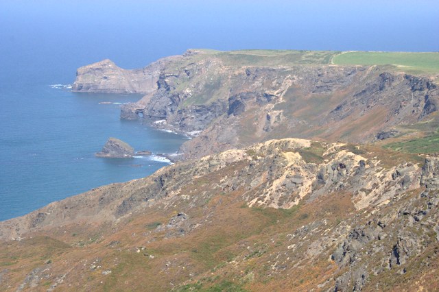
![]() This walk follows a section of the South West Coast Path from Boscastle to Crackington Haven Walk, on the Cornish coast. It's a splendid elevated section with spectacular sheer cliffs and tremendous views from the high point on Cornwall's coast.
This walk follows a section of the South West Coast Path from Boscastle to Crackington Haven Walk, on the Cornish coast. It's a splendid elevated section with spectacular sheer cliffs and tremendous views from the high point on Cornwall's coast.
The route runs for a distance of just over 6 miles along an undulating cliff top path.
Starting in Boscastle from the pretty harbour you head north to the interesting rock formations at Penally Point. You continue to Pentargon and Beeny Cliff before coming to the highest point on the Cornish coastline at High Cliff. There's some excellent views from this elevated spot.
The route continues to the wonderful headland at Cambeak before descending into Crackington Haven. It's a popular spot with a lovely beach and a fine sea front pub. There's also the option of visiting the historic Norman church at the little hamlet of St Gennys.
To continue your walking in the area head south on the Boscastle to Tintagel Walk to visit the splendid coastal castle of Tintagel.
Boscastle to Crackington Haven Walk Ordnance Survey Map  - view and print off detailed OS map
Boscastle to Crackington Haven Walk Open Street Map  - view and print off detailed map
Boscastle to Crackington Haven Walk OS Map  - Mobile GPS OS Map with Location tracking
Boscastle to Crackington Haven Walk Open Street Map  - Mobile GPS Map with Location tracking
Cycle Routes and Walking Routes Nearby
Photos
Beeny Cliff. Looking north along the cliffside from a point on the coast path just above Seals Hole.


