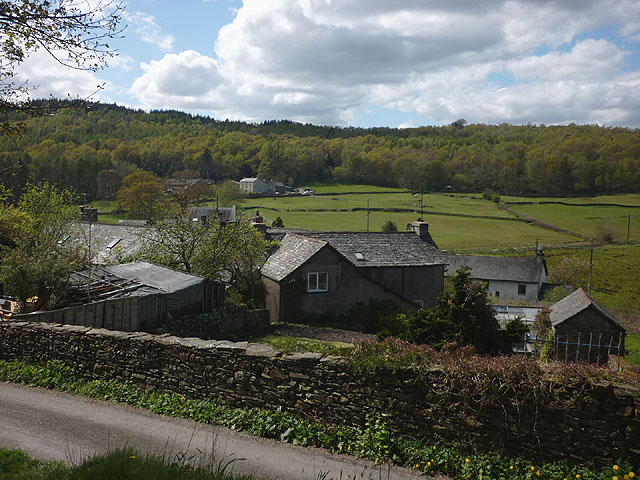
Bouth and the Rusland Valley Walk
![]()
![]() This small Cumbrian village is located near Greenodd and Haverthwaite in the South Lakeland area of the Lake District National Park.
This small Cumbrian village is located near Greenodd and Haverthwaite in the South Lakeland area of the Lake District National Park.
This circular walk from the village takes you through the lovely Rusland Valley with its pretty streams and excellent views of the surrounding fells.
You can then return to the village along quiet country lanes. Here you can enjoy some rest and refeshment at the historic White Hart pub.
Please scroll down for the full list of walks near and around Bouth. The detailed maps below also show a range of footpaths, bridleways and cycle paths in the area.
Postcode
LA12 8JB - Please note: Postcode may be approximate for some rural locationsBouth Ordnance Survey Map  - view and print off detailed OS map
Bouth Open Street Map  - view and print off detailed map
Bouth OS Map  - Mobile GPS OS Map with Location tracking
Bouth Open Street Map  - Mobile GPS Map with Location tracking
Walks near Bouth
- Greenodd - This Cumbrian village is located near Ulverston and the south western boundary of the Lake District National Park
- Haverthwaite - This walk climbs to Haverthwaite Heights near the Cumbrian village of Haverthwaite
- Ulverston Canal - This short canal runs from the centre of the Cumbrian town of Ulverston to the coast at Morcambe Bay
- Cumbria Coastal Way - Explore the wonderful coastline of Cumbria on this splendid long distance path
- Newby Bridge Circular Walk - This circular walk from the hamlet of Newby Bridge, climbs through woodland to Finsthwaite Heights and High Dam tarn
- Gummers How - Enjoy wonderful views over Lake Windermere on this short climb to Gummers How in the Lake District National Park
- Fell Foot Country Park - This beautiful lakeside country park is situated in the Lake District National Park at the southern tip of Lake Windermere
- Bowness - With its lakeside location the village of Bowness-on-Windermere is a lovely place to visit
- Cartmel Fell - This walk visits the village of Cartmel Fell from Bowland Bridge in the Lake District
- High Dam - This is a popular walk visiting the lovely tarns on Finsthwaite Heights, near Newby Bridge on the south western edge of the Lake District
- Latterbarrow - This is a fairly easy climb to Latterbarrow Hill in the Lake District
- Claife Heights - Claife Heights lies between Lake Windermere and Esthwaite Water in the Lake District
- Esthwaite Water - Enjoy a short stroll down to Esthwaite Water from the village of Hawkshead on this easy walk in the Lake District
- Backbarrow - This riverside village is located just south of Lake Windermere in the Lake District National Park.
- West Windermere Way - This new waymarked walk or cycle takes you along the south western side of Lake Windermere.
Pubs/Cafes
The White Hart is a 17th-century inn that embodies the quintessential charm of an ancient hostelry, adorned with old farming and hunting tools embellishing the walls alongside horse brasses and hops dangling from exposed beams. Its welcoming ambience is enhanced by slate-flagged floors and a wood-burning stove. Offering high-quality cuisine crafted from locally sourced ingredients, the inn provides dining options in the bar, upstairs dining area, or on the terrace. Alongside a regular beer from Ulverston Brewery, guest ales typically hail from nearby breweries. A scenic 20-minute stroll unveils breathtaking views of the Rusland Valley and Coniston Old Man. They have a car park and garden area as well as being dog friendly.


