Gummers How Walk Map
![]()
![]() Enjoy wonderful views over Lake Windermere on this short climb to Gummers How in the Lake District National Park. Gummers How is a fairly small hill at the southern end of Lake Windermere, near to Fell Foot Country Park. It stands at a height of 321 m (1,053 ft) and can be easily climbed from a parking area near Fell Foot Brow or you could go for a longer climb from Fell Foot Country Park itself. It's a lovely footpath with terrific views over Windermere, Lakeside, Newby Bridge and the coast. There's also a number of other trails which you can use to explore the area around the hill. Just to the east you can visit the interesting hamlet of Cartmel Fell where you will find a Grade I listed church dating from 1504. There's also Raven's Barrow where there are fine views from over the Winster valley to enjoy.
Enjoy wonderful views over Lake Windermere on this short climb to Gummers How in the Lake District National Park. Gummers How is a fairly small hill at the southern end of Lake Windermere, near to Fell Foot Country Park. It stands at a height of 321 m (1,053 ft) and can be easily climbed from a parking area near Fell Foot Brow or you could go for a longer climb from Fell Foot Country Park itself. It's a lovely footpath with terrific views over Windermere, Lakeside, Newby Bridge and the coast. There's also a number of other trails which you can use to explore the area around the hill. Just to the east you can visit the interesting hamlet of Cartmel Fell where you will find a Grade I listed church dating from 1504. There's also Raven's Barrow where there are fine views from over the Winster valley to enjoy.
If you'd like to extend your walk you could pick up the Windermere Way which runs past the hill.
Postcode
LA23 3LR - Please note: Postcode may be approximate for some rural locationsGummers How Ordnance Survey Map  - view and print off detailed OS map
Gummers How Open Street Map  - view and print off detailed map
*New* - Walks and Cycle Routes Near Me Map - Waymarked Routes and Mountain Bike Trails>>
Gummers How OS Map  - Mobile GPS OS Map with Location tracking
Gummers How Open Street Map  - Mobile GPS Map with Location tracking
Pubs/Cafes
Head down the hill to Fell Foot Park and you could purchase some post walk refreshments in the National Trust's Boathouse Café. There's a good range of meals and snacks which you can enjoy with a view over the lake.
Further Information and Other Local Ideas
Just to the south west is the lovely riverside village of Newby Bridge where you can pick up the popular Lakeside and Haverthwaite heritage railway.
Cycle Routes and Walking Routes Nearby
Photos
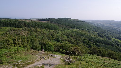
The view south from Gummer's How in mid summer. The hill stands at a height of 321 metres. The car park at the Astley's Plantation is already quite high up so its a fairly small climb suitable for families.
Trig Pillar, looking north on a clear winter day. The view extends to the Coniston fells, the central Lakeland fells and the coast at Morecambe Bay.


