Brackley Walks
![]()
![]() The Northamptonshire town of Brackley lies on the on the borders with Oxfordshire and Buckinghamshire. The market town is close to the famous Silverstone racing track and includes a noteworthy Parish church with parts dating from the 11th century.
The Northamptonshire town of Brackley lies on the on the borders with Oxfordshire and Buckinghamshire. The market town is close to the famous Silverstone racing track and includes a noteworthy Parish church with parts dating from the 11th century.
This circular walk from the town takes you through the countryside to the National Trust's Stowe Park. The route runs for just over 11 miles, exploring the farmland, woodland and villages to the east of the town before skirting the edge of the historic park.
The walk starts to the east of the town centre and follows country paths east towards Turweston. Here you pick up the waymarked Westbury Circular Ride, a shared cycling and walking footpath running through the area.
The path will take you along Ash Furlong Lane and through Westbury Wild Woods before coming to Wood Green. Here you can follow other public footpaths south east to reach the edge of the lovely Stowe Park.
You then head along the edge of the park and across Oxford Water on the interesting old stone bridge. The paths then head west to Shalstone before passing the village of Westbury. Soon after you pass Oatley's Farm before returning to Turweston and Brackley.
Brackley Ordnance Survey Map  - view and print off detailed OS map
Brackley Open Street Map  - view and print off detailed map
*New* - Walks and Cycle Routes Near Me Map - Waymarked Routes and Mountain Bike Trails>>
Brackley OS Map  - Mobile GPS OS Map with Location tracking
Brackley Open Street Map  - Mobile GPS Map with Location tracking
Walks near Brackley
- Stowe Park - Explore 250 acres of stunning parks and gardens at this major Buckingham attraction
- Westbury Circular Ride - This is a circular walk or cycle ride around Westbury in Buckinghamshire
- Banbury - Explore the area surrounding the Oxfordshire town of Banbury on this long circular walk
- Jurassic Way - This walk follows the Jurassic limestone ridge from Banbury to Stamford passing through Northamptonshire, Oxfordshire and Lincolnshire.
The walk includes a stretch along the Oxford Canal from Banbury and another waterside stretch along the Grand Union Canal near Braunston - Broughton Castle - Enjoy a short stroll around Broughton Castle and Broughton park on this interesting walk in Oxfordshire
- Macmillan Way - This epic long distance path links Boston in Lincolnshire to Abbotsbury in Dorset
- Spiceball Country Park - Enjoy an easy stroll along the Oxford Canal and the River Cherwell in this country park in Banbury
- Battlefields Trail - This interesting walking trail links three of England's most significant Battlefields:
Edgcote (1469) in Northamptonshire
Cropredy Bridge (1644) in Oxfordshire
Edgehill (1642) in Warwickshire
It runs from Chipping Warden, Northamptonshire and ends in Kineton, Warwickshire, passing through some beautiful countryside along the way.
The first section of the walk takes you from Chipping Warden to Upper Wardington - Grimsbury Reservoir - This pretty reservoir in Banbury has a nice circular footpath to follow around the perimeter
- Tusmore Park Estate - This walk explores the Tusmore Park Estate, near Bicester in Oxfordshire.
- Stoke Wood - These ancient woods are located near Bicester in Oxfordshire
Pubs/Cafes
The Plough in Brackley is a friendly pub with a good menu. In the warner months you can relax outside in the large terrace garden. You can find the pub on the High Street at a postcode of NN13 7DW for your sat navs.
Further Information and Other Local Ideas
To continue your walking in the area head west to the popular Oxfordshire town of Banbury. Here you can pick up the Jurassic Way and further explore the countryside on a good, waymarked walking trail.
Brackley is also the source of the River Ouse where you can pick up the Ouse Valley Way which will take you all the way to the mouth of the river at The Wash at King's Lynn.
The market town of Buckingham is located just to the east. Here you can enjoy some nice waterside walks along the Grand Union Canal.
Photos
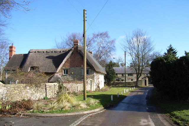
Turweston, Buckinghamshire. On the left is Thatched Rose Cottage, which is 17th- or 18th-century. Ahead is Turweston Barn, now converted into a private house.


