Walk around Boston Lincolnshire
![]()
![]() This market town in Lincolnshire has some nice riverside trails and a local nature reserve to visit. It's in a notable location on the edge of the Wash where Norfolk meets Lincolnshire. In the town there's some interesting old buildings including the 14th century Guildhall, Maud Foster windmill (1819) and the impressive St Botolph’s Church.
This market town in Lincolnshire has some nice riverside trails and a local nature reserve to visit. It's in a notable location on the edge of the Wash where Norfolk meets Lincolnshire. In the town there's some interesting old buildings including the 14th century Guildhall, Maud Foster windmill (1819) and the impressive St Botolph’s Church.
This walk explores the quays and docks to the south of the town, following a footpath along The Haven river.
The walk starts in the town centre where you can pick up the Macmillan Way and follow the waymarked footpath south past the Quay, the Swing Bridge and the docks. The trail then takes you along The Haven to Slippery Gow where you can pick up alternative paths to the west of the river. These will take you north before rejoining the river and following it back into the town centre. You can extend the walk by heading north along the River Witham towards Anton's Gowt.
Boston Ordnance Survey Map  - view and print off detailed OS map
Boston Open Street Map  - view and print off detailed map
Boston OS Map  - Mobile GPS OS Map with Location tracking
Boston Open Street Map  - Mobile GPS Map with Location tracking
Walks near Boston
- Macmillan Way - This epic long distance path links Boston in Lincolnshire to Abbotsbury in Dorset
- Frampton Marsh - Visit this splendid RSPB nature reserve on the Wash on this circular walk near Boston
- Sleaford - This walk from the town takes you along the River Slea to the neighbouring villages of Anwick and South Kyme
- Gibraltar Point - Enjoy a walk around this beautiful coastal nature reserve near Skegness
- Skegness - This walk takes you along the Lagoon Walk and then around the boating lake in the popular coastal town of Skegness
- Tattershall Lakes - This waterside walk takes you along Tattershall Lakes and the River Bain in the Lincolnshire village of Tattershall.
The walk starts in the village centre on the River Bain, next to the remains of Tattershall Castle - Woodhall Spa - Woodhall Spa is a very attractive former spa town on the edge of the Lincolnshire Wolds
- Freiston Shore - This circular walk explores the RSPB's Freiston Shore nature reserve near Boston in Lincolnshire.
- Culverthorpe - This circular walk visits Culverthorpe Hall near Grantham in Lincolnshire.
Pubs/Cafes
Back in the town Goodbarns Yard is a good choice for some post walk refreshments. They have a good menu and a lovely large garden area right next to the river. The pub also has some history, dating back over 700 years with some interesting old town photos on the walls. You can find them just east of the train station on a cobbled medieval street, near to St Botolphs church. The address is 8 Wormgate with a postcode of PE21 6NP for your sat navs.
Dog Walking
The riverside path is a nice one to try with your dog. Goodbarns Yard mentioned above is also dog friendly in the garden area.
Further Information and Other Local Ideas
If you continue south along the Macmillan Way it will take you to the Frampton Marsh Nature Reserve. The reserve is located on The Wash and includes reedbed, saltmarsh, tidal mudflats, freshwater scrapes and grassland. There's also the RSPB's Freiston Shore to visit in this area.
For more walking ideas in the area see the Lincolnshire Walks page.
Photos
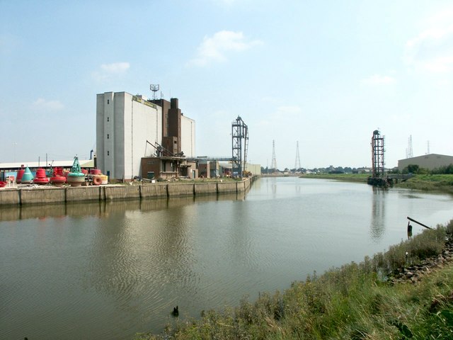
The Haven, Boston. A general view of the tidal Haven, looking up river. There are plans to build a tidal barrage near the Black Sluice so as to reduce the incidence of flooding in the town and to manage boat access between the River Witham and the South Forty-foot drain.
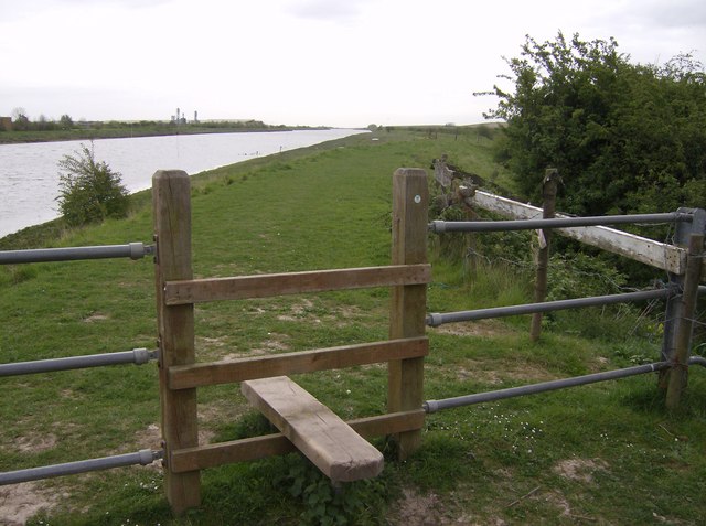
River Haven. As the River Haven heads towards the Wash, it becomes more rural, leaving the Post of Boston behind. The sea wall on both sides is a few metres above the river, sometimes close to its bank and sometimes drifting inland. The Macmillan Way (290-mile coast to coast route from Lincolnshire to Dorset) follows this bank for several miles.
River Haven sea bank. The River Haven flows through the Port of Boston. Here, shortly after high tide, it can be seen to be much higher than the surrounding land, protected by substantial sea banks, this being on the south of the river.
Two churches. From the sea wall on the south side of the River Haven south-east of Boston. Two churches can be seen. To the right, Skirbeck Church on the north side of the Haven. To the left below the pylons, Boston Stump (St Botolphs, Boston) in the centre of Boston; a landmark for miles around. In the foreground the flood plain of the River Haven can be seen, contained by the sea bank to the left.
Across the Haven. Where the southern sea bank turns inland away from the Haven marshy areas are left. On the north bank of the river opposite the sea bank runs adjacent to the river, with industrial units behind it. The 1:25K map marks the small bank close to the camera then where it turns right at right angles. This location is also on the meridian line, 0 degrees, directly north of Greenwich.
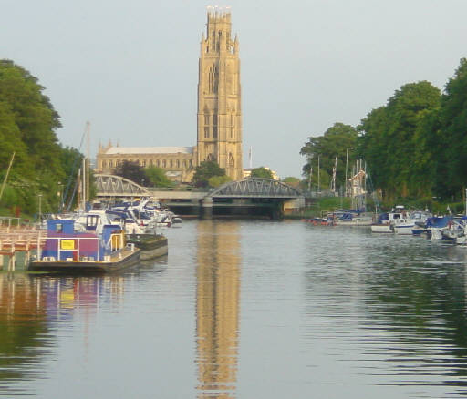
"Boston Stump". The tower of St Botolph's Church, Boston, is visible for many miles over the flat scenery of Lincolnshire and is known as "Boston Stump". Looking south east from the visitor moorings on the River Witham. The church is notable as the largest parish church in England. Its tower is 266 feet high and can be seen for miles around.


