Brizlee Wood Walk
![]()
![]() This walk visits RRH Brizlee Wood on the edge of Hulne Park near Alnwick.
This walk visits RRH Brizlee Wood on the edge of Hulne Park near Alnwick.
The walk starts in Alnwick and heads west along a public footpath to Brizlee Wood where there's peaceful woodland, rhododendrons and Remote Radar Head Brizlee Wood (or RRH Brizlee Wood), an air defence radar station operated by the Royal Air Force. The striking dome looks like a large golf ball and is positioned next to Cloudy Crags in a scenic, elevated location.
You can extend the walk by exploring Hulne Park and visiting the nearby Brizlee Tower. The Grade 1 listed folly was erected in 1781 for Hugh Percy, 1st Duke of Northumberland. There's wonderful views over North Northumberland, the Borders and the coast from the top of the tower, though this is not normally open to the public.
Brizlee Wood Ordnance Survey Map  - view and print off detailed OS map
Brizlee Wood Open Street Map  - view and print off detailed map
Brizlee Wood OS Map  - Mobile GPS OS Map with Location tracking
Brizlee Wood Open Street Map  - Mobile GPS Map with Location tracking
Cycle Routes and Walking Routes Nearby
Photos
Birds and Brizlee Wood Radar Dome. Originally opened as an Ace High site in the early 1960s, it now forms part of the Air Surveillance and Control System (ASACS) of the Royal Air Force. The site is located at 820 feet (250 m) above sea level and is notable from the surrounding area being known locally as "The Golf Ball".
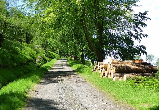
Looking east along the track from West Brizlee in Hulne Park, the Duke of Northumberland's estate. The public is permitted to walk in much of the parkland although this track is private to protect the game birds and the wildlife. Access for this photograph was kindly granted by the gamekeeper.


