Bronte Way
![]()
![]() Follow the Bronte Way through Lancashire and Yorkshire and visit many of the places associated with writings and lives of the Bronte Sisters.
Follow the Bronte Way through Lancashire and Yorkshire and visit many of the places associated with writings and lives of the Bronte Sisters.
Highlights on the walk include:
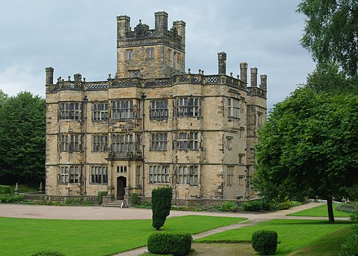
Gawthorpe Hall - visited by Charlotte Bronte on several occasions, the impressive Gawthorpe Hall is the start point of the walk
Wycoller Country Park - Wycoller Hall is believed to have inspired Ferndean Manor in Charlotte Bronte's "Jane Eyre".
Top Withens - the inspiration for the location of Wuthering Heights
Ponden Hall - situated near the village of Stanbury it inspired Thrushcross grange in Wuthering Heights. It sits next to the pretty Ponden Reservoir.
Haworth - this Yorkshire village is where the Bronte sisters wrote many of their works and includes the Haworth Parsonage Museum
Thornton - birthplace of the Brontes
Oakwell Hall - inspiration for 'Fieldhead' in Charlotte Bronte's novel Shirley and also the end point of the route
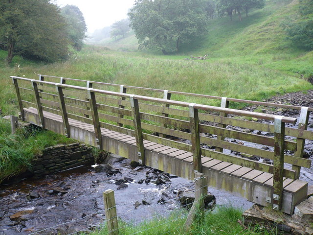
Bronte Waterfall - this beautiful waterfall is located in Bronte Country on Haworth Moor. It was a popular spot for the Bronte sisters who loved visiting the waterfall. There is a pretty little bridge called Bronte Bridge next to the falls.
Oxenhope - the trail passes through the village and along the Leeming and Thornton Moor Reservoirs.
The Keighley & Worth Valley Railway can also be picked up at the staion here. The heritage railway runs from Keighley to Oxenhope through the lovely Worth Valley on some classic old steam trains.
As well as the interesting places above the walk also passes some beautiful scenery including Ponden and Leeming Reservoirs, the Leeds and Liverpool Canal and Penistone country park.
Please click here for more information
Bronte Way Ordnance Survey Map  - view and print off detailed OS map
Bronte Way Open Street Map  - view and print off detailed map
Bronte Way OS Map  - Mobile GPS OS Map with Location tracking
Bronte Way Open Street Map  - Mobile GPS Map with Location tracking
Pubs/Cafes
In Wycoller village you could stop off at the Wycoller Craft Centre which has some nice tea rooms and a gift shop. It's in a lovely spot with a pretty garden area where you can sit outside and enjoy a scone with views of the little stream. The family run business can be found in the heart of Wycoller village at postcode BB8 8SY for your sat navs. It's also dog friendly if you have your canine friend with you.
Cycle Routes and Walking Routes Nearby
Photos
Gawthorpe Hall. Elizabethan country house on the banks of the River Calder, in Ightenhill. The family home of the Shuttleworth family which Charlotte Bronte visited frequently as a friend of John Kay-Shuttleworth.
Top Withens, a ruined farmhouse near Haworth, West Yorkshire. The house is said to have been the inspiration for the location of the Earnshaw family home 'Wuthering Heights' in the 1847 novel of the same name by Emily Brontë.A plaque affixed to a wall reads:
This farmhouse has been associated with "Wuthering Heights", the Earnshaw home in Emily Brontë's novel. The buildings, even when complete, bore no resemblance to the house she described, but the situation may have been in her mind when she wrote of the moorland setting of the Heights.— Brontë Society 1964.
Bronte Waterfall. Located on the South Dean Beck near Stanbury. Below the falls is Brontë Bridge, an old stone bridge across the beck.
Elevation Profile


