Brown Clee Hill
![]()
![]() This walk climbs to Brown Clee Hill from the village of Burwarton. The circular route runs for about 6 miles with woodland trails, tarns and fine views from the high points.
This walk climbs to Brown Clee Hill from the village of Burwarton. The circular route runs for about 6 miles with woodland trails, tarns and fine views from the high points.
The walk starts in Burwarton just to the east of the hill. From the village you can follow public footpaths west through Burwarton Park. On the way you'll pass pockets of woodland and the pretty Boyne Water. Just after passing the little lake you turn north west and link up with the Shropshire Way. Continue north along the waymarked path and it will take you toward Brown Clee Hill. Another public footpath branches off to the north east to take you up to the 540 metres (1,770 ft) summit of the hill where there is a Wireless Station and the Abdon Burf toposcope. This details some of the landmarks that you can see from this splendid, elevated position. You can take in far ranging views over the Shropshire Hills and into Wales from here.
After taking in the views the route then descends to the east through Stanbroughs Wood. You then turn south to follow a bridleway back into Burwarton.
Brown Clee Hill Ordnance Survey Map  - view and print off detailed OS map
Brown Clee Hill Open Street Map  - view and print off detailed map
Brown Clee Hill OS Map  - Mobile GPS OS Map with Location tracking
Brown Clee Hill Open Street Map  - Mobile GPS Map with Location tracking
Pubs/Cafes
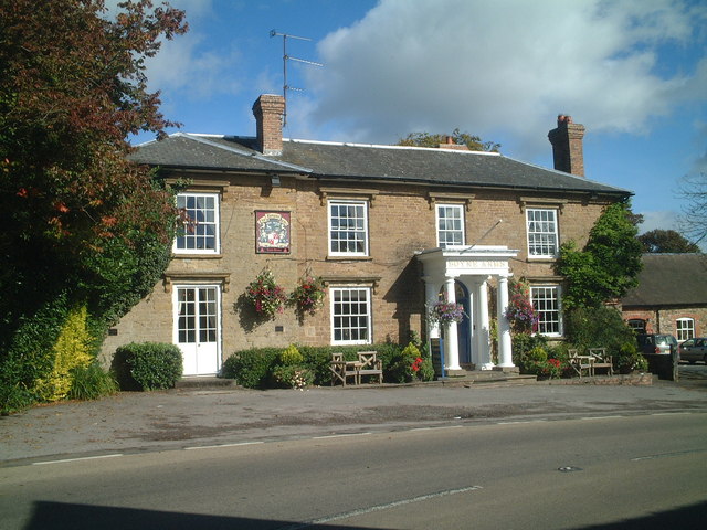
The Boyne Arms at Burwarton is a nice place to go for some post walk refreshments. The gastro pub does excellent food and has a nice garden area for warmer days. You can find it at a postcode of WV16 6QH for your sat navs. The pub provides accommodation if you need to stay over and is also dog friendly if you have your canine friend in tow.
Further Information and Other Local Ideas
To further explore the Clee Hills follow the Shropshire Way south to visit Titterstone Clee Hill. Though slightly smaller than Brown Clee, Titterstone is well known for providing some of the best views over Britain.
To the west there's Aston Munslow where you can pick up the Corvedale Three Castles Walk. The circular waymarked trail explores the valley of the River Corve, visiting a series of historic sites on the way.
Cycle Routes and Walking Routes Nearby
Photos
Through Bryan's Wood, Burwarton, Shropshire The whole area has the appearance of a well managed country park. This surfaced road is also designated as a public bridleway.


