Brown Willy Walk
![]()
![]() Climb to the highest point on Bodmin Moor on this circular walk in north east Cornwall. The summit stands at a height of 1,378 feet (420 m) making it the highest point in the county as well. There's fantastic views across the moor to the Cornish coast and a number of fascinating historical sites to see on the way.
Climb to the highest point on Bodmin Moor on this circular walk in north east Cornwall. The summit stands at a height of 1,378 feet (420 m) making it the highest point in the county as well. There's fantastic views across the moor to the Cornish coast and a number of fascinating historical sites to see on the way.
Start the walk from the car park at the end of Roughtor Road, just to the north west of the hills. You then follow paths south east onto the Roughtor Moors and up to Rough Tor. The fascinating site is the 2nd highest point on the moors and includes a logan stone, a neolithic tor enclosure, a large number of Bronze Age hut circles, and some contemporary monuments.
After exploring Rough Tor the route branches to the left to visit Showery Tor. The granite Tor is a prominent landmark consists of a natural outcrop enveloped by a giant man-made ring cairn thought to have been a religious focal point.
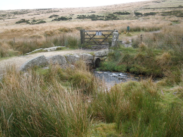
The route then continues the ascent to Brown Willy, crossing the De Lank River on the way. Here you can see a number of Bronze Age cairns including a summit cairn thought to be the resting place of an ancient Cornish king.
After exploring the summit and taking in the views the route then descends across the Rough Tor Moors, passing more cairns before returning to the car park.
Just to the north of the hill you will find Crowdy Reservoir. It's a good place to extend your walking on the moor. There's nice views across the water, woodland trails in Davidstow Woods and lots of wildlife to look out for on the lake. Around here you can also pick up the long distance Copper Trail. The epic trail takes you to many of the scenic highlights on the moor and several historic Cornish Copper mines.
A few miles to the south you can visit the 900 acre Colliford Lake, the largest lake in Cornwall.
Postcode
PL32 9QJ - Please note: Postcode may be approximate for some rural locationsBrown Willy Ordnance Survey Map  - view and print off detailed OS map
Brown Willy Open Street Map  - view and print off detailed map
Brown Willy OS Map  - Mobile GPS OS Map with Location tracking
Brown Willy Open Street Map  - Mobile GPS Map with Location tracking
Pubs/Cafes
Head west into nearby Camelford and there's a few good refreshment options. The Masons Arms does good food and has a lovely garden area to sit in when the weather is good. The interior is full of character with a ceiling full of old bottles, mugs, cups, tankards and old newspaper clippings. You can find the pub in the market place at a postcode of PL32 9PB for your sat navs.
The Camelford Way long distance footpath can also be picked up in the town. The trail explores the River Camel Valley to the south of the riverside settlement.
Dog Walking
The hill and surrounding moorland make for a fine dog walk. The Masons Arms pub mentioned above is also dog friendly.


