Burnham Overy Staithe to Holkham Beach Walk
![]()
![]() This pretty village is located on the north coast of Norfolk, between Burnham Market and Wells Next the Sea.
This pretty village is located on the north coast of Norfolk, between Burnham Market and Wells Next the Sea.
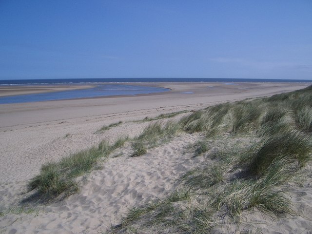
The village includes a lovely secluded beach, a harbour, salt marshes, creeks, sand dunes and a picturesque old mill.
This walk from the village takes you east along the Peddars Way and Norfolk Coast Path to Holkham Beach where there is a National Nature Reserve.
The walk can be extended by heading south to visit Holkham Park. The expansive park includes woodland, a lake and a deer park with miles of footpaths to try.
Postcode
PE31 8JE - Please note: Postcode may be approximate for some rural locationsBurnham Overy Staithe Ordnance Survey Map  - view and print off detailed OS map
Burnham Overy Staithe Open Street Map  - view and print off detailed map
Burnham Overy Staithe OS Map  - Mobile GPS OS Map with Location tracking
Burnham Overy Staithe Open Street Map  - Mobile GPS Map with Location tracking
Walks near Burnham Overy Staithe
- Peddars Way and Norfolk Coast Path - The Peddars Way & Norfolk Coast Path begins at Knettishall Heath Country Park in Suffolk and takes you to Holme next the sea on the Norfolk coast along designated footpaths
- Holkham National Nature Reserve - Explore 9,600 acres of grazing marsh, woodland, salt marsh, sand dunes and foreshore in England's largest Nature Reserve.The walk begins at the delightful village of Burnham Overy Staithe, following Overy Creek to the beach at Holkham Bay
- Burnham Market - This Norfolk based village is located in a lovely spot near to the coast and the delightful neighbouring village of Burnham Overy Staithe
- Wells-Next-the-Sea to Blakeney - This walk takes you from the popular town of Wells-next-the-Sea to Blakeney where you can visit the lovely Blakeney Point Nature Reserve
- Holkham Park - Enjoy a super cycle or walk in this 3000 acre deer park near Wells-Next-The-Sea on the Norfolk coast
- Blakeney Point Nature Reserve - This beautiful National Nature Reserve on the Norfolk coast is a four-mile-long sand and shingle spit with sand dunes, salt marshes, tidal mudflats and farmland
- Cley Marshes Nature Reserve - This walk takes you around the stunning Cley Marshes on the Norfolk coast at Cley next the Sea
- Pensthorpe - This 700 acre natural park in Fakenham has miles of nice walking trails to try
- Scolt Head - This walk takes you to the Scolt Head Nature Reserve on the Norfolk coast.
- Wells-Next-The-Sea to Hunstanton - This route follows National Cycle route 1 between two pretty Norfolk coastal towns.
The route is fairly flat and passes through attractive countryside and the pretty villages of Burnham Thorpe and Burnham Market.
The final stretch takes you along the Hunstanton coast with splendid views of The Wash and the Hunstanton cliffs
Pubs/Cafes
The Hero pub is a fine place to enjoy some post walk refreshments. The inn includes an attractive interior with many brass ornaments and items with naval connections. They serve high quality dishes which you can enjoy in the pleasant outdoor seating area. The pub is dog friendly with biscuits available for your four legged friend.
Further Information and Other Local Ideas
The walk to Scolt Head Nature Reserve starts from Brancaster Staithe. There is a tidal walk to the island from here.
Photos
Burnham Overy Mill. A disused water mill -about 1km from Burnham Overy Staithe - this property is owned by the National Trust who let bits out as self catering flats.
Burnham Harbour from the Dunes looking North-east. Despite its name, Burnham Harbour is a natural feature and not a conventional man-made harbour. The harbour is an attractive unspoilt stretch of the River Burn that runs through the golden sands parallel to the coast.


