Caergwrle Castle Walk
![]()
![]() This walk explores the ancient ruins of Caergwrle Castle in Flintshire.
This walk explores the ancient ruins of Caergwrle Castle in Flintshire.
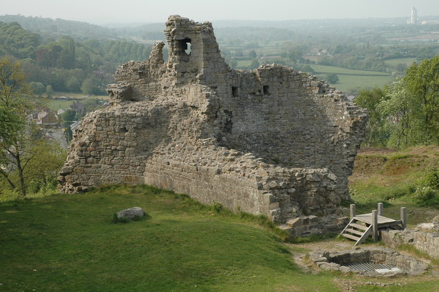
The 13th century castle lies just to the south of Caergwrle village. You can follow a waymarked path south from the junction of Wrexham Road and Castle Street in the centre of the village. This will take you up to the ruins which stand at a height of 137 metres. From the elevated position of the castle there are some excellent views to the surrounding hills and mountains. You will also find some information boards here detailing the history of the castle.
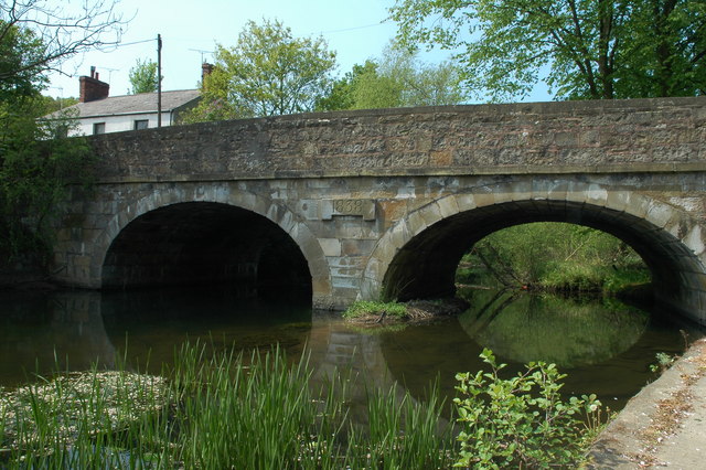
After exploring the castle you can head into the village to enjoy views of the River Alyn which runs through the area.
To continue your walking in the area head west to climb to the excellent viewpoints at Hope Mountain and Waun-y-llyn Country Park.
Postcode
LL12 9DG - Please note: Postcode may be approximate for some rural locationsCaergwrle Castle Ordnance Survey Map  - view and print off detailed OS map
Caergwrle Castle Open Street Map  - view and print off detailed map
Caergwrle Castle OS Map  - Mobile GPS OS Map with Location tracking
Caergwrle Castle Open Street Map  - Mobile GPS Map with Location tracking
Walks near Caergwrle Castle
- Waun-y-llyn Country Park - Climb to the top of Hope Mountain on this walk through Waun-y-llyn Country Park in Hope, Flintshire.
- Alyn Waters Country Park - Enjoy peaceful walking and cycling in this lovely country park in the Alyn Valley, Wrexham
- Nant-y-Ffrith - This walk in Wrexham County visits a lovely wooded valley with streams, caves and waterfalls.
- Erddig Hall and Country Park - Explore the 1,200-acre country park surrounding the 18th century Erddig Hall in Wrexham
- Wat's Dyke Way Heritage Trail - A new walking route running through the pastoral countryside near the Welsh-English border
- Llandegla Forest - This large forest near Wrexham is a fantastic place for walking and cycling
- Wrexham - This circular walk explores the countryside to the south of Wrexham
Photos
Caergwrle Castle. Built between 1278–82 by Dafydd ap Gruffudd on lands given to him by Edward I and taken from Powys, it was the last castle to be built by a native Welsh prince.
Weir on the River Alyn/Afon Alun, near to Caergwrle, Flintshire/Sir y Fflint, Great Britain. Looking down on the weir from the bridge at Bridge End. The weir was built to provide a head of water that could be diverted through the sluice gate to power the mill on the left. The mill is now a private residence.


