Llandegla Forest Walks
![]()
![]() This large forest near Wrexham is a fantastic place for walking and cycling. There are 50km of graded, waymarked mountain bike trails. The trails range from nice easy family trails to more exhilarating downhill tracks. The Green Route is a leisurely ride around the pretty Pendinas Reservoir with views of the Clwydian Range. At the other end of the scale is the challenging Black Route with steep descents, large steps, gaps and drop-offs. The Blue route is a good one to try for people new to mountain bikers while the Red Route is for Intermediate riders.
This large forest near Wrexham is a fantastic place for walking and cycling. There are 50km of graded, waymarked mountain bike trails. The trails range from nice easy family trails to more exhilarating downhill tracks. The Green Route is a leisurely ride around the pretty Pendinas Reservoir with views of the Clwydian Range. At the other end of the scale is the challenging Black Route with steep descents, large steps, gaps and drop-offs. The Blue route is a good one to try for people new to mountain bikers while the Red Route is for Intermediate riders.
Walkers are also well catered for with a series of waymarked walks. Easy trail include one around the reservoir with views of Moel Famau. There's also a nice trail across the Ruabon moors where you can look out for the Black Grouse from the bird hides.
The forest has an excellent visitor centre with bike hire and a cafe.
The Offa's Dyke Path runs through the forest so you could pick this up to extend your exercise. If you follow the trail south for a couple of miles you will come to the lovely wooded gorge at World's End.
Postcode
LL11 3AA - Please note: Postcode may be approximate for some rural locationsPlease click here for more information
Llandegla Forest Ordnance Survey Map  - view and print off detailed OS map
Llandegla Forest Open Street Map  - view and print off detailed map
*New* - Walks and Cycle Routes Near Me Map - Waymarked Routes and Mountain Bike Trails>>
Llandegla Forest OS Map  - Mobile GPS OS Map with Location tracking
Llandegla Forest Open Street Map  - Mobile GPS Map with Location tracking
Pubs/Cafes
The forest has a very good cafe on site where you can enjoy refreshments after your exercise. They have tables outside if the weather is good too.
You could also head a little south to the Ponderosa Cafe on the spectacular Horseshoe Pass. The large cafe serves a good range of meals and snacks. There's a splendid outdoor seating area with excellent views over the surrounding hills. At 1,400 ft above sea level you can see the Clwydian Mountain range and on a very clear day the three peaks of Snowdon. There's also Bed & Breakfast Accommodation, a gift shop and a large car park at the extensive complex. Postcode is LL20 8DR.
The circular Horseshoe Pass Walk also starts from the cafe. The trail visits Cyrn-y-Brain mountain, Llandegla Forest, World's End, Craig Arthur and the Eglwyseg River valley.
Dog Walking
The expansive forest is a great place to bring your dog so you're sure to see other owners on your visit. The on site shop and cafe are also dog friendly.
Further Information and Other Local Ideas
Just to the north east you'll find Nant-y-Ffrith where there's a splendid wooded gorge with streams, caves and a significant waterfall.
A few miles to the east there's Alyn Waters Country Park where there's woodland, riverside paths, a visitor centre, a nature reserve and trim trail to enjoy.
Nearer to Wrexham you can try the Clywedog Trail where there's riverside trails and a visit to the picturesque Nant Mill and Bersham Waterfall.
Follow Offa's Dyke north and it will take you to the villages of Llandegla and Llanarmon-yn-Ial. On the way there are nice views of the River Alyn and a visit to the lovely Llyn Gweryd.
Cycle Routes and Walking Routes Nearby
Photos
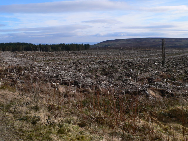
Llandegla Forest is a mature conifer plantation planted in 1972-3. This view NNE is near the edge of the plantation, immediately north east of the blue forest mountain bike trail and near the new-felled area. One of the ridges along which the trees are planted is visible in the foreground. The light in the distance is created by several fallen trees. Mossy ground cover is present in some areas (centre and left).


