Cathkin Braes Country Park
![]()
![]() Enjoy panoramic views of the city of Glasgow and the mountain peaks beyond in this country park south east of Glasgow.
Enjoy panoramic views of the city of Glasgow and the mountain peaks beyond in this country park south east of Glasgow.
There are a number of walking trails taking you through ancient woodland, grassland, heath and scrub. The park is excellent for cycling having been used for the mountain bike competitions at the 2014 Commonwealth Games. The course is a 5.5 km long figure of eight and is of a very high standard - see the video below for an idea of what you can expect.
If you want to continue your activity then Linn Park is just over a mile west of Cathkin Braes.
Postcode
G42 9UJ - Please note: Postcode may be approximate for some rural locationsCathkin Braes Country Park Ordnance Survey Map  - view and print off detailed OS map
Cathkin Braes Country Park Open Street Map  - view and print off detailed map
Cathkin Braes Country Park OS Map  - Mobile GPS OS Map with Location tracking
Cathkin Braes Country Park Open Street Map  - Mobile GPS Map with Location tracking
Dog Walking
The expansive park is ideal for dog walking. It's a popular place so you will probably meet other owners on your visit.
Further Information and Other Local Ideas
The Cathkin Marsh Wildlife Reserve is located just south east of the park. There's some pleasant boardwalks and lots of wildlife to see in this area.
To the east there's the historic Bothwell Castle where you can pick up the Clyde Walkway to visit Strathclyde Country Park and Chatelherault Country Park.
Cycle Routes and Walking Routes Nearby
Photos
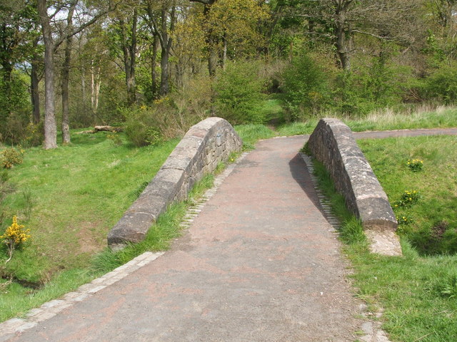
Footbridge. The path seen here begins at an entrance to the park that is located on Ardencraig Road. It then ascends for about a hundred metres before deviating slightly at this point to cross a little footbridge. The bridge has a round plaque on the side bearing the park logo (which also appears, surrounded by text, on both sides of the entrance gate) and the words "Cathkin Braes Country Park, est. 1995".
Entrance to Cathkin Braes Country Park This gateway is on Ardencraig Road, close to the point where it meets Castlemilk Drive. The park was established in 1995.
The viewpoint. From this spot, much of Glasgow is spread out before the viewer like a map. Above the left-hand edge of the viewpoint, a little horn can be seen on the horizon, marking the peaks of Dumgoyne and Dumfoyn. From there, the line of the Campsie Fells stretches towards the right of the photo.


