Cheesden Valley Circular Walk
![]()
![]() This circular walk explores the Cheesden Valley in the Rochdale area of Greater Manchester.
This circular walk explores the Cheesden Valley in the Rochdale area of Greater Manchester.
In the scenic valley you will find a series of footpaths running along the pretty Cheesden Brook. There's also lakes, hill climbs, ruins of the historic old mills and some lovely countryside views to enjoy.
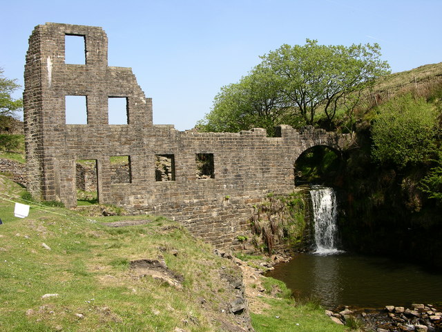
The walk starts from the 18th century Owd Bett's Pub next to Ashworth Moor Reservoir on the Edenfield Road, just to the north west of Rochdale. From here you can pick up trails running north west along the reservoir towards Lumb Bridge and the photogenic ruins of the Lumb Mill. Here you turn south to pick up the trails along the brook to Deeply Vale and Deeply Hill. You continue past Cleggs Wood to Simpson's Clough where you pick up the Rochdale Way for the return leg of the journey.
This waymarked footpath will take you north along the Naden Brook to return you to the reservoir and the car park.
For a shorter circular walk exploring the southern end of the valley see the Ashworth Valley Walk.
Postcode
OL12 7TY - Please note: Postcode may be approximate for some rural locationsCheesden Valley Ordnance Survey Map  - view and print off detailed OS map
Cheesden Valley Open Street Map  - view and print off detailed map
Cheesden Valley OS Map  - Mobile GPS OS Map with Location tracking
Cheesden Valley Open Street Map  - Mobile GPS Map with Location tracking
Further Information and Other Local Ideas
One nice idea is follow the Rochdale Way east from the reservoir to climb to the viewpoint at Knowl Hill. You can then descend down to Greenbooth Reservoir for more waterside walking.
Cycle Routes and Walking Routes Nearby
Photos
Cheesden Lumb Mill. This former woollen mill was built in 1786, just below the confluence of Cheesden Brook and Kilgate Brook. At first it was a fulling mill, but it later extended its activities to include carding, bleaching and dyeing. However it later changed to spinning cotton waste, and ended up producing lamp wicks. The mill closed around 1898 and was abandoned


