Chilham River and Lake Circular Walk
![]()
![]() This circular walk takes you around the Kent village of Chilham, visiting the River Great Stour, Chilham Lake and Denge Wood. It's a very picturesque place with pretty cottages and a noteworthy old manor house.
This circular walk takes you around the Kent village of Chilham, visiting the River Great Stour, Chilham Lake and Denge Wood. It's a very picturesque place with pretty cottages and a noteworthy old manor house.
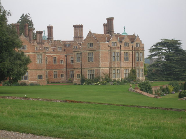
The route starts in the delightful village centre near to Chilham Castle. The site includes a fine manor house which dates from the early 17th century and a Norman Keep. It is the oldest building in the village, dating from 1174 and is still inhabited - making it perhaps one of the oldest dwellings in the UK.
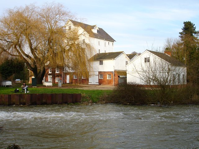
From here you head east through the village toward Bagham before picking up paths along the Great Stour River. These lead you to the pretty Chilham lake which includes a beautiful 5-storey watermill and is a popular spot for fishing. At the eastern end of the lake you can pick up the Stour Valley Walk and follow it back towards the village. On the way you will skirt the edge of Denge Wood which is a nice place to extend your walk. The woods include a number of different type of orchid and are an important habitat for nesting and migratory birds including the nightingale, chiffchaff, and spotted flycatcher. After passing the woods the route returns to the village where you can enjoy refreshments at one of the two large pubs. This includes the Woolpack and the White Horse, the latter of which dates from the 16th century.
The village is located within the North Downs and Kent Downs so there is great scope for continuing your walking. You could pick up the North Downs Way in the village and follow it toward Old Wives Lees, Denstead Wood, Chartham Hatch and Canterbury. Heading south west would take you to the expansive King's Wood.
Just to the east of the village, near Chartham, there are some nice footpaths and lots of wildlife in the Larkeyvalley Nature Reserve.
Chilham Ordnance Survey Map  - view and print off detailed OS map
Chilham Open Street Map  - view and print off detailed map
Chilham OS Map  - Mobile GPS OS Map with Location tracking
Chilham Open Street Map  - Mobile GPS Map with Location tracking
Further Information and Other Local Ideas
Just a couple of miles north west of the village there's the delightful Perry Woods to explore. There's some pleasant ancient woodland trails and the climb to the splendid Pulpit viewpoint to enjoy here. From here there's great views over the Thames Estuary, North Downs and the Isle of Thanet.
Just east of nearby Canterbury you can visit the Stodmarsh National Nature Reserve which boasts the largest reedbeeds in the South East of England. This area also includes the lovely Grove Ferry Walk which starts at the eastern end of the reserve. There's a car park, picnic area, boat trips and a fine riverside pub here. At the western end of the reserve you'll also find the Westbere Marshes and the noteworthy town of Fordwich. Fordwich is notable as Britain's smallest town and also has a great pub with a dining terrace overlooking the Stour.
A few miles to the south west there's miles of walking and cycling trails in King's Wood. The woods are also home to a fine sculpture trail, bluebells in the spring and wildlife including deer and green woodpeckers.
Cycle Routes and Walking Routes Nearby
Photos
Chilham Castle. A red-brick Jacobean manor house dating from 1616AD. One of several flights of brick steps linking the various garden terraces can be seen to the right.


