Chulmleigh Walks
![]()
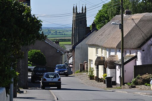
![]() This attractive market town is located in North Devon in the valley of the River Little Dart. It's a worthy place to visit with a number of old thatched buildings and a church dating to the 15th century. There's also a fine 17th century pub to relax in after your exercise.
This attractive market town is located in North Devon in the valley of the River Little Dart. It's a worthy place to visit with a number of old thatched buildings and a church dating to the 15th century. There's also a fine 17th century pub to relax in after your exercise.
This walk from the town takes you along a section of the Ridge and Valley Walk to visit the nearby Eggesford Forest and Eggesford Garden Centre.
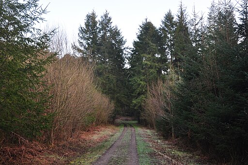
You can pick up the waymarked Ridge and Valley Walk in the town and follow it south, crossing the River Dart before coming to Upcott Wood and Eggesford Forest. The woods are a fine place for a walk with Douglas Fir trees, pretty streams, an ancient motte and bailey castle and lots of interesting flora and fauna to see.
The walk then heads west to visit the Eggesford Garden & Country Centre. Here you can enjoy a pleasant stroll and admire the quality plants and flowers on display. There's also a fine Restaurant selling delicous home made cakes.
In this area you can also pick up the popular Tarka Trail long distance walk.
Chulmleigh Ordnance Survey Map  - view and print off detailed OS map
Chulmleigh Open Street Map  - view and print off detailed map
Chulmleigh OS Map  - Mobile GPS OS Map with Location tracking
Chulmleigh Open Street Map  - Mobile GPS Map with Location tracking
Walks near Chulmleigh
- Eggesford Forest - These woods near Lapford are a popular place for dog walkers.
The walk starts off at the car park, just off the A377 - Ridge and Valley Walk - Follow the valley of the River Dart on this lovely walk through Devon.
The walk starts at Eggesford Barton near the train station and heads towards Chawleigh and then Leigh Bridge where you join the river - South Molton - The market town of South Molton is located in a pleasant position in the Mole Valley
- Tarka Trail - This wonderful walk through Devon follows the path taken by Tarka the Otter in the book of that name
- Landacre Bridge from Withypool - This circular walk takes you from the little village of Withypool to the medieval Landacre Bridge on Exmoor
- Two Moors Way - Travel from Ivybridge to Lynmouth through the Dartmoor and Exmoor National Parks on this splendid walk through Devon and Somerset
- Exe Valley Way - The walk starts in Starcross on the banks of the River Exe Estuary and heads past the 14th century Powderham Castle and then along the Exeter Canal to Exeter
- Wimbleball Lake - Enjoy cycling and walking trails around this large lake on Exmoor
- Tarr Steps - This circular walk visits the famous Tarr Steps before a lovely riverside stroll along the River Barle in the Exmoor National Park
- Land's End Trail - This terrific trail runs for over 300 miles from Avebury in Wiltshire, through Devon and Somerset to Land's End in Cornwall
- Knightshayes - Explore the beautiful country estate of this Gothic Revival Mansion in Tiverton, Devon
- Haddon Hill - This circular walk explores Haddon Hill in the Brompton Regis area of Somerset
Pubs/Cafes
After your walk you could enjoy refreshments at the Old Court House Inn. The historic building dates from around 1633 and was at that time a local Court. The original Charles 1 ‘Coat of Arms’ plaque remains. The inn was visited by the King in 1634 whilst on his first tour of the West Country in a wheeled carriage.
The Rear section of the building is much older, with parts dating from around 900 AD. Some original walls from that time are still to be seen.
The pub serves traditional home cooked food and a good selection of ales. They are dog friendly.


