Clywedog Trail
![]()
![]() Enjoy a waterside walk along the River Clywedog on this pleasant route in Wrexham. The walk runs for just over 5 miles, following a fairly flat, waymarked footpath from King's Mills to the Minera Lead Mines Park.
Enjoy a waterside walk along the River Clywedog on this pleasant route in Wrexham. The walk runs for just over 5 miles, following a fairly flat, waymarked footpath from King's Mills to the Minera Lead Mines Park.
The walk starts at King's Mills at the south eastern tip of the town. From here you pick up the trail and head west toward Felin Puleston where you skirt the edge of the National Trust's Erddig Hall and Country Park. You can take a detour from the route and head south to explore the 1,200-acre estate surrounding the 18th century Erddig Hall.
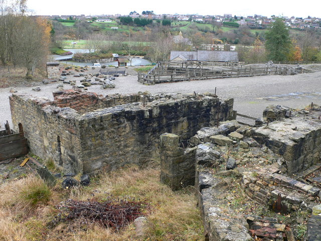
The route continues west past Ddol and Bersham before coming to Nant Mill. Here you'll find another country park with a visitor centre named after the historic corn mill located at the site. You'll also enjoy some woodland trails through Plas Power Wood before coming to the Minera Lead Mines and Country Park. The park gives you a view into the interesting industrial past of the Clywedog Valley. On the site there's a museum where you can explore the remains of the lead processing areas from the 18th and 19th centuries. There's also the restored beam engine house, winding engine and boiler houses. You could extend the walk by continuing on to the Minera Quarry Nature Reserve where there's more mining history and some significant plants and wildlife species.
Postcode
LL13 0NS - Please note: Postcode may be approximate for some rural locationsClywedog Trail Ordnance Survey Map  - view and print off detailed OS map
Clywedog Trail Open Street Map  - view and print off detailed map
Clywedog Trail OS Map  - Mobile GPS OS Map with Location tracking
Clywedog Trail Open Street Map  - Mobile GPS Map with Location tracking
Pubs/Cafes
The Kings Mills pub is located at the start/finish of the route. They do very good food and have a nice outdoor area if the weather is good. You can find the pub at a postcode of LL13 0NS.
Further Information and Other Local Ideas
A few miles to the north you can visit Alyn Waters Country Park where there's some pleasant paths along the River Alyn.
Cycle Routes and Walking Routes Nearby
Photos
The Clywedog Trail through Plas Power Woods. Great section this, through well managed mixed woodland
Mystery Cast Iron Marker. These markers are located on the Clywedog Trail, between Minera and Bersham. They are standing about 9high, 9 across, and marked W W. They could be a boundary marker of the Williams-Wynn estate. Sir Watkin William Wynn held the Wynnstay estate near Ruabon. [information supplied by John Turner]


