Crayke Walks
![]()
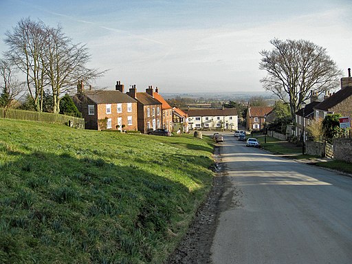
![]() This picturesque village is located just to the east of Easingwold in the Hambleton District of North Yorkshire. The village is a great base for exploring the surrounding countryside of the Howardian Hills Walks AONB and the Hambleton Hills.
This picturesque village is located just to the east of Easingwold in the Hambleton District of North Yorkshire. The village is a great base for exploring the surrounding countryside of the Howardian Hills Walks AONB and the Hambleton Hills.
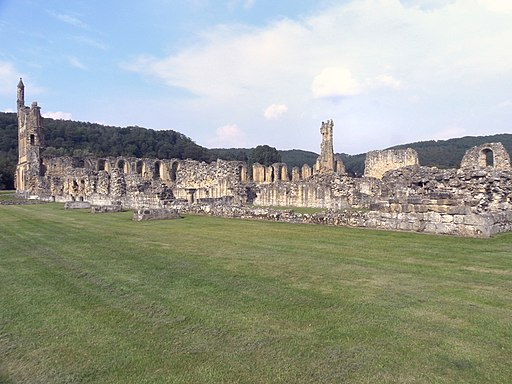
This walk from Crayke takes you north to visit some of the highlights of the area. The route follows a section of the Foss Walk long distance trail to visit Oulston Reservoir, Coxwold, Newburgh Priory and Byland Abbey. It's a varied walk with views of the River Foss, woodland trails and two historic sites to see on the way. The 12th century Newburgh Priory includes some lovely grounds with gardens and a lake to admire. At Byland Abbey you can explore the extensive ruins of the 12th century abbey.
For an alternative circular walk through the area see the Easingwold Walk.
Postcode
YO61 4TE - Please note: Postcode may be approximate for some rural locationsCrayke Ordnance Survey Map  - view and print off detailed OS map
Crayke Open Street Map  - view and print off detailed map
Crayke OS Map  - Mobile GPS OS Map with Location tracking
Crayke Open Street Map  - Mobile GPS Map with Location tracking
Walks near Crayke
- Easingwold - This attractive market town is located in a fine location for walkers, sitting on the edge of the North York Moors National park and the Howardian Hills.
- Coxwold - This pretty little village in the North York Moors makes a fine base for walkers
- Byland Abbey - Visit this fascinating ruined abbey before exploring the surrounding countryside of Ryedale
- Beningbrough Hall - The 18th century Beningbrough Hall has 8 acres of formal gardens to explore including a walled kitchen garden, herbaceous borders and Italian border filled with colourful Mediterranean blooms
- York Millennium Way - A circular walk around the outskirts of this historic city
- York River Walk - Enjoy an easy stroll along the River Ouse on this waterside circular walk through York
- Hambleton Hills - This walk explores the Hambleton Hills range on the western edge of the North York Moors
- Sutton Bank and the Kilburn White Horse - This challenging circular walk in the North York Moors visits the Kilburn White Horse, the lovely Gormire Lake and the scar at Sutton Bank
- Gormire Lake - A short and easy walk around this pretty lake in the North York Moors
- Sheriff Hutton - This village is located in the Ryedale area of North Yorkshire
- Foss Walk - Follow the River Foss, from the historic city of York to Easingwold, on this lovely riverside walk through Yorkshire
- Sutton on the Forest - This delightful village is located near York and Easingwold in the Hambleton District of North Yorkshire.
- Oulston Reservoir - This walk visits Oulston Reservoir in the Hambleton district of North Yorkshire.
- Nun Monkton - This worthy North Yorkshire village sits in a lovely spot at the confluence of the Rivers Ouse and River Nidd.
Pubs/Cafes
Head to the 300 year old Durham Ox for some rest and refreshment after your exercise. The historic pub serves good food and also includes a nice garden area for warmer days. There's also a car park here. You can find them on West Way at postcode YO61 4TE for your sat navs.
Dog Walking
The woodland and country trails are ideal for dogs. The Durham Ox mentioned above is also dog friendly.
Further Information and Other Local Ideas
For more walking ideas in the area see the Howardian Hills Walks page.
Photos
Crayke Manor. Jacobean manor built in 1620 with stone mullion windows, thick oak beams and yorkstone flags. Now used as a wedding venue.
Church Hill, Crayke. Crayke stands on the first significant hill to the north of York, marking the boundary between the Vale of York and the Howardian Hills. The village includes the Grade I listed Crayke Castle. The castle consists of a restored 15th-century four-storey tower house with attached outbuildings to the rear and a separate ruined 15th-century tower.


