Nun Monkton Walks
![]()
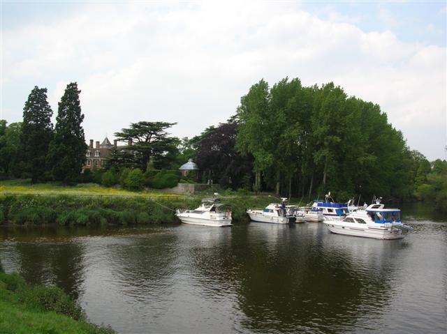
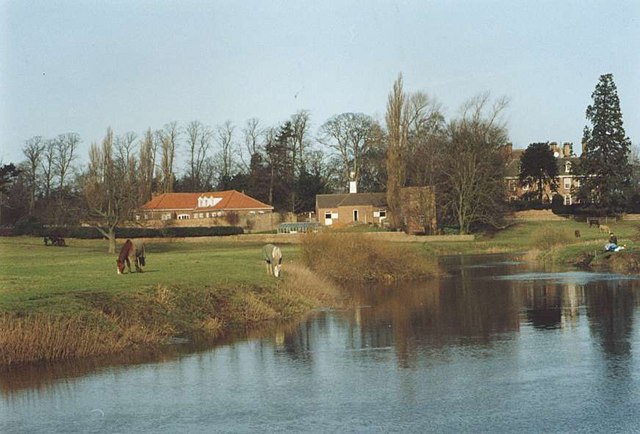
![]() This worthy North Yorkshire village sits in a lovely spot at the confluence of the Rivers Ouse and River Nidd.
This worthy North Yorkshire village sits in a lovely spot at the confluence of the Rivers Ouse and River Nidd.
The picturesque village includes a village green, duck pond, pretty cottages, riverside trails and the impressive 17th century Nun Monkton Priory. The priory stands on the site of an ancient nunnery.
The village is located on the opposite side of the river to Beningbrough Hall. The 18th century house is one of the highlights of the area with some beautiful gardens to explore.
The Jorvic Way can also be picked up just to the south at neighbouring Moor Monkton. The long distance trail is a good way to explore the surrounding countryside.
Postcode
YO26 8EW - Please note: Postcode may be approximate for some rural locationsNun Monkton Ordnance Survey Map  - view and print off detailed OS map
Nun Monkton Open Street Map  - view and print off detailed map
Nun Monkton OS Map  - Mobile GPS OS Map with Location tracking
Nun Monkton Open Street Map  - Mobile GPS Map with Location tracking
Walks near Nun Monkton
- Beningbrough Hall - The 18th century Beningbrough Hall has 8 acres of formal gardens to explore including a walled kitchen garden, herbaceous borders and Italian border filled with colourful Mediterranean blooms
- Jorvic Way - A circular walk through the countryside surrounding the city of York
- York Millennium Way - A circular walk around the outskirts of this historic city
- York River Walk - Enjoy an easy stroll along the River Ouse on this waterside circular walk through York
- Knaresborough River Walk - Enjoy a lovely riverside walk along the River Nidd, from Knaresborough Castle to the nearby Conyngham Hall
- Knaresborough Round - This 20 mile circular walk takes you on a tour of the countryside, lakes, rivers, woodland and villages surrounding the historic Yorkshire town of Knaresborough
- Easingwold - This attractive market town is located in a fine location for walkers, sitting on the edge of the North York Moors National park and the Howardian Hills.
- Sheriff Hutton - This village is located in the Ryedale area of North Yorkshire
- Sutton on the Forest - This delightful village is located near York and Easingwold in the Hambleton District of North Yorkshire.
- Crayke - This picturesque village is located just to the east of Easingwold in the Hambleton District of North Yorkshire
- Goldsborough - This village in North Yorkshire is located close to both Harrogate and Knaresborough
- Green Hammerton - This village is located in the Harrogate district of North Yorkshire
Pubs/Cafes
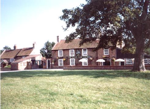
The Alice Hawthorn is in a lovely spot next to the Green. They serve good food and have a delightful garden with new perennials. You can find them at postcode YO26 8EW.
Photos
Nun Monkton Priory. The priory was a Benedictine nunnery founded circa 1147 dissolved 1536.The site is now occupied by a late 17th century house.


